In short:
- Starting point: parking in the forest at Laret (toll road from Bondo)
- Total duration: 4 ¼ hours
- Difficulty: T2 - Mountain Hikes
- KMZ file for Google Earth
- Profile (up & down):

- Aloneness index:

Maps:
- Extracts:
1:25'000 1:50'000 1:200'000 - Swisstopo shop:
1:50'000
268T
Julierpass
1:50'000
278T
Monte Disgrazia
Links (click on flag):
 A report on the site Waltellina.com
- A hike to the hut and back, narrated by an italian blogger. A noteworthy addition: the very nice sketch of the route, a sketch borrowed by an other website
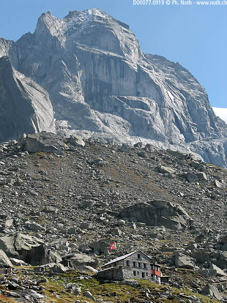
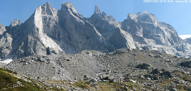
Capanna Sciora

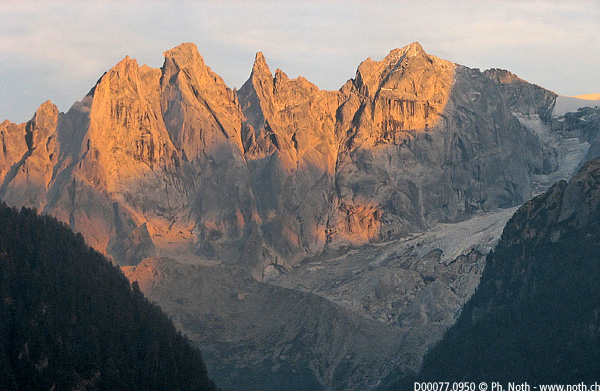
When you see the Capanna di Sciora, sitting under an enormous scree slope and set against a backdrop made up of the granite walls of the Pizzo Badile and the Pizzo Cengalo, you would expect it to be at least at 3000m, and not 2120m, its true height. During this walk we will therefore be crossing high mountain landscapes and heading for a site renowned for mountaineering.
The Val Bregaglia (Bergell in German) is a beautiful Italian speaking valley squeezed between two ridges of high peaks in the Swiss Grisons region. The peaks on the southern ridge are highest, and we will soon be getting closer to them. The walk starts at Laret (1377m, 4518ft), heading through a pine forest of the Val Bondasca. The car park at Laret is reached via a road coming up from Bondo. To be able to drive along this road, you'll have to pay 12 CHF to the automatic toll machine just outside the village of Bondo.
The walk starts by a pleasant climb in the forest alongside a mountain stream. After about 10 minutes the path splits up: we will head left towards Sciora (2½ hrs) leaving the path to Sasc Fürä (2 hrs), another nearby hut, to the right. During the climb, I fondled the idea of doing a round trip via Laret, Sciora and Sasc Fürä. Time wise it seemed plausible: 3 hrs from one hut to the other would mean a total walking time of 6 to 7 hours. But it was the difficulty of the terrain that made me give up: the way between the two huts gets really close to the glaciers and crosses moraines and massive boulders once part of the great cliffs above. To add to this, there is a difficult portion, at Viäl. Maybe if I hadn't been on my own that day I would have given it a go - but not alone. If one of you readers has done this walk, please write to tell me about it.
A clearing in the forest will provide us with a first view out towards the slab walls of the Piz Badile, 3305m (10843ft). Shortly after a waterfall coming down from the left, the path makes a sharp left turn and takes us up this very side of the mountain. The Piz Badile gets more and more proeminent even in the morning light when the contrast between sun and shadow is particularly marked, masking for the moment the other main peak, Piz Cengalo.
All of a sudden the climb gets much harder. This portion, named "Camin" on the 1:25,000 map, is made up of boulder fall. After many hairpins, two bridges and a great deal of physical effort, the path comes to a plateau with a great view over the whole cirque. This place is called Naravedar and is reached within about 1½ hrs after leaving Laret.
But the climb continues on, although not quite as steeply as before. Soon we'll be able to see out in all directions since the pine trees give way to smaller bushes and there, low and behold, lies the hut, no distance away. It's not really surprising, just mathematical, since after all that climbing we were bound to get there in the end! The last few yards are still quite demanding since several streams full of boulders need to be crossed. I reached the hut in 2¾ hrs with a 20 minute break.

The way back follows the same path as on the way up, and takes about 1¾ hrs. The main part of the descent is done quite quickly, mostly next to the waterfall in the "Camin" portion. In short, you can make it to an extraordinary alpine amphitheatre in 4½ hrs there and back with a 750m climb.

