In short:
- Starting point: Pont-de-Nant
- Total duration: 7-8 hours
- Difficulty: T3 - Challenging Mountain Hikes
- KMZ file for Google Earth
- GPX track for GPS
- Profile (roundtrip):

- Aloneness index:

Maps:

Links (click on flag):
 Ascending Pointe des Perris Blancs, various itineraries explained. On Randalp.
- A first glimpse of this tour thanks to the numerous pictures taken by the people at Transpiree.ch.
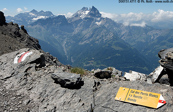
Col des Martinets, Col des Perris Blancs
This imposing route climbs the entire Vallon de Nant, a natural reserve, comes right up close to the Petite Dent de Morcles at the Col des Martinets (2615 m, 8579 ft) and opens new horizons to the south and the Rhone valley.
But first let us give credit where credit is due ... and namely to Francis Weill who first described this circuit in his book as the "Circuit des Perris Blancs". Quite frankly, I found the description of the walk and sketch rather unsettling - was I to be clambering along "crumbling ledges" between "dolomitic walls"? Not to mention that every time I travel along the Bex motorway, the sight of the Dents de Morcles peaks don't exactly match with my idea of a pastoral walk. Still, I managed in the end to build up my courage and didn't regret it. The route is not dangerous, but it is all the same quite strenuous: 7-8 hours and a 1500-m uphill climb. Francis Weill even gives a cumulated time of 9½ h.
The walk starts at Pont de Nant where there is a hotel/restaurant and 2 car parks. Take the path that runs along the Thomasia alpine garden, heading to Col des Martinets. The route then follows a forestry track which is a little for the worse in some places: in July there were portions covered with rocky landslides and other part that you could have driven along. The path climbs the Nant valley following a tumultuous stream, in and out of the woods and clearings. A dozen instructive exhibits on 'the Thomas familly', 'erosion', 'the formation of the Alps', etc. provide a didactical background. Since the walk is long enough in itself, I did not spend much time looking at them. After going through a gate, you'll enter the natural reserve of Nant.
Don't follow the path indicated 'Cinglo' (45 min). The same signpost shows that the Perris Blancs are 2 hours away. Five minutes later you'll reach Nant farm, at 1500 m (4921 ft). The farmstead lies on a flat area surrounded on all sides by vertical cliffs, especially to the East and South, which is where we're heading for. Rather confusingly, the signpost here indicates that the Perris Blancs are now 3 hours away! The Col de Martinets is at 3 h 10 min. Cross this wide alpine meadow and head towards the Torrent des Martinets. The stream bed is quite wide and not easy to cross. I couldn't find a bridge although I reckon that there must normally be one. On my way back towards the end of the afternoon, crossing the stream was even quite difficult since the water level was higher. On the other side of the stream, the slope gets a bit steeper but the path remains quite wide up to the fork where another path leads off towards the Col des Pauvres (1½ h from Pont de Nant). But we'll take the path to the left, as instructed by the indications 'Martinets' and 'Perris Blancs' painted on a large rock. From here on the path turns into a real mountain trail which is a little worse for the wear with a few bushes and treacherous stones to watch out for. The path gets really quite steep since it climbs up 'Les Ayers' and negotiates the rocky spur at about 2000 m. After 2½ hours you should have managed that. Notice the weather station propped on the rock.
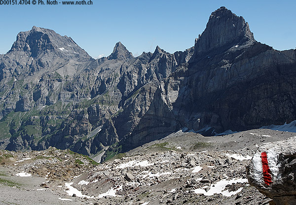
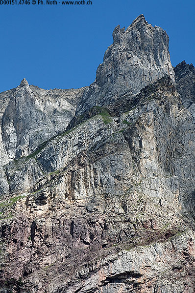
A few more strides and you'll reach the Martinets signpost at 2087 m (6847 ft). This signpost marks the start of the upper valley, called La Grande Vallée (the big valley). The path splits up here: the right path heads for the Perris Blancs and the left one for the Martinets. Stay on the left path, we'll come back via the other one on our way back from the Perris Blancs. As we climb up the valley, the grass gets scarcer and scarcer between the rocks and then big multicoloured purple, red and lighter-coloured boulders. To the right, you can see the long ridge rising up to the Pointe des Martinets and the stratified rock face under the Pointe des Perris Blancs. To the left lies the Martinets glacier, or rather the remaining snow field that owes its survival to the shadow of the Dent de Morcles. Let's not forget the other peaks: the Dent Favre, the Pointe d'Aufalle, the Petit Muveran and the Grand Muveran - no need to blush over the comparison with the Dolomites. The company of a geologist would have been welcome at this point to explain the folds, layers, plates and constraints that are so obvious here. If you don't have a friend who's a geologist, you can find more information for example here (Via GeoAlpina geological documentation, in French or German).
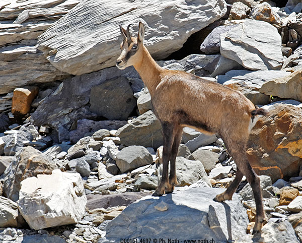
The route continues climbing up the Grande Vallée. The marking seems to take us rather more to the right than described in Weill's book. Underfoot is only stone, stone and more stone and the slope is nearly too steep to be able to stand properly. When I did the walk I saw a chamois on a nearby patch of snow, a hare that jumped suddenly out from under a boulder and if you stop a moment and listen, you can hear the sound of stones moving here and now, probably under the feet of the different mountain animals that thrive in this reserve.
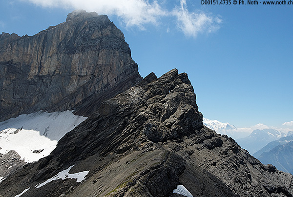
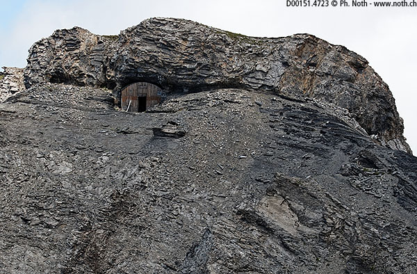
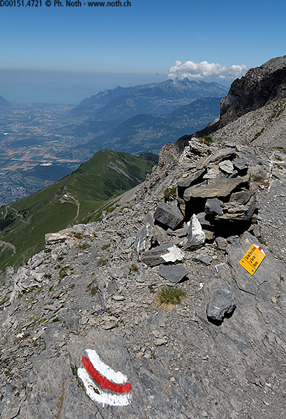
You'll reach the Col des Martinets (Swift's pass) in about 4½ hours counting a 15-minute break. From here you can look down into the Rhone valley or over towards the Dents du Midi or Mont Blanc. Still, it's surprising and slightly unsettling to be able to hear man-made noises rising from the valley 2200 m down below. Below on a grassy spur, a small hut, Cabane de la Tourche, is being done up - a vertiginous path leads down to it via the Rionda barracks. Just looking at it makes me shiver even though people use it often enough so it can't be that bad. Anyhow, we're not going down that way but continuing on to the right along one of the famous ledges gouged out by our dear Swiss army (dear in every sense of the word!). What a pleasant surprise to discover that the ledge is wide and easy to walk along. Fortunately too because on the Rhone side, it looks like the wall of a cathedral. It is still a bit scary and it feels like being on the patrol path of some gigantic castle. And the comparison is not as innocent as you might think since abandoned military fortifications can be found behind this rock. Amazing! It's hard to believe that troops, mules and canons were up here!
Another 20 minutes and we'll have got around the Pointe des Martinets (which can be climbed quite easily). A sharp bend to the right and we'll be following a crack along one of the rare gentle slopes around. Not used to this any more - it was all so vertical up to now! Continue on to the Col des Perris Blancs, on the way a path leads down towards La Tourche but we'll climb the last 50 metres up to the pass (2544 m, 8346 ft), 5½ hours from the start.
Just down from now on. Down does not necessarily mean easy - or maybe I'm just tired already. From the pass, head for the big red diamond-shaped marking on the boulders that will bring you back to the fork where you turned left this morning. Then clamber carefully down the 450 metres of the 'Ayers' portion. Do be careful since I do find this path treacherous (risk of sprained ankles). Once you reach the track again it's much easier, except for the bloody stream with no bridge! The poles were of great help here and I managed to get across without soaking my feet too much. The walk ends back at Pont de Nant.

