In short:
- Starting point: Vallée du Motélon, near Charmey and Broc
- Total duration: 3 hours
- Difficulty: T3 - Challenging Mountain Hikes
- KMZ file for Google Earth
- Profile (up & down):

- Aloneness index:

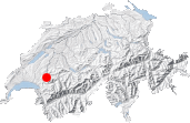
Maps:
Links (click on flag):
 Hike report on Hikr.org.
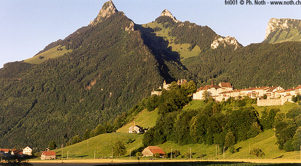
Dent de Broc
The Dent de Broc (Broc peak) is a modest summit (1829m, 6000ft) but ideal for early or late season hiking, when the trails of Valais and Berner Oberland are still or already snow covered. Its location in the middle of the green region Gruyère, overlooking Gruyères' medieval castle, makes it a nice spot for a panoramic view.
Since this hike is straightforward and does not require lots of explanations, let me use the opportunity to give a small terminology course on the word Gruyère, because it is so commonly misused. First, there is la Gruyère, the region of the southern part of canton Fribourg. Then there is the village of Gruyères, with a "s", a popular touristic destination thanks to its castle and its gastronomic specialities. Finally, there is le Gruyère, which is the cheese produced here in the mountain pastures (or in the factories, lets be less poetic and more realistic). And this cheese has no holes!
The maps show at least 2 routes for this summit. The one we have chosen is short (1½ h), thus half a day will be sufficient. Please note that the difficulty is rated 3, which means that this hike is slightly more technical than the others because of some rock climbing just under the summit.
The vehicle can be left in the Motélon valley, at a place called Groins d'en Haut (it is a very narrow road that climbs from Motélon up behind the mountain). If you have no transport, then the other route starting in Gruyères would be more convenient. However, I do not know it, so I cannot give you more precise informations about this one.
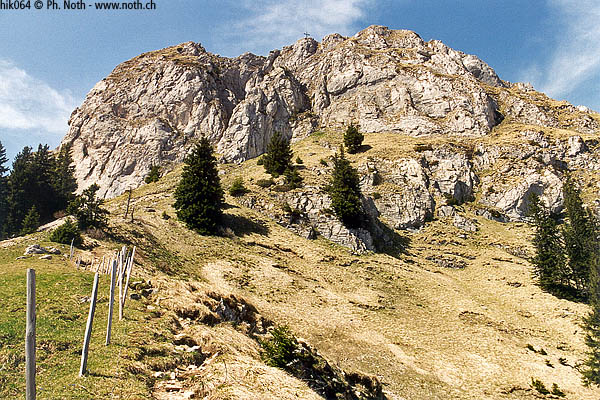

First, the trail leads to Col des Combes, the saddle (clearly visible on picture 1) between the two twin mountains Dent de Broc and Dent du Chamois. From this point, it turns right and zigzags under the summital cliff. The very last meters need to be climbed, actually it is more rock scrambling than real climbing. A cross, that could already be seen from the saddle, indicates the narrow and somewhat dizzy summit.
The sight extends quite far, north towards the lake of Gruyère, east and south towards the bigger mountains of the Fribourg Prealps: Dent de Brenleire, Dent de Folliéran, the Vanil range and the Moléson.

