In short:
- Starting point: Schänis, a place which can be reached by a narrow road starting in Im Fang (La Villette)
- Total duration: 4 ½ hours
- Difficulty: T2 - Mountain Hikes
- KMZ file for Google Earth
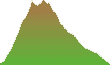
- Profile (roundtrip):
- Aloneness index:

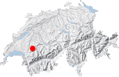
Maps:
Links (click on flag):
Hochmatt, Cheval Blanc
The mountains called Gastlosen are made of several Dolomite-like summits whose vertical faces particularly appeal to climbers. Located on the border with the canton of Bern and on the language limit between French and German, they are the backdrop of this excursion to the Hochmatt (2152m, 7060ft).
The surrounding landscape at the start of the hike, a place called Schänis (1424m, 4672ft), is promising: to the left rises the Gastlosen wall, followed by Dent de Ruth and Dent de Savigny. We take the road which is now forbidden to vehicles for a few minutes until we meet a chalet. Here we leave the road and follow the trail that climbs to the right in the middle of a meadow. A sign shows "Hochmatt 2h30".
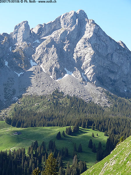
We enter a grove and, after a short while, reach a big farm. Maps call this place Bofels. It unveils a pretty rocky coomb that is part of the Cheval Blanc, Hochmatt's twin mountain (picture 3). We go round this coomb on the left. The trail makes a gentle and easy ascent, except where it crosses a little water stream and gets wet and slippery.
At the walls of a ruined farmhouse (after approx. 1 hour), the path bends to the right. It becomes steeper and less comfortable, ascending in a succession of switchbacks this grassy slope of Cheval Blanc. For half an hour, this gets tiring, particularly on a very hot day like the one I had. But half an hour does not last very long... more or less 30 minutes :-) The motivation will be boosted by the sight of big snowy summits emerging at the horizon. Looking back towards the Gastlosen ridge, one can measure the elevation that has been gained: now they are at the same level, which is around 1900m.
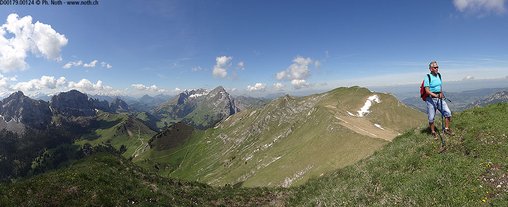
A smoother slope leads, after 2 hours, to the Cheval Blanc's final ridge. The landscape changes dramatically: bucolic pastures let place to big rocks, partly covered by snow, and the summit is clearly distinguished at the end of the crest. The view has extended even more. Now the Gastlosen ridge can be seen in its entirety. This final ridge needs another 30 minutes before the summit of Cheval Blanc is reached. That makes a total walking time of 2h30, altogether with no noticeable difficulties except a few places where the hands can help keeping the balance.

This mountain was unknown to me, despite the fact that I had been living 40 kilometers away all the time. That made my amazement even bigger to have such a spectacular view. South, Mont-Blanc, Dents-du-Midi, the Diablerets, and closer, the Vanil ridge are clearly recognized. In the direction of Bern canton, the Eiger and the Jungfrau were not so easy to identify, as all mountains of the Berner Oberland were snow covered.
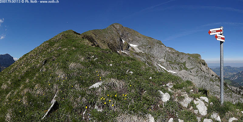
There is a wide flat pasture behind the Cheval Blanc's summit, an unusually even place on top of a 2150m (7060ft) high mountain. At the other edge is the Hochmatt's summit. It's 15 minutes of a straightforward walk to the cross marking the Hochmatt's highest point. The view here is less rewarding than it was at the Cheval Blanc.
For the descent, one can take the same route back or prefer a more varied alternative by doing a circuit, as described (in french) on a page of the SAC Moléson section. The route for the roundtrip follows the crest towards south, then descends steeply to a farm called La Gueyre on the maps (30 minutes from Hochmatt cross). From here, the wide dirt track is monotonous but takes you to the parking at Schänis. Count 1h30 minutes for the descent.

