In short:
- Starting point: Col de Jaman
- Total duration: 4 ½ hours
- Difficulty: T2 - Mountain Hikes (staircase)
- KMZ file for Google Earth
- GPX track for GPS
- Profile (roundtrip):

- Aloneness index:

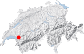
Maps:

Links (click on flag):
 Another description of this hike can be found on the website Around Lausanne by Dmitry Yakunin.
 One of the numerous (summer or winter) hikes to be found on the website of Les "Pius".
Rochers de Naye, Sautodoz, Col de Bonaudon
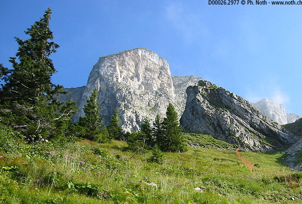
As with the neighbouring peak, the Dent de Jaman, Montagne d'Amont, the area surrounding the Rochers de Naye comprises many paths and consequently a great variety of routes for walkers. This is all the more so for the Rochers de Naye since a rack railway climbs all the way up to come to a stop at the top. Personally I have yet to try walking on the heights of Montreux using the trains, however I can tell you about two pretty walks around the Rochers de Naye: the first starts from the Col de Chaude, and the second, described hereafter, starts from the Col de Jaman.
A visit to the Naye cave can be included in this itinerary. If so, make sure you bring a torch and wait until all snow has melted away - from about mid-July onwards (the snow lasts a long time at this particular spot). If you plan to walk before mid-July you'll have to miss out on the potholing activities and use the outside route which is described further on.
The first portion of this walk is the same as for the Dent de Jaman. Head up through the woods from the Col de Jaman to the left of the Dent de Jaman until you reach the Jaman railway halt (after about 45 min). Optionally walk up to the top of the Dent de Jaman - about 30 min up and back.
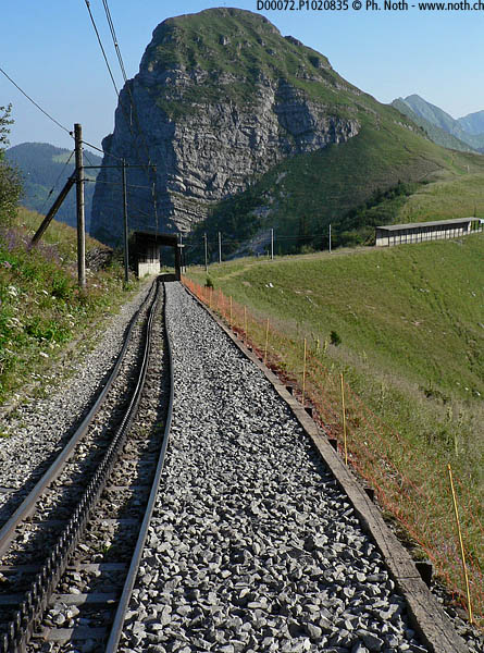
From the railway halt, follow the line upwards, and if possible avoid being flattened by oncoming trains! Walk through two short tunnels and then, when you get to the third tunnel called "La Perche" (1799m, 5902ft), follow the sign for Sautodoz 25 min, Rochers de Naye 1 hr 10 min. An alternative route to reach La Perche goes around to the right of the Dent de Jaman and then around the Merdasson. I haven't yet walked this path known as the "Chemin des 5000" - the 5000 route.
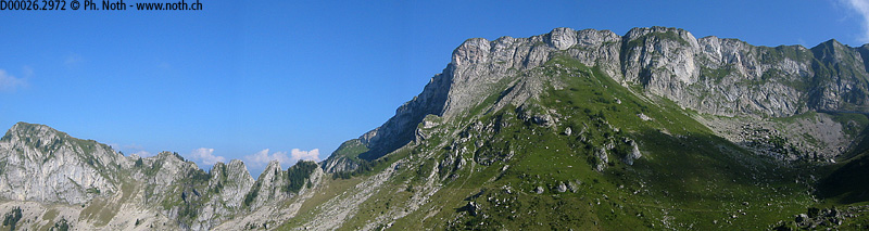
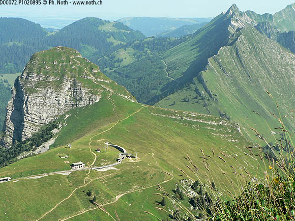
From La Perche, the path leads gently down the west slopes of the Rochers de Naye and then suddenly heads up a very steep zone of scree. In spite of the red warning sign, it's not too hard to overcome this diffculty and reach the Sautodoz hut (private). Here the path is enclosed on both sides by cliffs and you can see out towards the Tours d'Aï de Leysin. Now the path climbs pleasantly up through thick grass to the top of the Rochers de Naye. At first, you'll see the antenna and the yurts, then the railway terminus and the marmot park. In all, the whole climb from the Col de Jaman will take approximately 2 hrs (without breaks).
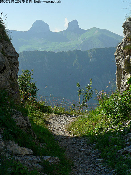
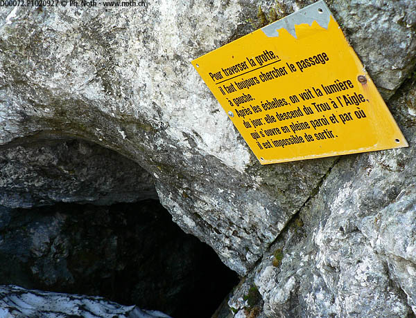
Let's now start on our way back via the ladders and the Naye cave. Walk past the marmot park and all the tourists (take care not to mistake who's who!), and then along the long Grande Chaux de Naye ridge. At some points you may dare to take a look down the drop and see the Jaman railway halt below. You may also meet climbers coming off the last steps of a via ferrata built in 2008 and renowned for its difficulty. Follow the path that then starts to go down until you come across a big red sign on which is written "Danger" in large capital letters and several languages. From here on you'll be heading straight down the cliffs, using ladders and holding on to cables and ropes. The ladders are in excellent condition and are mostly more like staircases than real ladders. The descent isn't therefore as bad as it looks as long as you can cope with the vertiginous terrain. If not, you can always head back the way you came or take the Naye-Jaman train back down. The highlight of that section is the cave: half way down the cliffs an opening leads into a for the least unusual itinerary within the mountain. I didn't make my way through myself because of the snow remaining in the entrance even in July. The way through seems to be of some length and comes out further down. To explore the route through the cave make sure to bring a torch and that there is no snow left inside the cave - otherwise use the outside route.
This tricky part of the route ends when you reach the Col de Bonaudon after about 3 hrs walking. Another 15 minutes walking through mountain meadows and you'll reach the Montagne d'Amont from where a wide track leads down to the car park at the Col de Jaman (about 45 min).
Here are approximative times for this fairly complicated itinerary (any breaks and the optional climb up to the Dent de Jaman are not included):
Start: Col de Jaman
Jaman railway halt 45 min
La Perche
Sautodoz 1 hr 30 min
Rochers de Naye (terminus) 2 hrs
Col de Bonaudon 3 hrs
Montagne d'Amont 3 hrs 15 min
End: Col de Jaman 4 hrs
At the beginning of this route description I mentioned an itinerary starting from the Col de Chaude. This alternative itinerary, quite different from the one described above and more off the beaten path, will be described on a separate page.

