In short:
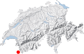
- Starting point: Villair, above Courmayeur
- Total duration: 6 hours
- Difficulty: T2 - Mountain Hikes
- KMZ file for Google Earth
- Profile (roundtrip):

- Aloneness index:

Maps:
- Extracts:
1:50'000 1:200'000 - Swisstopo shop:
1:50'000
292
Courmayeur
Links (click on flag):
 This same hike, reported by Pierre-Alexandre on his webspace which contains 89 tours in the Mont-Blanc region
Tête de la Tronche, Col du Sapin
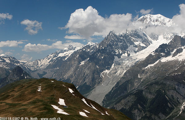
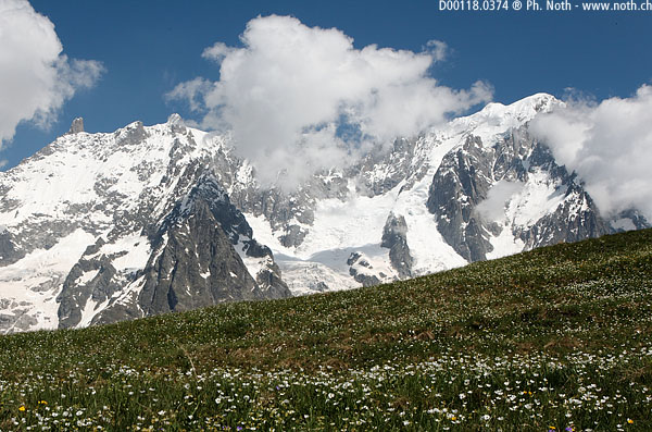
When looking for a walk to do early on before the height of the summer, I generally try to find an interesting route on the sunny side, i.e. on south facing slopes. This time I fixed my choice on Mont de la Saxe just near Courmayeur. This balcony route above the Italian Val Ferret valley looks across towards the highest peaks of the continent: the Mont Blanc range. We'll climb up to the summit of the Tête de la Tronche (2584 m, 8478 ft) - by the way a perfect tautology in French - before coming back down via the Val Sapin (but only if we can find the way without having to cross too much snow).
The walk starts just after the hamlet of Villair (Val Sapin): you can park at the small car park (about 12 spaces) just before a bridge where you'll find an information board about the Tour du Mont-Blanc (TMB) route. Our walk is shown as the "Grande Balconata" or the "Grande Corniche du Mont-Blanc". According to the tourist info, it takes about 7 hrs to complete the walk, and it is numbered n°42. You can also start directly from Courmayeur (1225 m, 4019 m) - no distance away but a 100 m lower down.
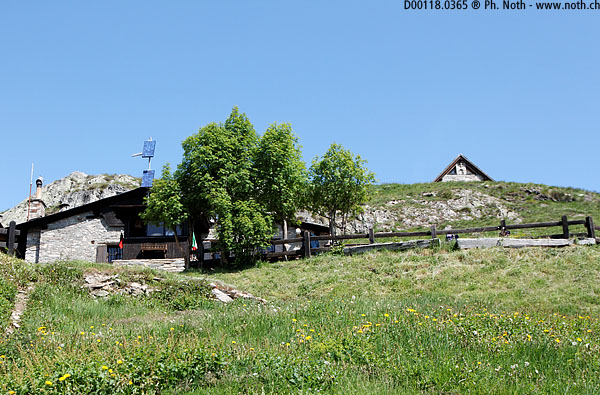
Soon after the start a signpost shows the way to the Rifugio Bertone (1½ hr). The sign also gives the walking time up to the Testa Bernarda: 3 hrs. The path is fairly steep and heads up through the forest. As the trees start to thin out you'll be able to see down to Courmayeur now and again. After an hour or so, you'll come out of the woods and see the Bertone mountain hut. Another sign states that the Tête de la Tronche is still 1 hr 40 min away - however no need for worry, all the walking times seem to be over-exaggerated around here. In fact the whole walk will probably take about 6 hrs (or even 5½ hrs according to the Randos Mont Blanc website, see the links opposite) and not the 7 hrs given at the car park.
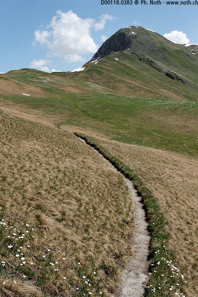
Above the hut, the path comes to a fork: on one side the path heads down into the Val Ferret, on the other it heads uphill. We'll keep climbing up this second path without forgetting to look out now and again towards the vertical peaks and gigantic ice-fields of the Mont-Blanc range. You'll be able to admire the view properly without tripping or falling over when crossing the La Saxe meadows which are wide and easy, as well as full of beautiful mountain flowers. The Testa Bernarda and Tête de la Tronche slowly get closer and closer. If you feel like it you can make the detour and climb the Testa Bernarda, if not, the path continues just below the summit and heads straight for the Tête de la Tronche which you'll reach within about 3½ hrs. A break is welcome to rest a bit before heading back down.
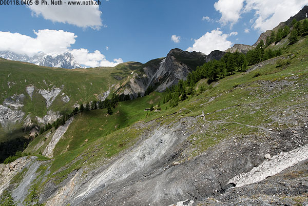
A few steep hairpins will bring you to Col Sapin. Here most hikers on the TMB will be heading east (left) towards the Col Entre Deux Sauts. We'll take the opposite direction towards Villair via the Val Sapin. The 400 m drop down to the Curru meadows won't take much time. After that, the path runs mid-slope, passes a stream, the Curru alpine chalets and then another stream (slightly trickier to cross than the first one). By the look of the bed of the stream, full of snow and rocks of various sizes, avalanches from the Col de Licony must come down this way during the winter. About 1 hr 20 min after leaving Col Sapin you'll get to the second part of the descent. Follow the sign "Chapy 35 minutes" (Tsapy on my map) and then "Chapy 30 minutes" to the right a little farther on. You'll reach Chapy after about 2 hrs downhill walking and then the car park near Villair after another ½ hour.

