In short:
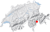
- Starting point: Monte Spluga, italian side of the Splügen (Spluga) pass
- Total duration: 5 hours
- Difficulty: T2 - Mountain Hikes
- KMZ file for Google Earth
- Profile (up & down):

- Aloneness index:

Maps:

Links (click on flag):
 About the bivouac, website of the Valtelline region waltellina.com.
Bivacco Cecchini
On the way back from a trip to Tuscany, I decided to take advantage of the occasion to stop over in a region of the Alps that I had never visited before, the San Giacomo valley, a small part of Italy squeezed between the Swiss Graubünden and Ticino regions and on the road to Splügen/Spluga. Nowadays the Splügen pass is not a particularly important route and in fact the road is quite terrible on the Italian side. This is perhaps why the valley has stayed so authentic on both sides of the border with beautiful villages and local dishes - no need to explain why you'll be in for a day of absolute calm and a great change of scenery.

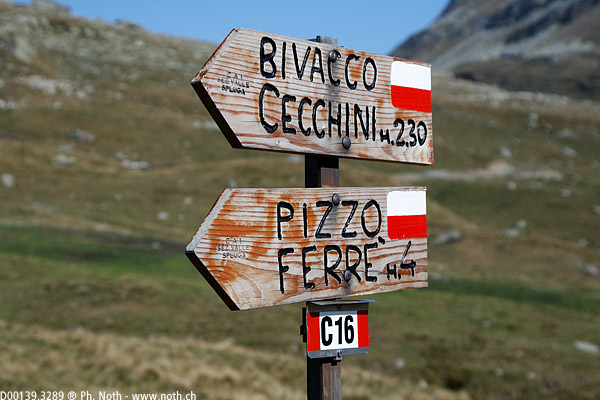
With very little knowledge of the area and only a digital map that couldn't be plugged into my rucksack, I decided to opt for a fairly easy route. After viewing the various possibilities on my laptop in the Monte Spluga lodge at the Spluga pass, I picked the route towards the Bivacco Cecchini at 2773 m (9098 ft). It proved to be a good choice: the walk lasts about 5 hrs (there and back) and takes you close to the snow fields of the Pizzo Ferrè. The route to follow is called C16 and marked with red and white stripes just like in Switzerland.
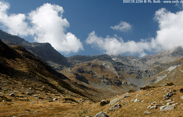
Drive down and park by the lake, and then follow the track up to a bridge. Here a broken signpost shows that the Bivacco Cecchini is some time over 3 hrs away, unfortunately the minutes were on the bit that was broken off! So who knows? Was it just 3 hrs or 3 hrs 55 min? A little farther on another sign gives 2 hrs 30 min for the Bivacco (and 4 hrs for Pizzo Ferrè). Never mind, just stride on - this is what makes Italy so Italian! For a good half an hour the path pushes into the Val Loga. The ground around the stream is quite wet. You'll soon be able to make out where the Bivacco stands, a light-coloured shape on a lump of darkish stone. I can never work out if it's a good thing to see where you're aiming for so early on in a walk - is it comforting or discouraging? I guess it's different for everybody. Anyhow, the Bivacco is some distance away and most of all much higher up!
Up to now the route was practically flat. The starting point was at 1965 m (3494 ft) and after an hour walking the path is still at just over 2000 m. This is where the real climb starts: the path heads left, up over successive terraces. At some points the path is not clear but the red and white marking is excellent and can been seen from some distance so it's quite easy to stay on the right track.
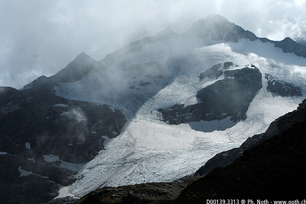

At about 2400 m (7874 ft) a much flatter portion leaves place to another steep climb. This second part of the climb varies between steep ascents and short flatter portions. Towards the top the path winds through big stone boulders. An arrow is painted on one of them and points left towards the "Bivacco". You'll reach the small hut after just under 3 hrs walking. There you'll discover high mountain landscapes and snowfields that were hidden from view before as well as the Pizzo Ferrè (3103 m, 10180 ft). Most photos on the web show the old hut with a red corrugated iron roof. Now the old hut has been replaced by a light-coloured wooden hut.
The way back down follows the same path as on the way up (about 2 hrs 15 min back). Another way up is shown on the local map via the Valle Schisarolo, a bit to the south (Le Mede, then via the dam). If you have been along this path recently please leave me a message saying how long it takes and what the path is like because it could turn this route into a really nice round trip.

