In short:
- Starting point: Stechelberg (Lauterbrunnen valley)
- Total duration: approx. 7 hours
- Difficulty: T2 - Mountain Hikes
- KMZ file for Google Earth
- Profile (roundtrip):

- Aloneness index:

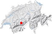
Maps:
Links (click on flag):

 Oberhornsee hike reports on Hikr.org.
Oberhornsee
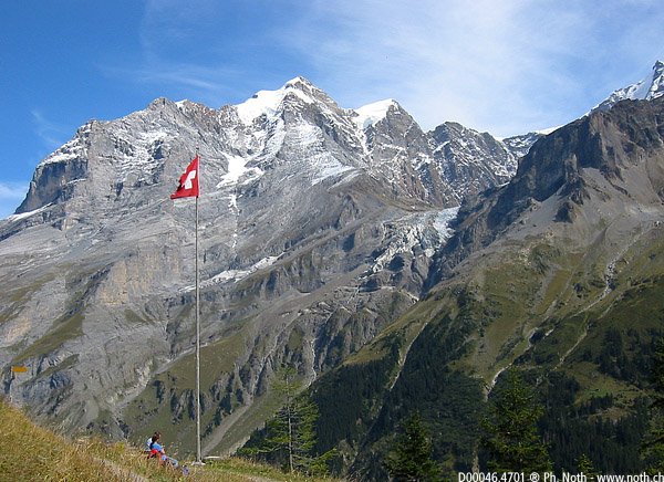
This hike takes you to the confines of the Lauterbrunnen Valley, where snowy peaks separate this land located in the canton of Bern from the Lötschental in Valais. After crossing a protected Pro Natura site, you arrive at the tiny Oberhornsee; the descent, facing the famous Jungfrau, is rather easy.
Aside from not being technically difficult, this hike allows you to stop at several inns: during the first half of the way back down, there is, for example, the Tschingelhorn Hotel and the Obsersteinberg Hotel; on the way up, you can stop at Trachsellauenen.
My hike began at Stechelberg. At an altitude of only 910 metres (2985 ft), Stechelberg is the lowest mountain village that I am aware of! But the steep walls that surround it immediately give you the feeling of an alpine setting. At Stechelberg, you have to pay to park your car and the day will cost you 7-8 francs. But you may like to know that the amount is subtracted from the cost of whatever you eat and/or drink at the nearby Stechelberg Hotel. If you choose not to drive to Stechelberg, you may also like to know that a mail bus stops at the car park.
Not far from Stechelberg is Gimmelwald, a village that is very popular with the British. Those of you who are now reading this and staying at Gimmelwald can naturally go on this hike. You can set out on one of the several paths at Gimmelwald that will link you to this itinerary without lengthening it too much. For more details, I suggest going to Google and/or the links listed below.
Now back to Stechelberg, our point of departure. At a few metres from the hotel, there is a sign that explains important things about the region, which is a Pro Natura reserve. According to the signs, it takes 3 hours and 30 minutes to reach Oberhornsee and 4 hours and 15 minutes to reach Schmadrihütte. My first intention was to do the loop that takes you from Stechelberg to Trachselauenen, Breitlauenen, Schmadrihütte, Oberhornsee, Obersteinberg, and then back to Stechelberg, as proposed in the "Berner Oberland Ost" Rother Guide.
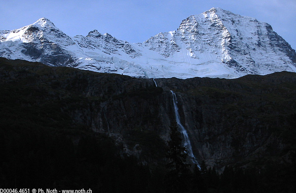
You start off on a wide path that at times becomes one with the gravel road for mountain bikes and that effortlessly takes you to Trachsellauenen (40 min). From this point, a pedestrian path leads you along a torrent. Ten minutes later, at a place named Bergwerk, two directions are proposed that lead to the same destination, though there is a difference of ten minutes between the two. The left path-the longer but hopefully more comfortable one-takes you to a steeper way inside a forest and among rocks. Once out of the forest (1 hour and 15 minutes), you have a superb open view of a powerful waterfall that you may have caught a glimpse of earlier. Behind the waterfall is the elegant presence of the Breithorn.
At Schürboden (1379m), you can take either "Wilde Egg, Obersteinberg, Tal" or "Höldrifälle, Läger, Tal". I chose the second route, still intending to do the loop via Breitlauenen, Schmadrihütte, Oberhornsee, and Obersteinberg. You take the other side of the torrent and start to climb the valley's other slope along a path that is narrower but still good. Most peaks and some pastures have been basking in sunshine for a while, but, on this slope and at this time of the year, the sun has a hard time rising above the Mittaghorn and Grosshorn. It was therefore still dark and chilly when, at 9.50 AM, 1 hour and 50 minutes after leaving Stechelberg, I found myself in Läger (beautiful wooden farmhouse).
I realized that, shortly before Läger, I should have taken another path for Breitlauenen and Tanzhubel. I backtracked and saw the small bridge across the stream and a wooden sign reading "Schmadrihütte" lying on the ground. In the end, I decided not to take this poorly marked path of shade and glaciers. Instead, I opted to go straight to Oberhornsee via Schafläger.
Back at Läger, there is a short descent partly inside the forest before you arrive at Tal, which takes about 2 hours (not including the 30 minutes that I lost in trying to find my way). The River Tschingel Lütschine shows up again, which was seen in Stechelberg and Trachsellauenen. Owing to the artificially made-up bank, it might be concluded that something happened here recently (2003). A landslide? The river burst its banks? Whatever happened will most likely remain a mystery, even though there is time to brood over these and other possibilities along the steep ascent that follows: 300 metres direct to Schafläger (1800 m, 3 hours).
Schafläger marks the junction with the upper path, the one that leads to Obersteinberg and that will be taken on the way back down. Marvellous view of glaciers below the Breithorn and Tschingelhorn.
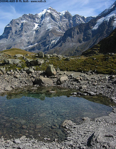
Only 250 uphill metres remain. The ascent is not so steep as the preceding 300 but is hard owing to the strangely cut steps that force you to adjust your stride frequently. Arrival at Lake Oberhornsee. It took me about 3 hours and 45 minutes. The lake is ridiculously small, owing to the summer drought. How much longer will it stand up to climatic changes?
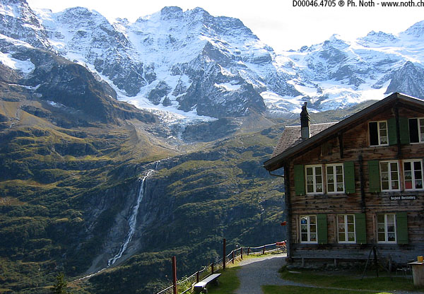
To make your way back down, I suggest the beautiful overhanging path of Obersteinberg. All along the way, you never take your eyes off the Jungfrau and Rottal glacier. Along the bank of the latter, you will find a cabin that could be the aim of a future hike: Rottalhütte. Note that it is located at an altitude of 2755 metres and that the path also starts at Stechelberg (910m)-I will let you imagine and weigh what it could cost you in terms of effort; moreover, it appears that access is not risk-free.
From the lake, you return to Schafläger (30 min). And, this time, stay on the upper path. After crossing the Tschingel Lütschine, it leads to the chalets of Obersteinberg (1 hour; hotel and restaurant) and then another restaurant near point 1678. Ignore the path that descends on the right toward the bottom of the valley-it is the third of its kind after leaving Schafläger. Be sure to remain on the same path, now inside the forest. Despite the densely leafy trees, you will end up seeing Stechelberg. When this path crosses a wider one, there are two signs pointing the way to Stechelberg: one points to the left and the other to the right. I think that it is best to take a right. Before long, you will see the gravel road and then Stechelberg. It takes 3 hours to hike down from Oberhornsee to Stechelberg via Obersteinberg.
Note that it is always useful to have a map on you, at least the 1:50 000. It is all the more true for this hike because of the many possible variants.
