In short:
- Starting point: Grindelwald, upper station of the Pfingstegg cable car
- Total duration: 6-8 heures (depending where one choses to return)
- Difficulty: T2 - Mountain Hikes (to Rots Gufer); going further up means hiking on a blue-white marked trail rated T4 - Alpine Hikes
- KMZ file for Google Earth
- Profile (up & down):

- Aloneness index:

Maps:
Links (click on flag):
 Pfingstegg-Stieregg (hike #9 on the website Walking Switzerland, by Lou Johnson)
- Carsten Clasohm has walked all the way to Rots Gufer. The same page shows other locations around Grindelwald.
Rots Gufer, Stieregg, Schreckhornhütte
Complete description currently available in french only.
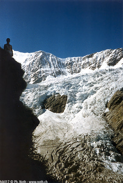
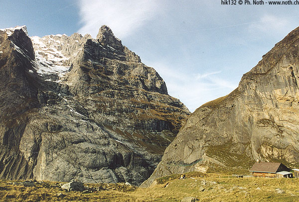
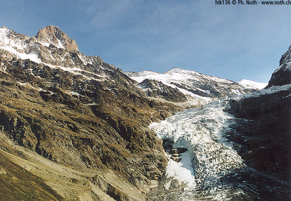
A good path hewn out of the rock goes to the Stieregg, a marvellous belvedere and a restaurant on a green meadow surrounded by glaciers and snow. Ambitious hikers can continue, getting closer to the glacier and discovering new alpine scenery.
The path leads to the Schreckhornhütte. We were willing to go to the hut but at one place called Rots Gufer on the map, the trail was crossing a cliff and the rocks were very slippery. We decided to turn back. Going to the hut would have required 4 ½ hours.