In short:
- Starting point: Läger, cable car from Kandersteg
- Total duration: 7 hours
- Difficulty: T2 - Mountain Hikes
- KMZ file for Google Earth
- Profile (up & down):

- Aloneness index:

Maps:
Links (click on flag):

 Hike report on Hikr.org.
- Report and pictures (ascent from Griesalp, descent to Oeschinensee) on Randomandie.ch.
Blüemlisalphütte (Blümlisalphütte), Hohtürli

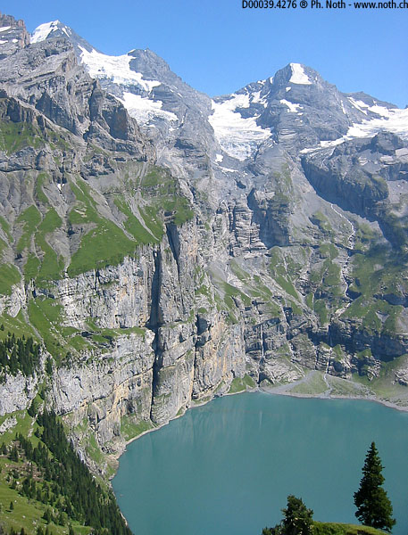
The Oeschinensee, above Kandersteg, is a delightful alpine lake almost completely surrounded by vertical cliffs. Numerous hiking and walking routes explore the shores (10 of them are enumerated in a free brochure that you can get at the cable car's lower station).
The rowing boats, the pedalos, all the bustling activity on and around the lake are not really my cup of tea, so let's take the two hardest and longest hikes to escape that (as a general rule, beyond one hour walking, you find the mountain's quietness again: tour groups and plain tourists don't go that far).

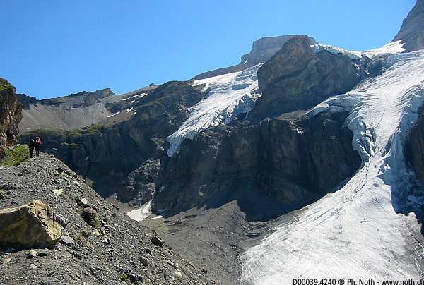
Head right of the lake for the path to Fründenhütte or choose the tougher hike to Blüemlisalphütte on the left. We will take the second one. Up to Underbärgli (1 ½ hours), it's a wide footpath slowly gaining height above the lake. Here you can take a rest in the restaurant and decide if you carry on, because immediately after that, the track crosses a steep section with steps in the cliff and chains to reach another restaurant! Last opportunity to relax, because from now on, things get serious. The last section, a steep ascent through black loose stones, is particularly exhausting under the beating sun.
Note that another itinerary exists, starting from the Kiental valley (not tested yet).

