In short:
- Starting point: Col de Chaude (road from Villeneuve)
- Total duration: 3 hours (substract ½ hour if not going further than Pertuis d'Aveneyre)
- Difficulty: T1 - Valley Hikes
- KMZ file for Google Earth
- GPX track for GPS
- Profile (up & down):

- Aloneness index:

Maps:

Links (click on flag):
 Gallery De la Pointe d'Aveneyre au Malatraix on montagne.ch.
- Various itineraries to and around Pointe d'Aveneyre (Randalp).
Pertuis d'Aveneyre, Pointe d'Aveneyre
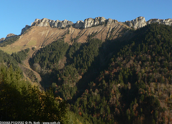
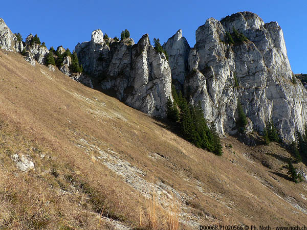
High above Villeneuve, a long cliff barrier stands between the Rochers de Naye and the Hongrin lake.The Pertuis d'Aveneyre (1846m, 6056ft) is a small pass at the top of a narrow gully that forms a line of ascent in between the cliffs. The summit of the Pointe d'Aveneyre (2011m, 6598ft) stands close by. This walk makes a good half day outing, provided you have some means of transport to get to the starting point described here. If not, you'll have to opt for a longer alternative, starting for instance from the Rochers de Naye or even, for the fittest walkers, from down in the plaine, near Roche.
No need to go to length to describe this short walk - so let's get started! You'll find a few parking spaces at the Col de Chaude (1621m, 5318ft) but since the path starts in the last hairpin of the climb, park there if it is free. There must be space for one or two vehicles, not more.

The route consists of 3 completely different stretches:
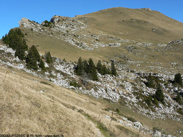
- The first leg is an almost completely horizontal traverse and lasts about 25 minutes. In the last hairpin of the road, a path runs into the woods off to the right. It crosses several ravines and streams that are normally dry but should be crossed carefully. These short passages of unstable stones, where remaining patches of snow can sometimes be found, are the only difficulties of the route. The first leg ends after the path goes up steep switchbacks and enters in thicker woods.
- The second leg starts at the junction for Grand Tour (1632m, 5354ft) and lasts about 30-35 minutes. Follow the signs to Pertuis d'Aveneyre, Malatraix, Joux Verte and Roche to the left. The path climbs a shoulder through the woods that then become sparser and sparser until you can see out towards the Pointe d'Aiguille to your right, the Pointe d'Aveneyre to your left, and a small portion of Lac Léman down behind you. Although sustained, the climb is quite easy because of the excellent state of the path (all the roots have disappeared). Just before reaching the pass, the path heads into a narrow chasm which takes you up on to the Malatraix-Pointe d'Aveneyre ridge. After such a climb between the high cliffs it's surprising how gentle the slopes are up top!
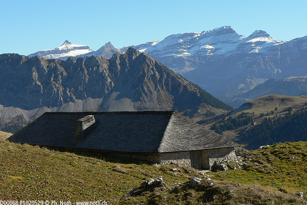
- Now one of goals of the outing has been reached, the third leg of the route begins: explore as you wish the beautiful grassy ridge. To the right of the pass, towards Malatraix, you can admire lapiazs (limestone pavement), but the path ebbs away rapidly this way. To the left of the pass, first go to see the magnificent "tavillons" (roofing shakes in local Swiss) at the Ferme du Pré. You'll also be able to admire the view towards the Tours d'Aï de Leysin which weren't visible from the pass, the Diablerets (you can make out the cube formed by the Botta restaurant sheltering against the mountain) and the Oldenhorn. Then, with no need for a path, you can make your way up through the grassland to the top of the Pointe d'Aveneyre, about 45 minutes there and back from the Pertuis d'Aveneyre. Some days you might hear explosions coming from over near the Hongrin lake but don't worry, the military training operations from which they originate are restrained to an area under the Tours d'Aï and the Tours de Mayen.
The way back follows the same path as on the way up (about 45 minutes from the Pertuis d'Aveneyre). Apparently there is a direct way down from the Pointe d'Aveneyre to the Col de Chaude although is does seem rather steep - probably better to try it out on the way up...