In short:
- Starting point: Hinterrhein
- Total duration: 5 hours
- Difficulty: T2 - Mountain Hikes
- KMZ file for Google Earth
- Profile (up & down):
- Aloneness index:

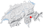
Maps:

Links (click on flag):
 Hike report on Hikr.org.
Valserberg


I decided to do this walk to a pass of historical interest offhand during a visit in the region. This pass, the Valserberg Pass, was the main way into the southern Italian-speaking valleys for the inhabitants of the Vorderrhein valleys in the Graubünden region.
The most enjoyable in our outing to the Valserberg Pass was the feeling to be well away from the buzz of modern life. Even here, at 1600m above sea level, the main road of the San Bernardino pass runs along the bottom of the valley which is also covered with various military facilities. In 2009, the appearance of this part of the mountains was spoilt by various building sites.
From the centre of Hinterrhein, follow the directions given on the signpost. Cross the bridge over the Rappierbach and follow the lane that winds up the mountain side towards the alpine meadows and their many stone barns: Cassana at 1780m (5840ft) just under the high power lines, Wald at 1902m (6240ft), Tristel, etc.
When you reach Brüchbärg (2084m, 6837ft) after about 1½ hrs, the lane splits up: take right here. You'll pass a sign for "Bergwanderweg" - for non German speakers, this is not the name of a village - then an antenna. Next, you'll reach a dampish flat area under a crag: a place called Alp Piänetsch. Here, take a small path to your left and make your way to the actual Piänetsch farmstead from where the Valserberg pass is given as 1 hr away. If you miss the first path left, you'll find another one farther on at Alp Piänetsch. This is where the lane to the meadows ends; the remainder of the climb is on paths.
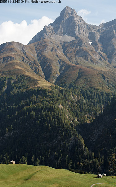
The path is quite steep, especially when it heads towards a rise with a big wooden 'X' on its top. You'll reach this point within about 2½ hrs and after having crossed a small stream in which runs maybe the famous Valser spring water. From this beacon onwards the path is much easier and you'll reach the Valserberg pass within 20 minutes. The pass is wide, nothing like the narrow and craggy Ecandies pass or the Sefinenfurgge. At 2504m (8215ft), it leads into the Vals valley. The beautiful cliffs of the Valserhorn peak are on the right of the pass and several military shelters can be found buried nearby - a reminder of times gone by.
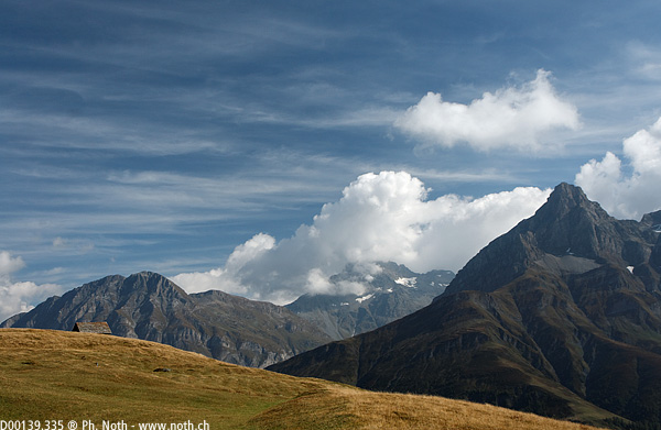

To make your way back, you can cut straight across the easy going slopes down to Brüchbärg. Then follow the small lane again and give your knees a rest! On the other side of the valley you can see the elegant pyramid of the Einshorn, towering at nearly 3000m. The descent lasts about 1¾ hrs.
