In short:
- Starting point: Blatten
- Total duration: 5 hours
- Difficulty: T3 - Challenging Mountain Hikes
- KMZ file for Google Earth
- Profile:
- Aloneness index:


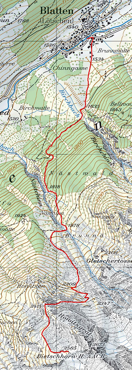
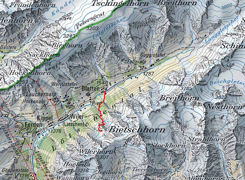
Maps:
Links (click on flag):
 Hike reports on Hikr.org.
 The cabin's website, AACB (Akademischer Alpenclub Bern).
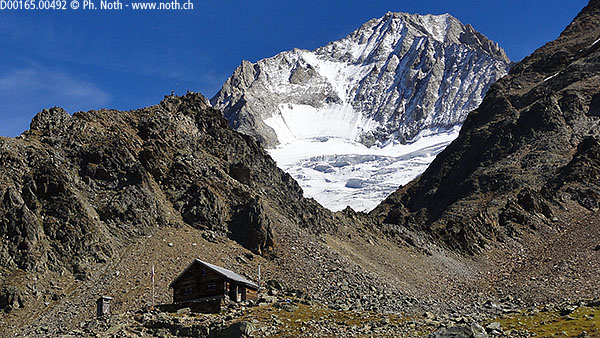
Bietschhornhütte
The Bietschhornhütte is another of the rare huts that has retained its hardy mountain nature. And like the Cabane de l’A Neuve, its keeper – who has been keeper since 1999 - is known for her commitment and great welcome. Apparently others agree with me in this because the keeper received the Wilderness 2004 award and was stated to be "a keeper who has voluntarily dispensed with modern comfort to preserve an atmosphere of alpine tradition, without any effect on the welcome guests receive".
This wooden chalet on the southern slopes of the Lötschental valley benefits from another important advantage that will appeal to hard-liner loners: a scenic path that links it, by means of a long 6-7 hour walk, to Goppenstein. The present page do not describe the Bietschhornhütte-Goppenstein path but rather the way up to the hut, and attempting the whole route should only be undertaken after very careful consideration because it is very long, infrequently walked, poorly marked (the path disappears in places) and technically difficult (T4 grade on the Swiss Alpine Club scale). However if you are a good walker looking for aloneness you can explore the first portion of the trail and return to the hut. The hut keeper will tell you more about potential difficulties and the pitfalls to avoid.
You can start the walk up to the hut from Blatten, Ried or Wiler. From Wiler the climb is slightly longer and starting in Ried is the more comfortable option. However, in Blatten there is a convenient large car park in the center of the village. Follow the signs from the center of Blatten which lead to a gentle sloped meadow that the path crosses towards the right. The path then meets up with a closed road that suddenly comes to an end [1635 m, 15 min]. This is where real things start because behind the embankment lies the Birchbach stream, the first obstacle to cross. In September, the stream was dry and there was no bridge to use. Climbing the other side of the ravine is also awkward.
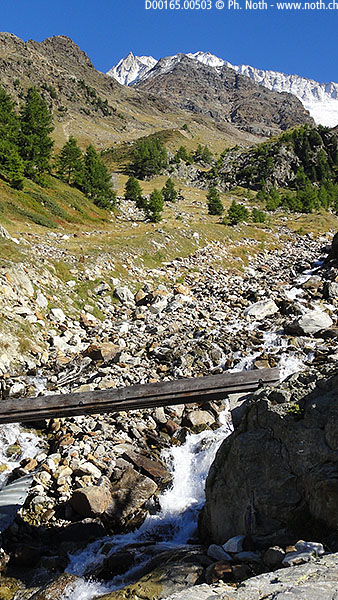
The next portion of the route takes you to another stream, the Nästbach, via a horizontal path through the Nästwald woods. When you meet the path coming up from Ried [approx. 1700 m, 30 min], take the obvious direction, i.e. left. The path starts to climb and the ascent becomes more strenuous. The Bietschhorn and Nesthorn appear high above you. As you come out of the forest, you will find yourself in a beautiful narrow valley directly underneath a glacier (Nestgletscher). In the summer season, a small metal bridge is provided to cross the glacier's meltwater stream [approx. 1960 m, 1h15]. At other times, you will need to take care to find the best stepping stones to get across. Remember that this is a glacial stream; its flow can increase depending on the time of day and the weather conditions.
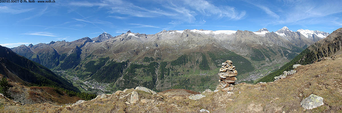
The Nästalp (or Bruna) meadows are covered with blueberry bushes and alpenrose in the summertime whereas the Howitzgrat shoulder displays fantastic colors in the autumn. So what is the best season for this walk? This rather depends on whether you prefer enchanting autumn hues or enjoying a good meal up a mountain? All I can say is that it's well worth seeing the Lötschental in the autumn at least once in a lifetime. Whether you set out for this walk, the Niwen trail or a more familial outing such as the Anenhütte, the Lötschental offers unique natural beauty that no-one remains indifferent to.
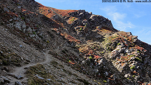
The path climbs straight up the right side of the stream, dispensing with unnecessary bends, until it reaches a steeper slope covered in the autumn with glowing red bushes. From there it turns right to seemingly take advantage of gentler slopes before changing its mind and climbing higher again to cross the ridge. There are in fact two paths here and the former path can be seen lower on the ridge. However it is not used anymore and rocks have been positioned across it to direct walkers along the new path. The latter climbs up across the slopes to the right following a slighter more vertiginous trail until it reaches the Howitzgrat ridge [2415 m, 2h15]. Be aware: the presence of snow on this portion could make it dangerous.
On the ridge two cairns and a small platform entice you to take a break, have a nibble or at least take time to admire the view. From here there is a great view out over the Lötschental, from the Niwen far to the left to the Breithorn to the right, as well as the famous Lötschepass and the Petersgrat ridge. As you set off again, you will see the hut not far above you. It seems close, and for once, actually is: just a few more minutes.
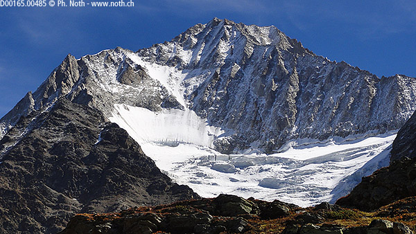
However don't relax too much because the short distance to be covered requires concentration. To your left you will find chains and ropes bolted into the rock to help you along. The final steps of the climb follow an old moraine up to the hut [2565 m, 2h45]. The Bietschhorn towers above the hut through a gap between two rocky crags. This eminent peak, very often depicted on photos of the Central and Upper Valais regions, shows here one of its broader, but still beautiful faces.
The descent from the hut follows the same itinerary. To make a change, you can take the path down via Ried for the last portion of the way.


This hike is featured in the book
Randonnées pour Grizzlys
Alpes valaisannes
published in 2013 by the editor Slatkine.
The book can be ordered online at the Slatkine website or bought in any good bookstore of French-speaking Switzerland