In short:
- Starting point: Ovronnaz or Chamosentse
- Total duration: 4 ½ hours, or 2 ½ hours with the new trail starting at the top of the Jorasse installation
- Difficulty: T2 - Mountain Hikes
- KMZ file for Google Earth
- Profile (up & down from Ovronnaz):

- Profile (up & down from Chamosentse):

- Aloneness index:

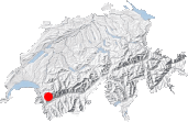
Maps:
Links (click on flag):
 Notes on Cabane Rambert and the quality of its welcome, Guide des refuges de haute et moyenne montagne by Markus Jaton.
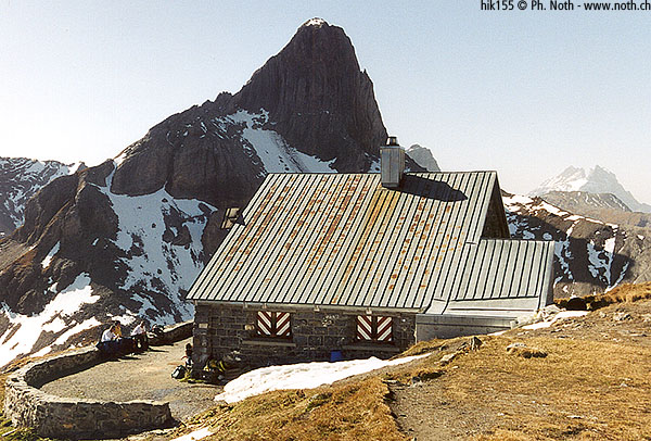
Cabane Rambert
At that time the snowy slopes and glaciers of the Valais region and the green Fribourg Prealps were my playground, and I guess I first discovered the Alpes Vaudoises with this walk to the Rambert hut (2580m, 8465ft). The austere Grand Muveran peak, at the foot of which the hut lies, and the other surrounding summits form an impressive craggy range quite different from those I had visited up to then.
There are several ways up to Rambert. The route described here is the most frequently walked; it is also the shortest and easiest. [Updated 21-Aug-2008: there exists now a shorter access than the one described here, thanks to the new trail starting at the top of the Jorasse chairlift. See below the comment by Téléovronnaz]. The itinerary starts from the spa village of Ovronnaz, more precisely from the chairlift for Bougnone. Do not take the lift, but start walking along the road which leads off just behind it until you find a path pointed out, as usual, by a yellow signpost. It should be noted that you will only gain 5 minutes by driving up here, and since there are limited parking spaces, it is better to leave your car at the chairlift car park. The starting point is at 1482m (4862ft).
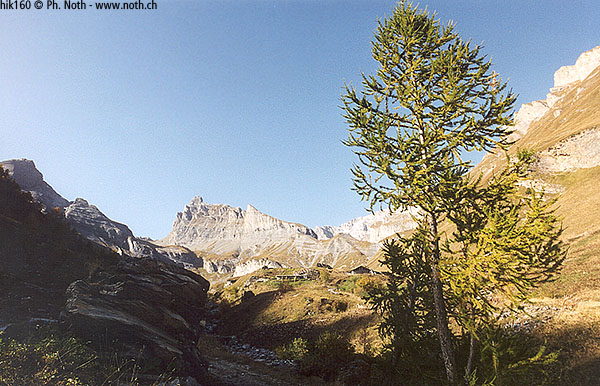
For about 35 minutes, follow a wide path which climbs many hairpins through a fairly sparse forest before coming out at La Saille alp chalets (1790m). Behind these stands the Petit Muveran and another quite elegant peak to its left. This is perhaps the Dent Favre but I'm not yet familiar with the Vaud Alps so I'm not entirely sure. In my defence I must admit that the Petit Muveran made me lose my bearings since it looks completely different from La Saille and the Rambert hut.
Unluckily that day the calm and peace of the setting was disturbed by a lorry unloading material for Bougnone. The noise of it followed me up to Plan Coppel!
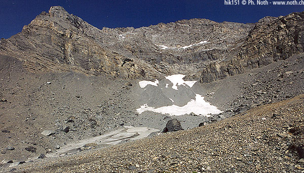
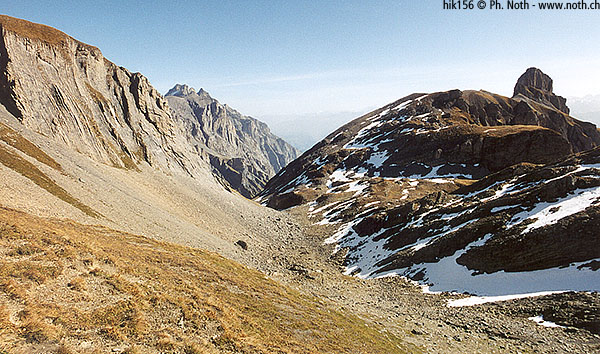
La Saille marks the end of the first level of the three levels of this walk. Looking back out towards the other side of the Rhône valley the viewpoint is already quite impressive, especially towards the Grand Combin. From La Saille, the path heads on up to the right for another 45 minutes of strenuous climbing until it reaches the next flattish area called Plan Coppel, a U-shaped small valley traversed by a stream. Leave the cross on a small peak (point 2335m on Swiss maps) to your left (at first I naively thought this was where I would find the hut) and climb 25 minutes more along the bottom of the Plan Coppel. The path eventually comes out in the Plan Salentse cirque, a magical but rather inhospitable place. The Grand Muveran lies to the north, the Petit Muveran to the west and very steep rocky slopes form the terraces of this natural amphitheatre.
The eastern slope of the cirque now needs climbing in order to reach a pass and then the Rambert hut. From here the Petit Muveran looks rather like the Brazilian Sugar Loaf. Much to my regret, the chances of meeting any throng-wearing samba dancers up here at 2500m above sea level are rather thin, unless you suffer from altitude sickness. Besides, the rest of the landscape will not lead you astray: scrawny plants, the great dark stern face of the Grand Muveran that towers above and overpowers the place, walkers' boots (and not flip-flops!) - so no, we're definitely nowhere near the tropics.
From the pass many walkers descend on the other side of the mountain towards Derborence - maybe they are doing the "Tour des Muverans" circuit. The view from the hut looks out towards the local peaks, which aren't particularly well known, and their craggy faces. Further off, on the other side of the Rhône valley and even though the light isn't particularly advantageous, you will be able to make out the great peaks of the Valais and Savoy Alps: Mont Blanc, the Grand Combin, the Dent Blanche, the Weisshorn, etc. (from west to east and only naming those that can be recognised with certainty).
The walk back down to Ovronnaz follows the same path as on the way up and takes about 2 hours.
Readers' comments:
Note: you can read the original comment at the bottom of the french page. Bottom line is:
 From: Téléovronnaz SA (www.teleovronnaz.ch)

                  Sent: 21-Aug-2008


                  (...)

                  please mention that a new trail « Bougnonne - Pierre à Vatserou » has been inaugurated on the 12th of July. With this possibility, the walking time from Jorasse to Rambert amounts to only 2.5 hours.

