The book can be ordered online at the Slatkine website or bought in any good bookstore of French-speaking Switzerland
Nanztal, bisse de Heido, bisse de Bodmeri-Niwa
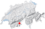
Closed at its southern end by the high peaks of the Fletschhorn range but opening into the Rhone valley, the Nanztal valley has managed to remain particularly wild, doubtless because there are no roads into it. Trekkers on the trail from Visperterminen to the Simplon Pass get only a brief view of the valley. This route will provide you with a more in-depth visit to the valley as you cover the over 1000-meter climb from the forests near Gibidum to the high mountain pastures of Fulmoos. On the way you'll see three magnificent bisses (irrigation channels), two of which are still in use.
The walk described here is very long, actually the longest in this guide, and covers in all a distance of over 25 kilometers. It is, however, technically an easy walk without any particularly strenuous portions. Nevertheless, you may find it more sensible to divide it into two separate circuits:
• a lower Nanztal trail, including the Boderi-Niwa and Obere Niwa bisses, along mostly forest paths,
• a upper Nanztal trail, quite different and mostly across open land, and including the Heido bisse and the Fulmoos pastures.
It's up to you. You can also use the Giw ski lift to shorten it slightly. To complete the whole circuit, a very early start in the morning is advisable; otherwise consider walking the trail the other way round.
In Bodma that can be accessed via a toll road from the north of Visperterminen and where there is a pretty campsite, follow the sign to Wyssi Flue. Only 5 minutes later, you will find the sign you are looking for: Hüoterhüsi, 25 min. For about 30 minutes, you will walk along the beautiful Bodmeri-Niwa bisse which flows from April on through the summer. The path follows the bisse as it flows down, sometimes the descent is barely perceptible, sometimes it is more obvious. It's a great start for a walk: a gentle stroll through a forest of larches. If you start the trail in the village of Visperterminen, first take the Waldkapelle (Chapel trail) path up to Muttji and then simply follow the bisse.
As you come to the end of a forest track [1581 m, 30 min], take care not to follow either the track or the bisse flowing down to the left because Hüoterhüsi is only 5 minutes away, but in the opposite direction. Hüoterhüsi is quite a surprising place: a little wooden shed with a portion of balustrade along the cliff. In the local Upper Valais dialect, less difficult to understand when written than spoken, Hüoterhüsi means "Hüterhaus", so this little house was where the bisse warden worked and perhaps lived.
Two crosses can also be found here - probably to help walkers intimidated by the awing path along the Obere Niwa bisse. It is indeed very vertiginous with a long drop under your feet, but also very suitably protected. A little afterward, the overhanging catwalk gives way to a forest path but the ground remains steep. Steep portions equipped with planks of wood, cables and barriers alternate with much easier portions where the path can be as much as a whole meter wide. Unlike the Boderi-Niwa bisse, the Obere Niwa bisse does not flow any more, but you can sometimes still make out the trench where the water used to flow.
Now the excitement is over, the next flat portion in the forest can seem rather boring. But there is still a long day of walking ahead over different types of terrain and with contrasting views. This is what makes this walk special. At the next crossing, take the path towards Mättwe Nanztal. A south-facing clearing in the forest, Äntschi [1648 m, 1h20], marks the entry into the Nanztal valley. The forest is still dense however, except when the path crosses a few gullies.
As the path heads to the right, you are now walking the along the tree-covered eastern slopes of the Nanztal, a zone called Äntschigrabe. Down below you can hear a torrent splashing and suddenly the path descends steeply towards it [1480 m, 1h45]. A few hairpins and you will be down next to the Gamsa river at an altitude of 1373 m, the lowest point of the trip.
The Gamsa bubbles down over small falls before reaching further downstream the impenetrable Gamsuchi gorges. On the other side of the bridge [1373 m, 2 h], the vegetation is lush and the forest more primeval. The arduous path that heads into the forest meets up with another wider and more comfortable path after a little under 30 minutes. Take right towards Mittluhüs 25 min, Mättwe Nanztal 1h25.
The going is easier now and you will soon reach Mittluhüs [1599 m, 2h45] where you cross back onto the left bank of the Gamsa. The trees give way to the pastures of Nidristi Alp (don't go over the bridge), and then Mättwe. The path turns into a passable track. You can sometimes meet here the jeeps of the farmers who use the pastures in the summer or mountain bikers riding down from the Gibidumpass. Indeed, the track does not come up from below but down from the vast wide pass visible up to your right on the grassy ridge. You will cross the Gibidumpass later on, but only after several more hours of walking.
Once past Mättwe, a hairpin in the track takes it back to the right [1835 m, 3h40]. If you want to split this long walk and do only the lower Nanztal trail, follow the track back to the Gibidumpass. Otherwise, leave the track and follow the path along the stream, even if there are no signs to help. Instructions are simple: just keep heading up the valley. This portion of the walk between Mättwe and the bisse de Heido is particularly wild and lonesome: the trail to the Simplon pass runs much higher up (Obers Fulmoos) so there is generally no-one around down here.
Various bridges take you back and forth over the stream. You will find one at Alte Stafel [approx. 1940 m, 4h05] where you can also see a large sheep pen ("Färriche") with beautiful dry stone walls. As shown on the Swiss national map and GPS maps, the path is less obvious and disappears in parts after Alte Stafel. Head to the right of the half fallen-down sheep shelter until you find a small trail which is even well-trodden in places. It climbs up away from the stream, passes a ruin at Lüstchugge and then crosses a small stream that flows down from the Blausee lake. The setting is splendid: alpenrose, waterfalls, the jutting Rauthorn (Böshorn) peak and the snowy dome of the Senggchuppa.
The path is easier to follow now and continues on winding its way, but still peters out in places, until it reaches Unners Fulmoos (farmstead). There is no point in going to the farm. Stay on the left bank of the stream, at about 30 meters from it, and continue climbing the grassy slope until you reach a flatter area where you might meet pretty black-headed sheep. Here you will find the drystone Stenofärich sheep shelter [2252 m, 4h45], the highlight of the day in my opinion. What a beautiful, peaceful view! Away from all the main trails, this place must see more sheep than hikers.
From the sheep shelter, the best thing is to climb directly up along the left bank of the stream, off-trail, until you reach the bisse. The latter is clearly visible as a horizontal scar across the mountainside about 100 meters further up. It's not without pleasure that you find the excellent path along the bisse de Heido, also called the bisse de Païen (pagan's bisse) [approx. 2400 m, 5h15]. This channel collects the precious water of the streams and glaciers of the upper Nanztal valley. It is not the highest bisse in Switzerland (a record held by the Gsponeri bisse), but one of the oldest. Its existence was recorded in documents dating from 1305 [3]. It is also one of the rare bisses to have been built over open land. I have been told that some mountain bikers ride the bisse path, which seems rather dangerous due to its narrowness – be aware!
Follow the path right, towards the Gibidumpass. It alternates between buried and open portions of bisse. While the path offers no shelter from the sun, it remains generally cool for walkers because of the high altitude. You might meet more hikers here, but most will have already disappeared at the end of the afternoon. Straight ahead, away in the distance, the Bietschhorn stands out. And directly across on the other side of the Rhone valley, in the exact same alignment as the Nanztal, lies the Gredetschtal valley, another beauty worth a visit [route No. 16]. You will reach the Gibidumpass without difficulty [2201 m, 6h30], apart from one short portion with planks and a cable that requires more attention.
From there on it is simply a question of returning home (or to the car): first follow the path down across the ski slopes from Gibidumpass to Giw [1962 m, 6h50]. Then, depending on where you started from in the morning:
• follow the signs Visperterminen/Waldkapelle to go back to Visperterminen on foot (1h15 from Giw)
• take the ski lift if it is still open (closes at 5 or 6 pm, depending on the day of the week and the season)
• if you started from Bodma: several options are possible, all fairly tedious (road and/or steep descent through the forest). Make sure you don't descend lower that you should: follow Müttji, then Bodma (1h30 from Giw).


This hike is featured in the book
Randonnées pour Grizzlys
Alpes valaisannes
published in 2013 by the editor Slatkine.
The book can be ordered online at the Slatkine website or bought in any good bookstore of French-speaking Switzerland