In short:
- Starting point: Anzère, Pas de Maimbré cable car upper station
- Total duration: approx. 6 ½ hours
- Difficulty: T2 - Mountain Hikes
- KMZ file for Google Earth
- Profile (roundtrip):

- Aloneness index:

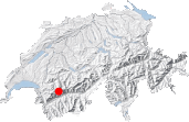
Maps:
Links (click on flag):
 Report and pictures on Randomandie.ch.
- Official site of the Cabane des Audannes.
Cabane des Audannes, Tour du Sex Rouge
With the brightness of the karst limestone and the blackness of the Couloir des Andins, the Tour du Sex Rouge is a 6 hour walk through contrasting landscapes. In its September 2008 edition, Les Alpes magazine suggested that this trip was better done over 2 days with a night at the Cabane des Audannes. I entirely agree with this as it means plenty of time both to climb to the summit of Sex Rouge (2893 m, 9491 ft) and to take in the very peculiar scenery at Audannes.
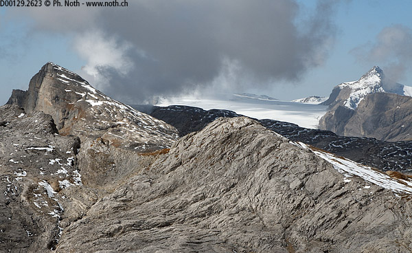
To start off, take the cable-car for Pas de Maimbré at Anzère. From there, head left for a few minutes until you reach a small ladder that helps negotiate a rocky outcrop part of the Chamossaire ridge: this is the actual Pas de Maimbré. After this, the path heads north crossing the mountainside of a beautiful natural cirque - this stretch is quite long but easy since the path stays fairly level. My fear of finding the landscape blemished by the Anzère ski slopes was happily unfounded. From the start the scenery of the upper Sionne valley is both wild and preserved.
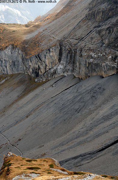
Our itinerary now heads towards the Col de La Selle (2709m, 8888ft) between Sex Rouge and Sex Noir - very well named peaks since the first is a tower of red rock whereas the other is black. On the first stage of the climb, easy steps and a path with red and white markings have replaced the former path with white and blue markings. After 1 hour 10 minutes, a cairn marks the end of this first stage of the climb and you'll discover a landscape of polished rock (limestone pavement called here lapiaz) as far as you can see. Many descriptions on Internet tell of a moon-like landscape and this does seem particularly appropriate.
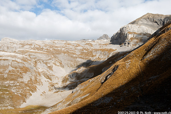
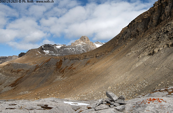
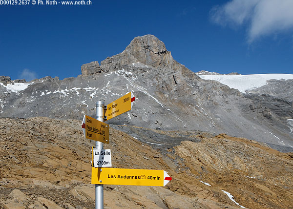
Another ½ hour across ochre-coloured scree and you'll reach the Col de la Selle (1h40). To your left you'll see the Diablerets glacier and straight on Mont Pucel and the Wildhorn glacier (or according to the maps the Audannes and Ténéhet glaciers, respectively). From the pass a signpost shows that the ascension of Sex Rouge would be a 30-minutes climb, whereas the Cabane des Audannes is 40 minutes away. On the opposite side of the Audannes valley the apparent steepness of the slope up to the Col des Eaux Froides (Cold water pass) makes it look impassable from here.
The descent in the lapiaz is easy and actually quite fun if you take care to keep away from the sharp edges. There's no way a path could be "built" on this portion of 100% rock so you can wander left and right as you wish following more or less the blue arrows on the rocks. Do be careful if there are still patches of snow as these can hide holes beneath them.
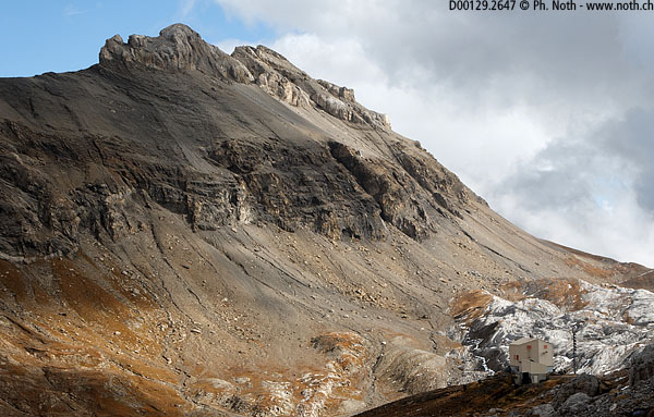
You'll reach the Cabane des Audannes after 2½ hours walking. It really looks more like some kind of lunar module than a mountain hut. And actually, as with the International Space Station, a new module has been connected on since my last visit: an extension was built in 2009-2010. On my autumn trip up here the lake was dry and the limestone on its banks gleamed in the sunlight.
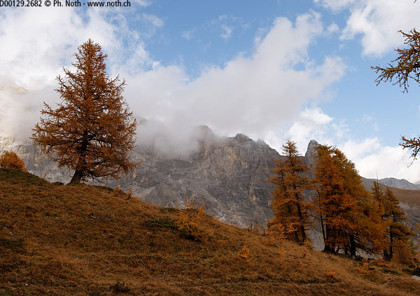
The descent from the hut starts with a flat portion over another lapiaz before plunging down the Combe des Andins, a bleak place but with a sort of Icelandic beauty. A few ropes have been placed to help you down. Then a signpost set into the cliff indicates two possibilities, either the Chemin de la Conduite (Serin, Les Rousses, Anzère) or the Chemin des Andins. The former comes with a warning sign: danger! I decided to go for this first option along the Chemin de la Conduite since it sounded more exciting and more direct. As you can see on the photo, the path crosses ground very similar to volcanic scoria. A rope protects the route nearly all the way along and comes in most useful in some places that have been ravined by heavy rain and snowmelt. Depending on the circumstances it may better to take the lower route but of course that's up to you and both paths join up again 30 minutes later at Poédasson. Here the setting becomes more welcoming again with the yellow autumn colours of the larches and red bushes. Further down at Serin the vestiges of the great 1946 landslide can still be seen. Eventually, about 1½ hours after leaving the mountain hut, you'll come across a forest track.
Following the indications for Anzère, the itinerary switches back and forth between the wide forest track and a footpath. A map can be useful here because there are many small paths. You can either go via Ravouéné, or follow lower down the Bisse d'Ayent (water channel) in which case you'll arrive via Forniri, slightly lower down in the village. It normally takes about 3 hours to reach Anzère from the Cabane des Audannes.
If the thought of walking around or climbing peaks called Sex Noir, Sex Rouge (the word "sexe" in French means both the act and "penis"), Mont Pucel (a "pucelle" being a "virgin") or La Motte (something dirty in French slang), has made you smirk then you have a one track mind. And if you felt proud on your way through the hamlet called "Pro du Sex" (sex professional) then you're just pretentious. The terms "sex", "scex" and "six" all stem from the latin "saxium" for rock and the "x" is not pronounced!
Commentaires reçus:
 From: gregoire sauthier

                  Sent: 14-Jul-2007


                  (...)

                  je m'appelle grégoire et j'ai lu ton article sur la cabane de bertol sur ton
                  site, fabuleuse mais j'aimerai just faire un petit comentaire au sujet de
                  l'interdiction de trafique a la sortie du village d'arrola. En effet
                  aujourd'hui j'avait prévu une sortie jusqu'à tête Blanche en passant par
                  Bertol, elle fut magnifique d'ailleur. Mais à ma grande surprise quand je
                  suis arrivé à ma voiture vers 15h30, un policier était en train de
                  verbaliser allègrement toutes les voitures se trouvant au delà du
                  panneau!!!!!


                  Alors par tous les trolls ne parquez pas au delà du panneau d'interdiction
                  si vous ne voulez pas que votre rando ne se transforme en un
                  cauchmar!!!!!!!!

