In short:
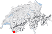
- Starting point: Ferret
- Total duration: 6 ½ hours
- Difficulty: T3 - Challenging Mountain Hikes
- KMZ file for Google Earth
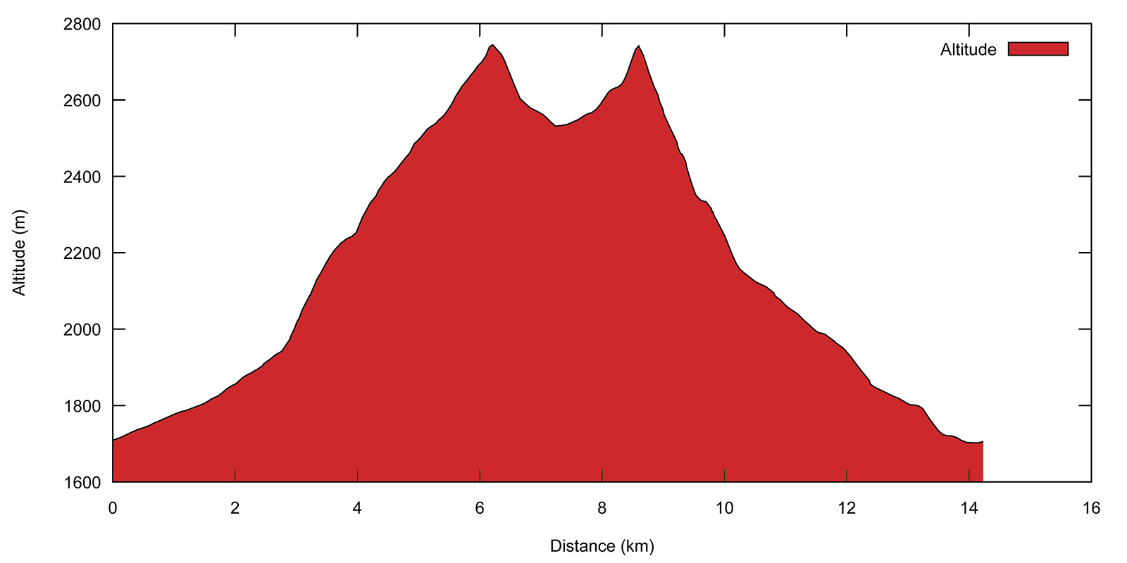
- Profile:
- Aloneness index:

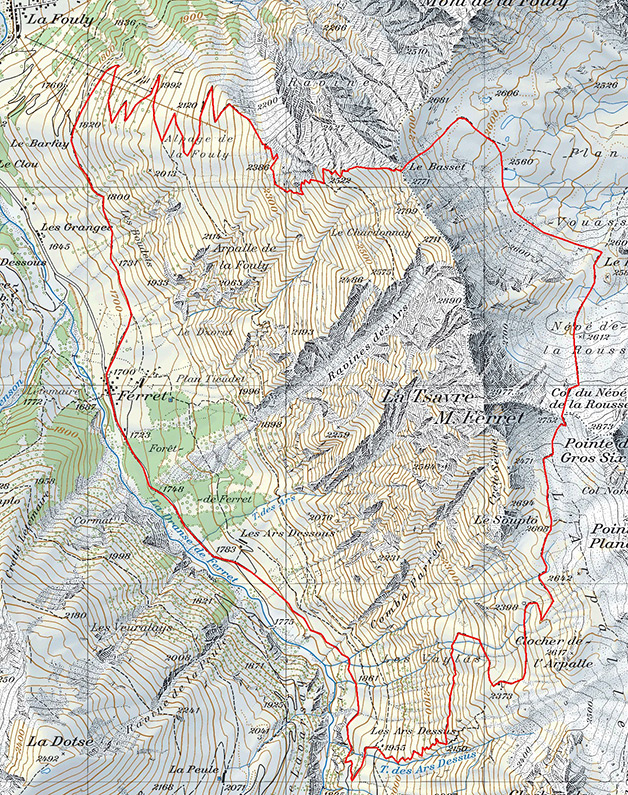
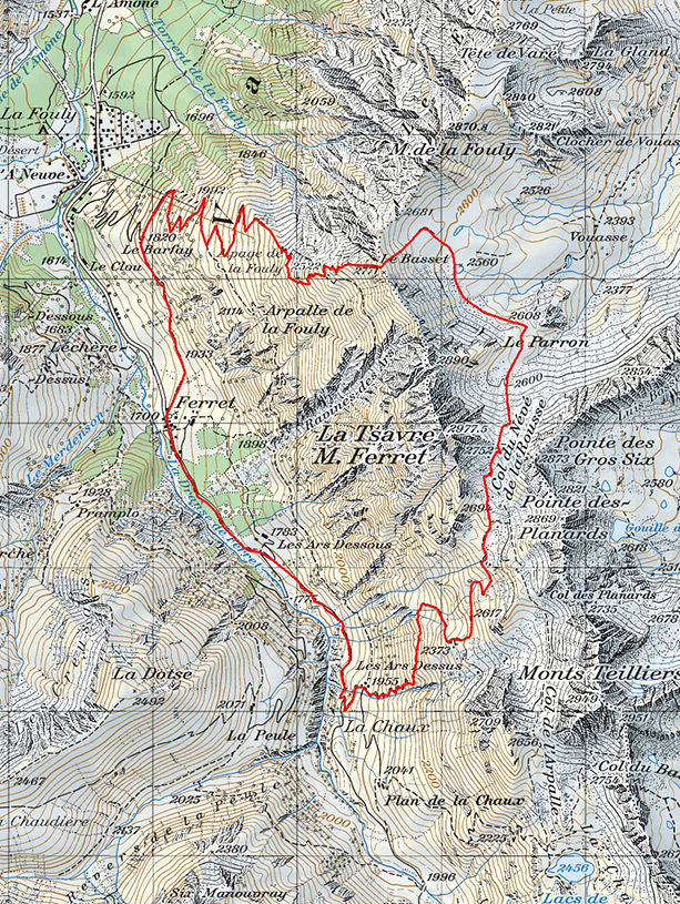
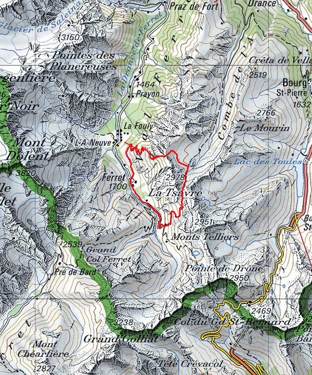
Maps:
Links (click on flag):
Combe de l'A, col du Névé de la Rousse, Le Basset
This itinerary could also have been called the "Tour of La Tsavre" since it will take you around this majestic near-three-thousander in the Ferret valley. A first pass, the Col du Névé de la Rousse, opens the way into the magnificent Combe de l’A. The route will then take you across the upper slopes of this haven for mountain animals and plants before reentering the Ferret valley via Le Basset on the northern ridge down from La Tsavre.
Before describing the route, a word of caution is nonetheless called for: the descent from the summit of Le Basset is quite exposed and comes down across steep grassy slopes alongside an area of spectacular ravines. Better to be forewarned than sorry later on, having to turn back after 4½ hours walking would not be pleasant! The walk can still be feasible for people with vertigo either by doing it in the opposite direction to that described here or just visiting the combe via the Col du Névé de la Rousse both on the way up and down.
The walk starts at the car park or the bus stop in Ferret. To begin with follow the tarmac road; little traffic is to be seen from Ferret on. After ¼ hour the road turns into a track up to the alpine meadows. At the junction, leave both the track down to the river and the track up left towards Ars Dessous and continue on up the valley towards the Ars Dessus farm.

The hairpins on the track will take you over a small stream two times. After the second crossing, take a path that leads straight up the mountainside. The sign indicates Col du Névé de la Rousse, Liddes/Combe de l'A, without showing the time needed to get there [1955 m, 55 min]. The path is quite narrow and climbs up in tight hairpins on the right bank of a mountain stream. It then leaves the stream to cross the slope towards the north. Opposite you stands La Tsavre, also known as Mont Ferret, which will be close by all day long.
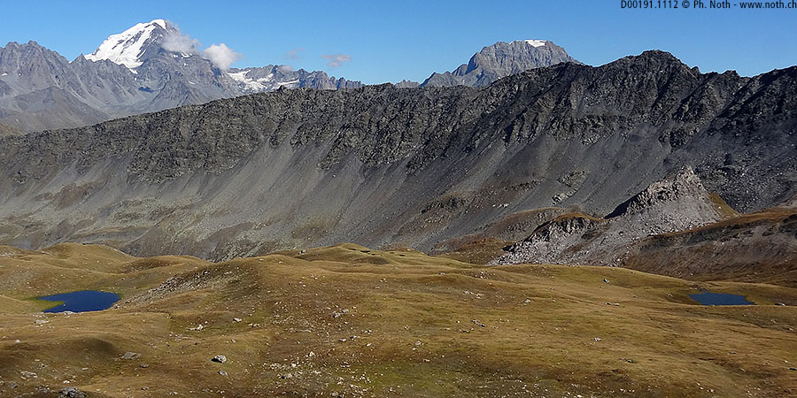
A small outcrop provides a good place to get your breath back and admire the scenery of the Ferret valley [2250 m, 1h40]. You can see the La Peule farm nesting under the enormous height of the Grandes Jorasses, and Mont Dolent with its stunted glacier. Those with good eyesight might be able to sight the Cabane de l’A Neuve and the Bivouac du Dolent. Although much smaller, due to its bright orange color, the latter should actually be easier to see.
A red arrow indicates to take to the right. The path practically peters out as it leads up the steep slope then, without good reason, becomes three times as wide. Maybe this is because you're getting near a wooden farm shed, recently rebuilt on the ruins of a former stone building [2373 m, 2 h].
The 400 last meters up to the pass are the most beautiful as the path crosses a vast alpine meadow, l'Arpalle, with gentle dips and folds like a puckered sheet. In 1995 some spooky happenings occurred here and a great many sheep were mutilated by a mysterious beast, the "bête du Val Ferret". The official report on these events, that even made national Swiss TV, could not provide definite conclusions but it is supposed that the sheep were attacked by one or several wolves from the nearby Italian Alps. If you are a real grizzly loner, then not to worry, a wolf or two won't scare you. On the other hand, if you are just a human, well, don't hang around too long!
Keeping the Clocher de l'Arpalle (rocky outcrop) to your right, you will soon reach a junction [2608 m, 2h40]. A sign shows the way to the Col du Névé de la Rousse and the Combe de l'A. Take the path left, the path to the right leads up to the Fenêtre lakes. The ground becomes rocky and soon you will be able to see the peculiar rocks of the Col du Névé de la Rousse shining in the sunlight. Maurice Brandt, in one of the Alpine Club reference books, describes how the ocre color of the eastern slopes around the pass is due to the presence of gypsum and cargneule. The few last meters below the pass form a dark shale ramp that contrasts beautifully with the white rock. At the pass [2752 m, 3 h], your next destination is indicated on a yellow sign: Le Basset, only 1 hour away.

At the pass you enter one of the 41 federal nature protection zones in Switzerland aimed at protecting rare and threatened animal species. To be precise, the walk actually started in a federal nature protection zone. However, Swiss law distinguishes between fully-protected and partially-protected zones. You have just entered the central, high-level protection zone.
The path leads down over stony ground towards an almost dry pond that does not appear on the map. Just below the pond, the markings indicate to follow the trickle of water leaving it. Not for long though, because shortly a sign indicating Basset raccourci (shortcut to Le Basset) shows you where to cross the stream [approx. 2600 m, 3½ h] to avoid losing an extra 200 m. Instead of taking the Basset path down to Vouasse, the shortcut leads straight across the slope following more or less the contour line at 2600 m. At a place called Plan de Vouasse, the Grand Combin can be seen reflecting in a small lake.
The shortcut is very well marked out, which is appreciable because the path disappears here and there. The short grass, areas of rock fall and patches of snow are easy to cross and you will quickly get nearer to a signpost that can be seen from far off. Based on the gentle, inverted humpback appearance of the pass, one would expect a gently sloped path to lead down the other side, so it is quite a surprise to look down the precipice it hides. The signpost marks the point at 2681 m on the map, the top of dizzying ravines.
Before starting down the final descent back to La Fouly, you must head south and climb another 100 meters, following directions along the ridge to Le Barfay 1h35, La Fouly 2h10. This leads to Le Basset [2771 m, 4½ h], more of a summit than a pass. The beginning of the way down is quite exposed, zigzagging on a razor's edge between a unfathomable precipice to the north and steep grassy slopes to the south. Ropes and chains are available to help you down this difficult portion.
The going gets easier as you descend, before becoming really comfortable after the Alpage de la Fouly [2120 m, 5¼ h]. There, the path turns into a passable track for cars and winds down from the small ski station. At the following farm, called Le Barfay, take the path back to your starting point, the village of Ferret.
This walk provides only a quick glance into the Combe de l'A, since it crosses only the upper valley at an altitude of over 2500 m. It's the wildest part of the valley but also the most barren. Although you will often be lucky enough to sight mountain ibex, chamois, eagles or marmots, most of the animals for which the Combe de l'A is famous actually live at lower altitudes. Which is a good idea for another trip out!


This hike is featured in the book
Randonnées pour Grizzlys
Alpes valaisannes
published in 2013 by the editor Slatkine.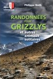
The book can be ordered online at the Slatkine website or bought in any good bookstore of French-speaking Switzerland