In short:
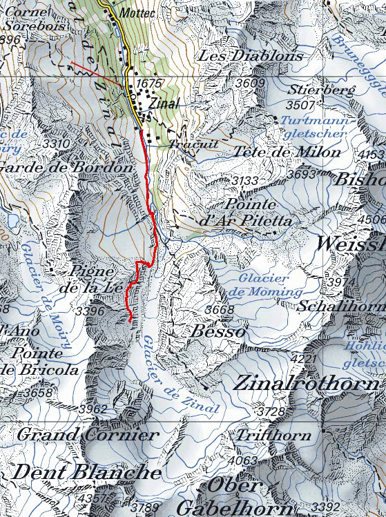
- Starting point: Zinal (La Barma, end of the road)
- Total duration: 6 hours
- Difficulty: T1-T3 (increasing difficulty, T1 up to the hut)
- KMZ file for Google Earth
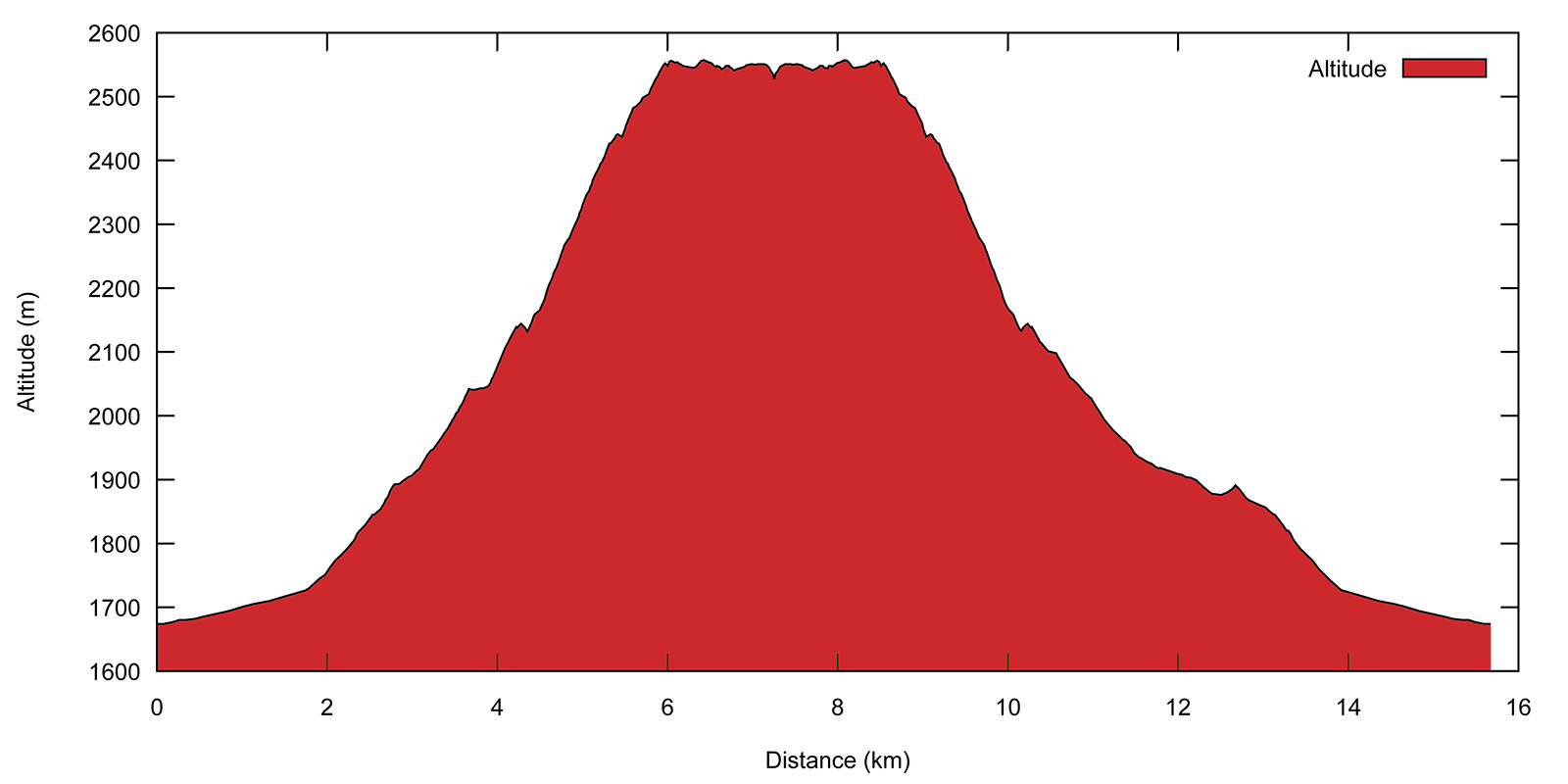
- Profile:

- Aloneness index:

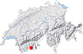
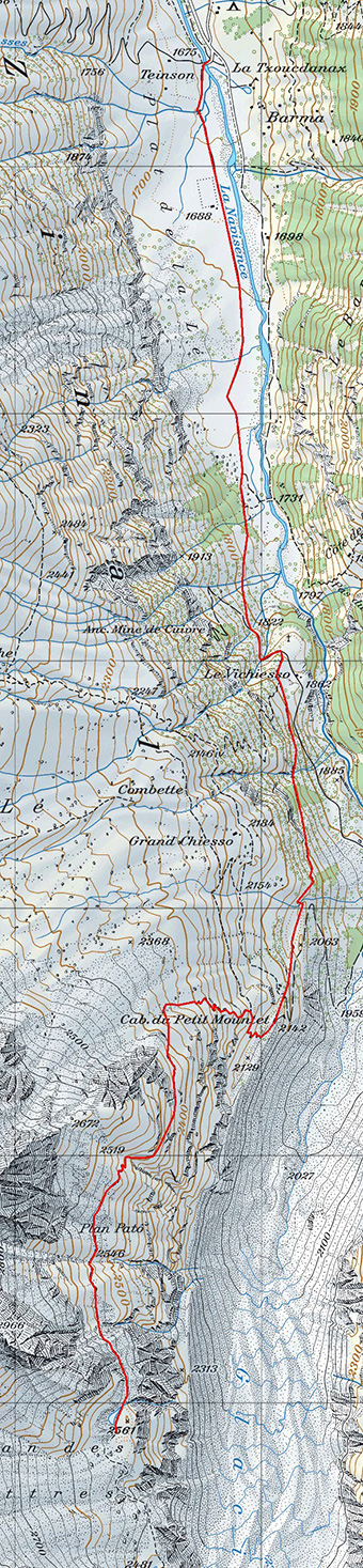
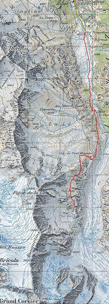
Maps:
Links (click on flag):

 Cabane du Petit Mountet.
Plan des Lettres, Plan Patô, cabane du Petit Mountet
Zinal has the privilege of offering some of the finest - and highest - alpine hiking routes. The end of the Anniviers valley has remained relatively sheltered from uncontrolled tourist development. The most strenuous hikers will probably have already made it up to one of the three mountain huts that lie at the feet of the great four-thousanders: the Grand Mountet hut to the sud, and the Arpitettaz and Tracuit huts to the east. And you can also find your heart's desire on the west slopes of the valley, not far from the Sorebois ski resort, by climbing the Pointe de Tsirouc.
So what's left once all these major walks done? Well, how about the Petit Mountet hut? At first, the interest of walking up to this hut seems pale in comparison with the previously-mentioned high altitude eyries. Some people consider that because the hut is easily accessible (grade T1), it is no more than a snack bar for tourists. It is true that as I walked up to the hut that day I met more out-of-breath foreign tourists than hardy firm-legged local mountaineers. But what those people probably do not know is that beyond the hut lies a magnificent balcony path that climbs the left bank of the Zinal glacier, the alternative route up to the Grand Mountet hut that crosses the glacier. This used to be the main path up to the Grand Mountet hut, before the Swiss army made a new path on the right bank to avoid having to cross the glacier. So now most walkers take the new path on the slopes of the Besso and the left bank path is seldom used. The advances and retreats of the glacier, as well as the precarious structure of the moraine, make this a fairly long, tortuous route.
The aim of the day is to reach the peaceful marshy plateau of Plan des Lettres, one of the farthest points of the Anniviers valley one can walk to, just before the path dives down to cross the glacier.
The walk starts in the village of Zinal, or if you come by car, at the La Barma carpark just after the village. The walking times provided hereafter are based on starting from the carpark (add 15 minutes if you start from the village). The footpath sign at the carpark says 1h50 for the walk up to the Petit Mountet hut whereas the hutkeeper's sign immediately next to it is more lenient and has preferred to make tourists aware that it might take them 2 to 2,5 hours. The route starts out on the straight, tedious track across the Plateau de la Lé that remains flat until you pass the junction towards Pas du Chasseur [1723 m, 20 min]. Those of you who have already been up to the Grand Mountet or Arpitettaz huts will be familiar with that path.
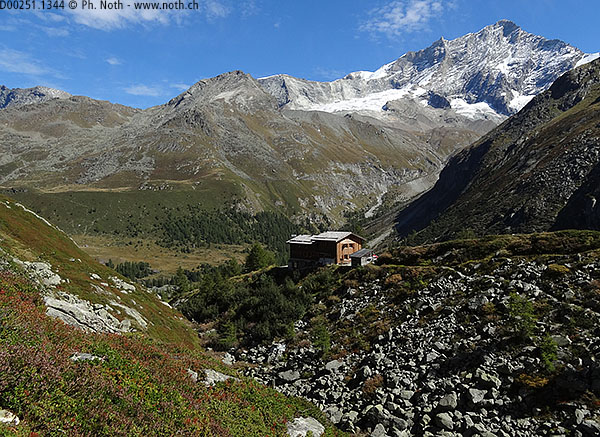
After 35 minutes walking, you can decide whether to continue on the track (1 hour more to the Petit Mountet hut) or the path that leads off through the woods to the right (45 minutes). This wasn't a difficult choice for me, I chose the path through the woods without the slightest hesitation! The track might prove easier for the return route, especially if you decide to stop off at the hut for an evening meal. Whatever you choose, you should reach the hut without much effort [2142 m, 1h30]. All the same, the walk up to the hut is a 500-meter climb, i.e. a little more than half of the day's total climb. Sitting on its mound of moraine debris, looking out over the Besso and the Val d'Arpittetaz, a short rest at the Petit Mountet hut is generally welcome before starting some more serious walking.
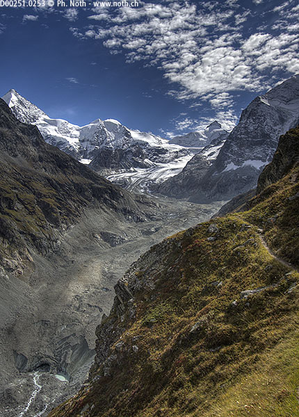
To do this, follow the sign towards Sorebois, Grand Mountet which leads off the moraine. Another sign explicitly prohibits continuing along the moraine as that path is now too dangerous and has been abandoned. The path therefore leads to the right up through the alders and climbs about 200 meters. You will soon come to a junction [1h45 from the carpark]. There is actually nothing written on the 1st sign (towards the right), I expect it should indicate « Sorebois ». Follow the sign to the left that indicates Grand Mountet in big red letters. Alders and blueberry bushes cover the mountain slopes and color the mountain in shades of red and yellow in the autumn time. On the other side of the Zinal glacier, or rather on the other side of the glacial valley because the glacier has retreated further up, you can see the main path leading up to the Grand Mountet hut.
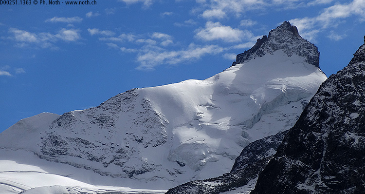
As you reach the altitude of 2350 m, the path turns to the south towards the glaciers and the four-thousanders of Zinal's "Imperial Crown". The climb is mostly behind you now. Slightly to the side of the path, magnificent outcrops with panorama views beckon you to spend some time in aesthetic contemplation (or a quiet nap!). You should remain undisturbed, the path being seldom used. I myself met only two walkers and a hunter between the hut and the Plan des Lettres.
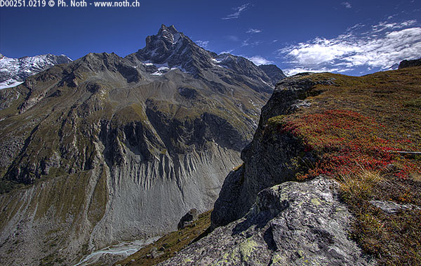
The path now follows a beautiful balcony route, high above the Navisence stream arising from the glacier. The path is in an excellent state and must have been maintained only recently. Sooner or later it will dive down towards the glacier but for now it still leads steadily up. At 2500 m, the path crosses a short portion of boulders before reaching Plan Patô [2530 m, 2h30].
Littered with boulders than have fallen from the slopes of the Pigne de la Lé, this is the less enjoyable part of the route. Be sure not to linger in the gully just after Plan Patô, this is the main route when rocks and boulders come crashing down! The path skillfully finds its way over and around the boulders. There are many ropes and chains available to help walkers on the last part of this walk even though it is not particularly dangerous. However things would be difficult when snow lies on the ground and the ropes and chain would probably prove very useful.
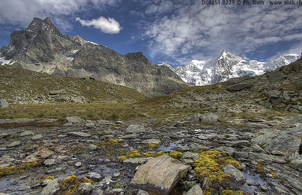
Plan des Lettres is at the end of the rocky portion, behind the east ridge down from the summit of Pigne de la Lé [2557 m, 3h]. It is a flat marshy area with a small pond spotted with alpine bulrush. The setting is surprisingly idyllic with the Grand Cornier and Dent Blanche in the background. It should be noted that the pool cannot be found on the 1:25,000 map on Swissmap Online, even though it is shown on the 1:50,000 map. If you have time and still feel like exploring, you can continue on along the path but be aware that it goes on down towards a treacherous moraine and the glacier. Explaining where the name "Plan des Lettres" comes from is not too challenging: just look for the letters written in the grass! Apparently they are not simply the fruit of tourist stupidity but take their origin at a much earlier date.
The return route is the same as on the way up. During the summer and until the end of September, you can stop for an evening meal at the Petit Mountet hut. Their website is mouth-watering and mentions cheese fondue! If it is dark when you walk back down or if you are slightly tipsy, make sure to take the wide track. The track makes two hairpins before reaching the valley bottom and meeting the track down from Arpitettaz Grand Mountet. The walk back down the track takes about an hour from the hut.


This hike is featured in the book
Randonnées pour Grizzlys
Alpes valaisannes
published in 2013 by the editor Slatkine.
The book can be ordered online at the Slatkine website or bought in any good bookstore of French-speaking Switzerland