In short:
- Starting point: L'Erié
- Total duration: 5 ½ hours
- Difficulty: T2 - Mountain Hikes
- KMZ file for Google Earth
- Profile (roundtrip):

- Aloneness index:

Maps:
Links (click on flag):
 Official website of the Cabane du Demècre.
Lacs de Fully, Cabane du Demècre, Le Diabley, Tête du Portail
At a bend in the Rhône river, the Sorgno (Sorniot) trough is trapped between two worlds. To the west lie the Vaud Alps, Lac Léman and the Prealps; to the east is the Central Valais region and its much drier climate. This round walk will take you up to the the Demècre pass and hut, along the ridge between the Diabley and the Portail de Fully, before heading back down via the Lac Inférieur (lower lake).
As it's quite easy and not too long, this walk is ideally suited to a thematic hike. Why not take your time? Observe, discover and try to understand? A particularly detailed book by Sabine and Charly Rey Carron, from Fully, describes the Hauts de Fully (the Fully heights). It describes many, many things that any normal person just wouldn't even notice: tectonic folds, rock glaciers, rare plants, tracks of wild animals, etc.
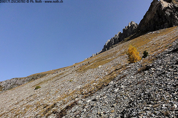
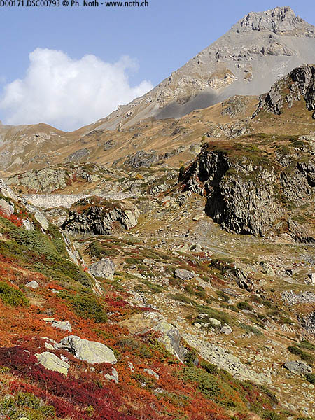
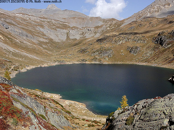
The first part of the hike, L'Erié - Montagne de Fully, follows part of the route of the Tour du Grand Chavalard, but when walking in the opposite direction. At L'Erié (what a road to get there!), a big information board gives information about the various local walking routes: Tour des Muverans, Tour du Grand Chavalard, etc. as well as "our" walk called Tour du Portail, which is the shortest with its 4½ hours. The path is wide, quite flat and in the sun since it's on the southern side (adret) of the Rhône valley and follows the vertiginous slopes coming down from the Grand Chavalard. The path follows the upper tree line as seen by the larch trees which are particularly beautiful in the autumn time but only present on the first part of the path. A gully (altitude 2133m, spot called La Blè according to [76]) marks the entry into the Sorgno cirque (1¼ hr from the start). A few hairpins down a slope of scree will take you to the lower lake, from which a wide path leads to the Sorgno hut.
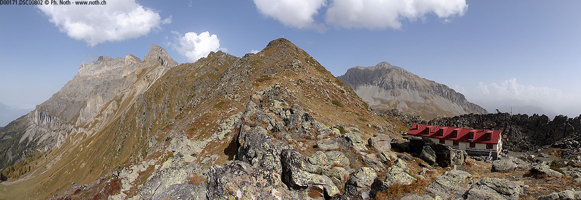
The path passes a chapel before heading up towards the Col du Demècre. Along the former bisse (aqueduct) de la Vardète you'll come across many blueberry bushes which are a pretty red colour in the autumn. And probably thousands of flower at the start of the summer. The real climb starts as the path heads left and up near the dam that regulates the flow out of the Lac Supérieur. One hour after leaving Sorgno, you'll get to the Demècre hut, hidden away and nested under a rocky crag. In some seasons there is no hut keeper but it can still be used and there is even food and beverages (if you pay for it, of course).
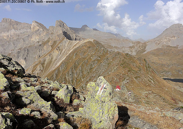
Now the route follows the ridge to the south in order to reach the Portail de Fully in about 1 hour. The main path lies slightly under the ridge to the west. However the path along the top of the ridge is nicer, even if it's much narrower, as described in the Rother guide. The view from up here is so much better: the formidable great south-west wall of the Dent de Morcles, the Dents du Midi, the Sorgno cirque and far down below the Chablais region. The Mont Blanc and the Grand Combin can also be seen if the weather's good. Our direction changes completely at the Portail de Fully. The antenna on the top of the Sex Carro is visible below but we won't go that far even if the balcony path leads to it.
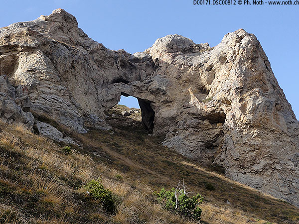
Our way heads down to the north-west first above the cliffs before getting easier. The Hauts de Fully book explains how the rock arch over the path came to be: a very specific underlying rock called "cornieule". After about half an hour from the Portail de Fully, walking across the moor-like ground between Lui Desande and Creux de Branson, you'll meet up with the path taken this morning at the bottom of the Le Blè hairpins. This is the last "difficult" stretch since afterwards the path back under the Grand Chavalard is long (45 minutes) but easy.