In short:
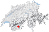
- Starting point: Mottec (Val d'Anniviers)
- Total duration: 7 hours
- Difficulty: T3 - Challenging Mountain Hikes
- KMZ file for Google Earth
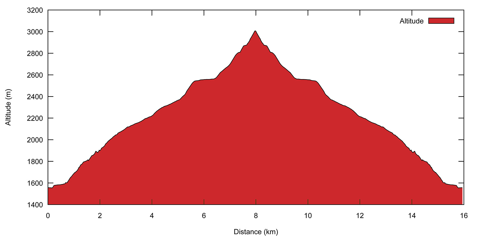
- Profile:

- Aloneness index:

Maps:
Links (click on flag):
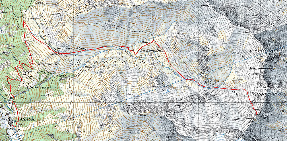
Col des Arpettes, Remointse de Barneuza
The Col des Arpettes (3008 m) – not to be confused with the Fenêtre d'Arpette in the Trient region on the Eastern side of the Mont Blanc range - is a wild, seldom-visited pass. It is most often mentioned in ski mountaineering guides or as an alternative route for passing from the Turtmann valley into the Anniviers valley or vice-versa. Although marked with blue/white paint, the grade of the path on the Anniviers side is never over T3 (Swiss Alpine Club grades) and offers a magnificent view over a landscape of rock, snow and ice.
The pass doubtless suffers the competition of its more renowned neighbor, the Forcletta (Furggulti) pass to the North, which provides a much easier route between the Turtmannhütte and the Val d'Anniviers, and indeed the Tour of the Matterhorn trek climbs the Forcletta pass rather than the Col des Arpettes. So much the better for us loners! This, combined with the distance to be covered and the blue-white marking, is probably why the Col des Arpettes is still a haven of Alpine peace.
This walk is an ideal outing for hot summer days. The initial climb to the Barneuza mountain pastures is in the shade, and if you follow the my recommendations in chapter 2 of the guidebook, your descent later in the day will by bathed by the evening sunlight - until about 7 pm in August!
The best place to start is the hamlet of Mottec on the road to Zinal. The path leading up to the Barneuza alpine pastures can be found just after the bridge over the Navisence. The pylon in the forest is that of a cable car to Mayens de Barneuza. However, no worries, you won't be seeing tourists in flip-flops in the Barneuza pastures, the cable car is privately-owned! Anyway, the path takes a left before reaching Mayens de Barneuza and leaves the huts off to the right.
A few more hairpins and you will come out of the woods near a chalet at an altitude of approximately 2000 m [1h10]. The path then joins up with a wider track leading up to the pastures (sign Barneuza Alpage, 20 min pointing to the right). In front of you lies the astounding Val d'Anniviers with the Besso, Zinalrothorn, Pointe de Zinal, Grand Cornier and Dent Blanche, some of the summits of the "Imperial Crown" surrounding Zinal.
Appreciable aloneness starts at the Barneuza mountain pastures [2211 m, 1h45] and its border is marked by a wooden sign showing the way up to the Col des Arpettes. Here is where you must leave the easy paths towards the Hôtel Weisshorn to the left and towards Zinal to the right to follow the sign up into the Barneuza valley.
My main recommendation for this part of the route is to keep your mouth closed: an unbelievable number of grasshoppers, beetles and other flying bugs jump across the path as you walk by. Otherwise you will follow a well-beaten path that will bring you unhindered to La Remointse, a small wooden chalet [2414 m, 2h25]. In the local dialect, "remointse" means a high altitude mountain pasture where cattle and sheep can graze for a short time in the summer, and you will frequently hear the bells of the cows on the other side of the stream.
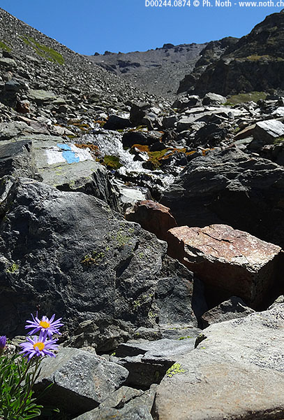
After another 100-meter climb, you will come across the other building in La Remointse, the ruins of a stone house reminiscent of the "alpe" huts in the Ticino canton. In between, the path fades and animal tracks lead off to the left and the right. Make sure you follow the blue/white marks, and basically ignore the paths. By heading straight up the grassy slope, you will reach the upper part of La Remointse within about 15 minutes [2545 m, 2h45].
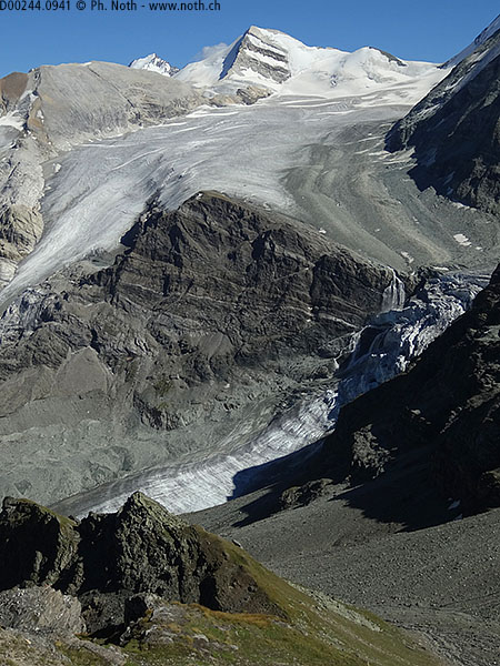
The Col des Arpettes is still 2 hours away. It can be seen far off in the distance, dark and desolate. You can end your walk at Remointse de Barneuza if you don't feel that your stamina is up to the climb to the pass, it's a pleasant enough and peaceful spot in itself. However you will miss the scenic view over the glacier that opens up just as you reach the pass and not before.
The path is well-trodden again from here. It heads off across the mountain slope towards the bed of the small stream in the valley. Practically all vegetation has disappeared here and the landscape consists of rocky outcrops, stones and scree, but the blue-white marks are still clearly visible, everywhere in fact. There was no skimping on the amount of paint used, and there are plenty of cairns too. You should have no trouble therefore finding the way up the right bank (left side) of the stream. This part of the walk will bring you to an area where the ground flattens out slightly between Omen Roso and Les Diablons [approx. 2800 m, 3h30]. Two small lakes used to lie here when the winter snow melted but now have dried up.
The last 200 meters under the pass are the hardest and you should count about 30 minutes for this final climb. Walking sticks can be helpful to get up and, all the more so, down the unstable scree below the pass. It should be stressed again that the path is well marked-out without any of the difficult portions that the blue-white marking is typically used for. The descent on the other side of the pass is doubtless more arduous with tricky scrambling, so perhaps that is why blue-white paint has been used, even if the path on the Turtmann side of the pass is not on official Swiss maps.
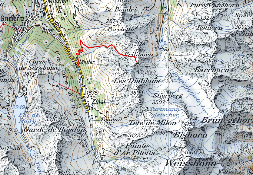
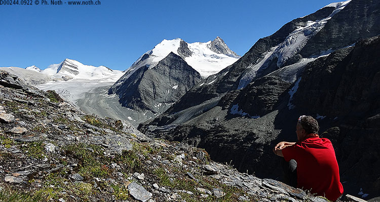
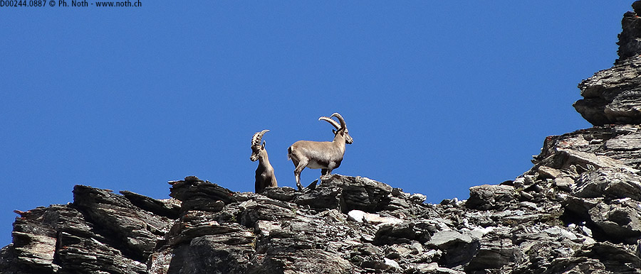
Once you have got to the Col des Arpettes [3008 m, 4h20], you'll have nothing better to do than to enjoy a well-deserved rest looking out over an amazing view. Immediately to the south you can see the start of the ridge up to Les Diablons. On the Eastern side of the pass lies the Turtmann (Tourtemagne) valley above which rise the Bishorn, Weisshorn and Brunegghorn. The wide, flattish Brunegg glacier contrasts with the Turtmann glacier that dives down a narrow gully in an impressive icefall. The Tracuit hut would be visible if not hidden behind the north-east ridge of Les Diablons. You might spot Alpine ibex if you're lucky since a herd lives on the slopes of the Wängerhorn, which by the way seems easy to climb from the pass for particularly keen climbers.
The way back down follows the same route and should take about 2h40 in all. An alternative route is to start out from up above Zinal and/or go back down to Zinal. In this case, between Zinal and the Barneuza mountain pastures, you will follow the final portion is the famous Sierre-Zinal mountain race itinerary. The altitude difference is less if you opt for this route, but the distance is longer, so all in all about the same total time. Please note that the walking times provided on the sign at the Col des Arpettes are more than fanciful, with 1 hour for Remointses and above all 3 hours for the Berneuza pastures. I do not know what the good Valais worker in charge of putting up the sign had in his flask that day - Petite Arvine, Johannisberg or Fendant - but the times are largely overestimated since the same as those given for the ascent. Less than 3 hours after leaving the pass, you should be back in the valley at Mottec without problem.


This hike is featured in the book
Randonnées pour Grizzlys
Alpes valaisannes
published in 2013 by the editor Slatkine.
The book can be ordered online at the Slatkine website or bought in any good bookstore of French-speaking Switzerland