In short:
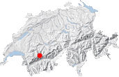
- Starting point: Rawil dam (Tseuzier lake)
- Total duration: 6 hours
- Difficulty: T3 - Challenging Mountain Hikes
- KMZ file for Google Earth
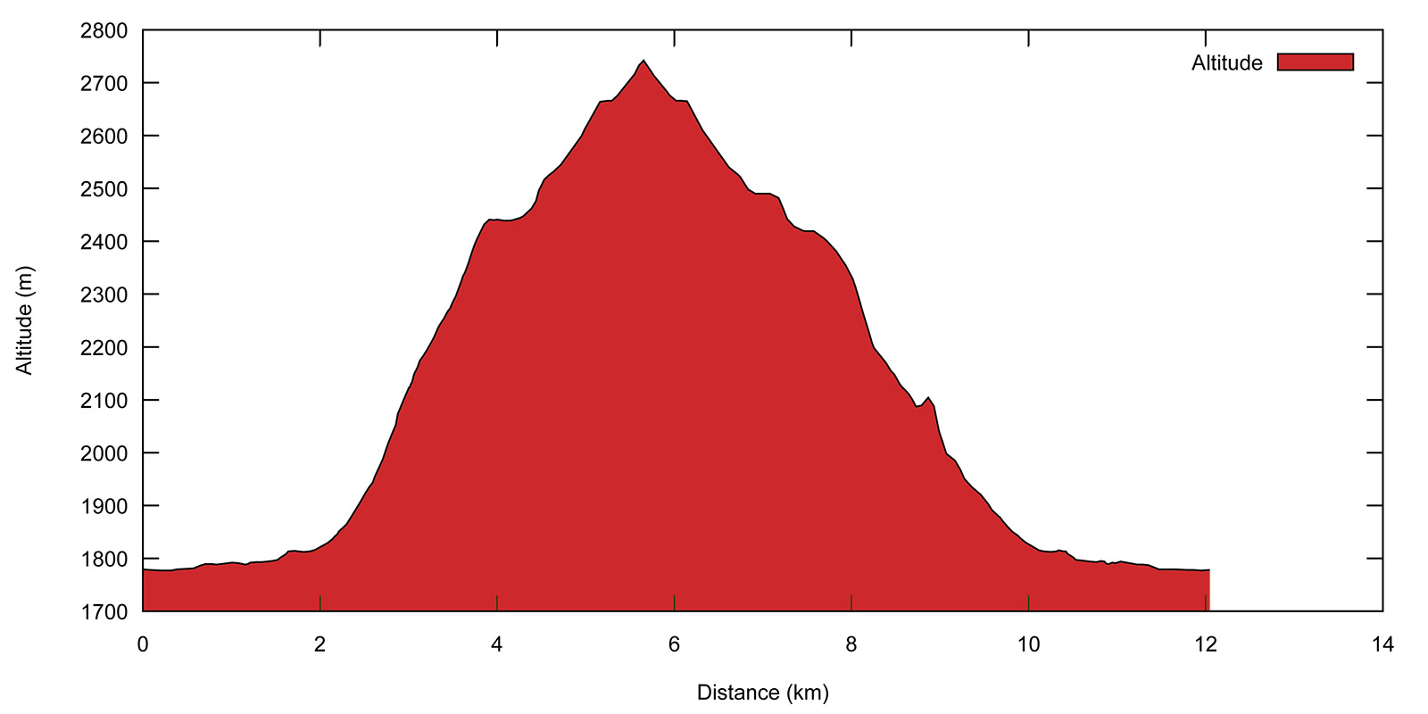
- Profile:
- Aloneness index:

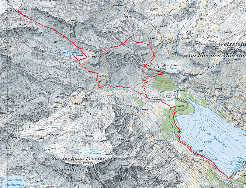
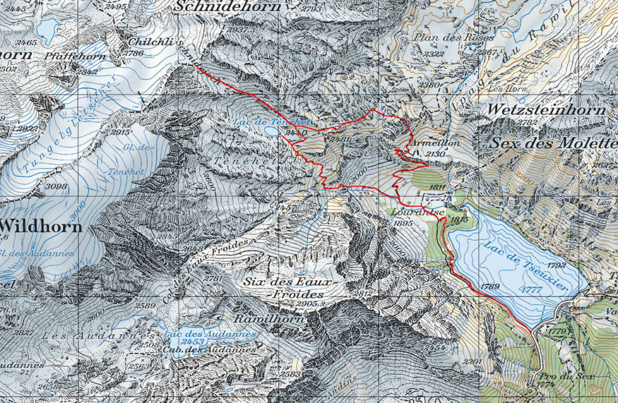
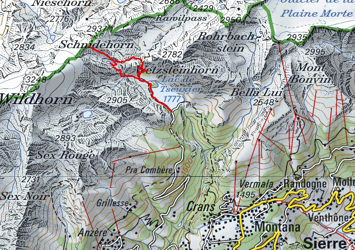
Maps:
Links (click on flag):
Lac de Ténéhet, Schnidejoch
Global warming also has its advantages. The Schnidejoch pass, seemingly frequently used both 5000 years ago and during the Roman empire before being covered by snow and falling into oblivion, is now again accessible to hikers. On the way up, you will discover the small Tenehet lake entrapped in a gangue of limestone.
This walk provides an opportunity to implement some of the advice given to solitude lovers, such as taking advantage of an alpine restaurant to remain in the mountains until dark, or even longer. The Gîte de Lourantze is perfect for this kind of experience, and I even survived the walk back to the car park at the dam after a few too many drinks: no head-on collisions or major accidents! Of course, walking is completely different from driving so whoever's driving should not be drinking.
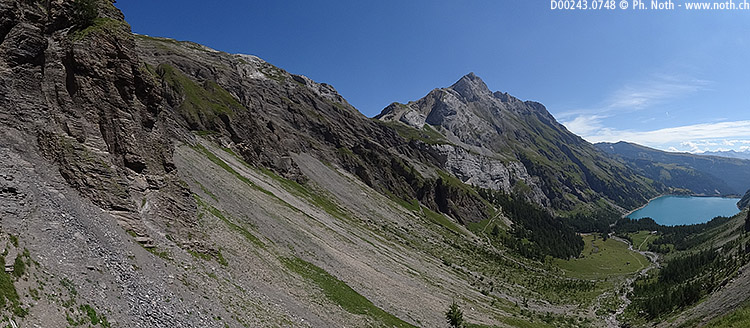
The Rawil dam attracts crowds of tourists on nice summer days, but only a very few of them will make it to Tenehet and even less to Schnidejoch. Based on the signs at the dam, the walk up to the Lac de Ténéhé (as written on the sign), the first objective of the day, will take 2h30. The path lies along the right bank of the lake, and soon follows a bisse (an alpine irrigation canal). At the end of the lake, the path leaves the bisse and turns left at a signpost for Lourantse, Ténéhé.
Shortly after the Lourantse refreshment bar [1815 m, 30 min] start the first slopes of the Wildhorn and Schnidehorn. The ground gets gradually steeper until you reach a junction where signs give Ténéhé both to the left (2h) and the right (2h30). Take the steeper, more direct path to the left as it is better to come back down the easier, less steep way. As the path gets closer to a rocky outcrop, the climb gets more arduous and the ground unstable under your feet. A few meters more of stony but not dangerous scrambling and you will have overcome the difficult portion.
After climbing another similar second level again to the left of a rocky outcrop, the route to the lake follows a long last ramp. The path comes up close to the cliffs on the left, one of the only, and perhaps the only, spot of shade for this portion of the way! The lake is still no where to be seen, but a reassuring sign says it is only 10 minutes away.
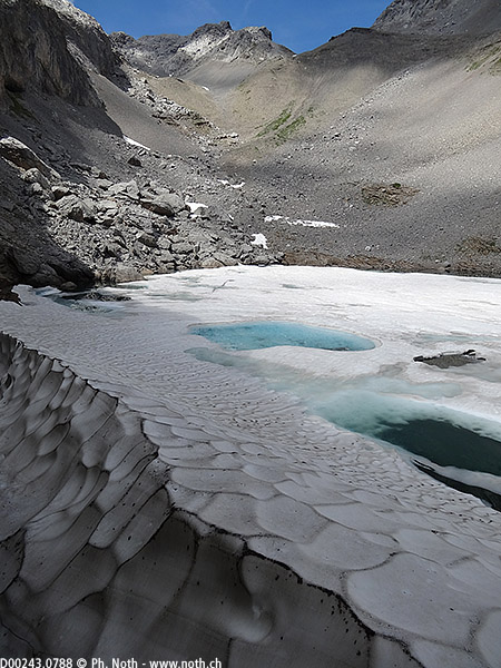
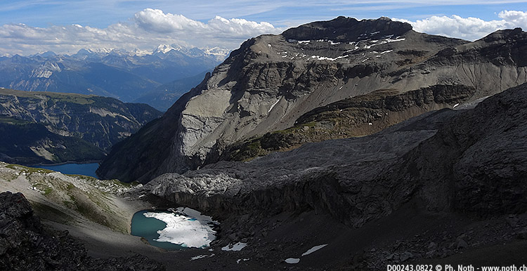
Depending on years, the lake can stay frozen until late on in the summer. After an invigorating break at the lake, and if you feel so inclined, you can continue the ascent up to the pass. The path starts out across a long scree slope, rising slowly and not especially demanding. The difference in altitude between the lake and the pass is only about 300 meters. Be careful though to look out for stones and rocks for above knocked down by negligent mountain ibex. The last portion of the valley opens up behind a rocky dome and snow often remains in its lower parts until late into the season. The last few meters before the pass are the only strenuous part of the climb [2756 m, 3h30]. This is where various objects from different historical era, including the Stone Age, were discovered according to local newspapers in 2005. Will you discover the next Ötzi?
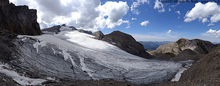
The Schnidejoch pass marks the linguistic border between French-speaking and German-speaking Switzerland. It's worthwhile to continue down over the border for a minutes more, because on the way down towards the Wildhorn hut on the Bernese side lies the glacier with the most unpronounceable name in Switzerland: the Chilchligletscher. In the silence of the mountains you will be able to hear the glacier melt: a continuous, ever-present muffled sound of flowing water when no stream or surface water are to be seen. So much happens out of view under the ice!
You can go back down either by the same way as the climb up or make a detour and follow the slightly longer route to the east of the Tenehet lake. If you opt for the second itinerary, follow to signpost for "Plan des Roses" at an altitude of about 2500 m. The path crosses a large area of limestone pavement which it is best to avoid if visibility is poor. Indeed, you'll be continuously on the lookout for the next route markings and the best way to get over these stable but sharp and jagged blocks of rock. Because the deep canyons between the higher zones of limestone lie hidden when covered with snow, it is certainly not advisable to cross this area when snow is still on the ground.
About 1h15 after leaving the Tenehet lake, you should reach a junction where a right will take you back down to Lourantse. The karstic landscape is now behind you and the path starts to climb down (at last!). From the Armillon (or Armeillon) pastures [approx. 2100 m, 5h15 in all], a meter-wide track leads down a cliff and back to the Gîte de Lourantze [1815 m, 5h45 m] where you can dig into a well-deserved evening meal. It's best to make inquiries and reserve your dinner on the way up in the morning. The walk back to the car from the restaurant takes about 20 minutes and is of no difficulty at all.
In summary, here are the waypoints for this walk:


This hike is featured in the book
Randonnées pour Grizzlys
Alpes valaisannes
published in 2013 by the editor Slatkine.
The book can be ordered online at the Slatkine website or bought in any good bookstore of French-speaking Switzerland