In short:
- Starting point: hamlet of Le Flon (parking or postal bus)
- Total duration: 6 hours
- Difficulty: T1 - Valley Hikes
- KMZ file for Google Earth
- GPX track for GPS
- Profile (up & down):

- Aloneness index:

Maps:
- Extracts:
1:25'000 1:50'000 1:200'000 - Swisstopo shop:
Not very handy! The itinerary crosses the boundaries of several national maps.
Links (click on flag):
 Report and pictures on Randomandie.ch.
Le Grammont, Lac de Tanay (Taney)
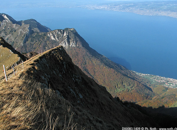
At the east end of Lac Léman (aka Lake Geneva), the Chablais mounts drop down to meet the vast flat expanse of water. The peaks of this region, standing at near 2000m (6562ft), with summits such as Rochers de Naye, Dent de Jaman, Montagne d'Amont, Pointe d'Aveneyre or Grammont, offer breathtaking plunging views over the lake which itself culminates at the great height of 372 metres. The outing described here is the climb to the summit of Grammont, the highest summit of the region.
The route given here is in no way original since it is the main, rather busy route up and back from the Tanay lake. Plenty of opportunities to leave the beaten path behind you (both literally and figuratively) are available if you want to make your own way up to the top, however a good deal of will power and physical effort is needed if you plan setting off from the lakeside. The Combe de Chauméry is extremely steep, as you may see for yourself from the summit. Walkers who are interested by this route should visit the Randomandie website where a rather difficult but very exciting round walk is described.
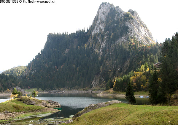
Leave your car at the hamlet of Le Flon (its large car park is rapidly full on weekends). The signpost at the car park shows two separate routes for Tanay: either 1 hr 20 min via the road or 1 hr via the path. On the way up it's best to choose the latter, even though the road is never very busy because of restrictive local regulations. Climb up the path through a wood of birches, coming across the road on 2 or 3 occasions. Each time, you can choose whether to stick to the path or change to follow the road. As a matter of fact, on the day I did this walk, a stretch of the path was closed due to tree felling. The road starts to get steeper as it reaches a narrow gorge, just below the La Tâche peak. Behind this lump, you'll discover the écrin de Taney (écrin: small flat area surrounded by mountains) and the lake that fills it. At the far end of the lake several restaurants seem like a good place for a drink and a rest.
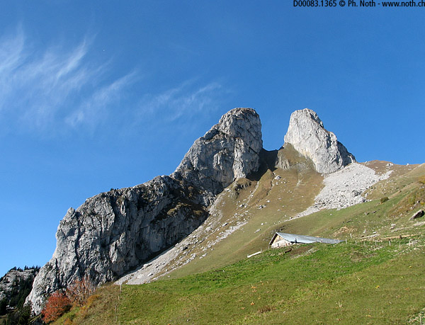
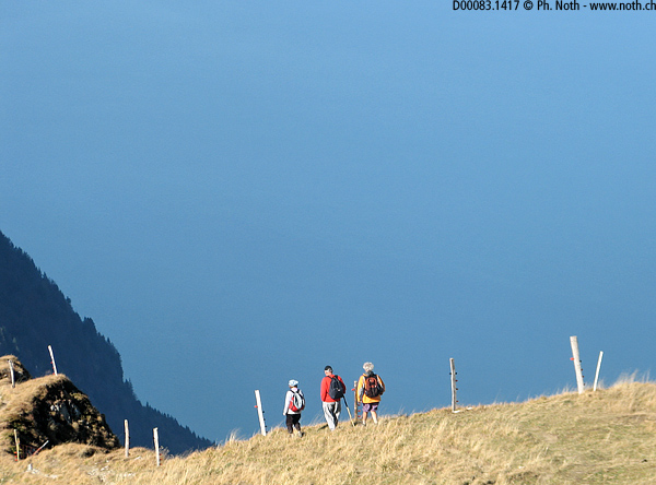
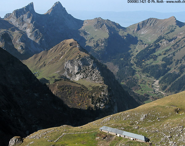
In the centre of the hamlet, a sign for "Grammont" points right towards the forest. The path heads up a few hairpins before joining up with a wider track (that can be followed from the village if you ignore the signs which show only the short cut). Half an hour after having left Taney (i.e. about 1½ hr from Le Flon), the track comes out from under the trees. It then takes you towards Les Jumelles, via the Chalet des Crosses, before getting slightly worse for the wear. Whilst remaining unusually wide for a mountain path, more and more stones scatter its bed as if it has been quickly gorged out by a bulldozer.
A final even steeper climb will bring you to a pass (1971m, 6646ft) to the right of Les Jumelles. After this, the nearly flat section of path which takes you to the Combe des Pecheux seems quite relaxing. Take left towards the Lovenex lake. Looking out this way you'll be able to see the Dent d'Oche and the Chateau d'Oche away in the distance, separated by a gently curved pass. You'll also get a first glimpse of Lac Léman, and start to realise how impressive a view you'll find up top. The Voyis alpine chalet is at exactly 2000m (6562ft). From here it's impossible not to look down into the chasm: Saint-Gingolph and the lake lie 1600 meters further down. Another hundred meters to the right along the path, which is now much narrower, will take you to the top. The path follows the grassy ridge leading up to Grammont, not of any danger since the southern side isn't very steep, where the summit is marked out by a big cross. The entire climb will take you between 3 and 3½ hrs, including a stop off at Tanay.
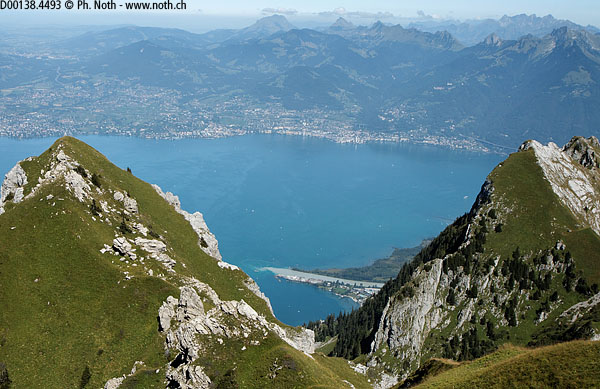
Before setting off back down via the same route (reckon about 2 hrs), take a few minutes to admire the 360° viewpoint: the Rochers de Naye, the Dent de Jaman, the Tour d'Aï of Leysin, the Diablerets, the Moléson, etc. Further away stand the Eiger, Mönch and Jungfrau, and across towards the Valais region you can make out the Grand Combin, the Dents du Midi, Mont Blanc and the Matterhorn. The sight of the Rhône river flowing into Lac Léman also contributes to make the climb so worthwhile. The contrasted colors of the waters before they mix is beautiful. Also don't forget to look towards Lausanne, Vevey, Montreux, the castle of Chillon and the motorway viaduct. Those of you who, like me, live on the Riviera will recognise other familiar places such as the cycling centre in Aigle, the Rennaz sexshop, the Mai-Tai restaurant terrace, the Villeneuve swimming pool or the Stravinsky auditorium. The list of sights to find is endless and you could spend hours up here looking down over the familiar setting. Don't forget to bring your binoculars!

