In short:
- Starting point: Crêt du Midi (upper station of the cable car from Vercorin)
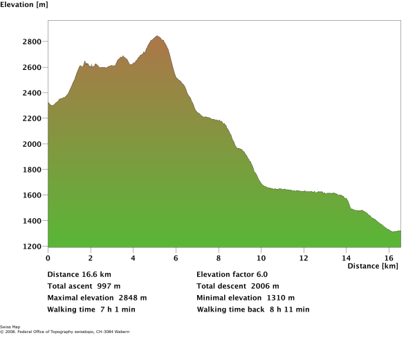
- Total duration: 6-7 hours
- Difficulty: T2 - Mountain Hikes
- KMZ file for Google Earth
- Profile (roundtrip):

- Aloneness index:

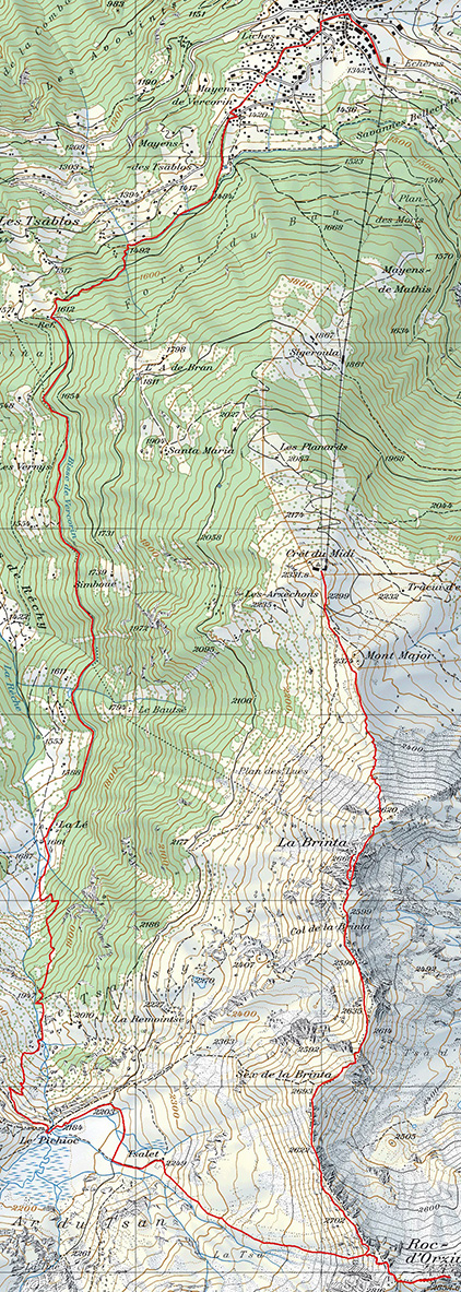
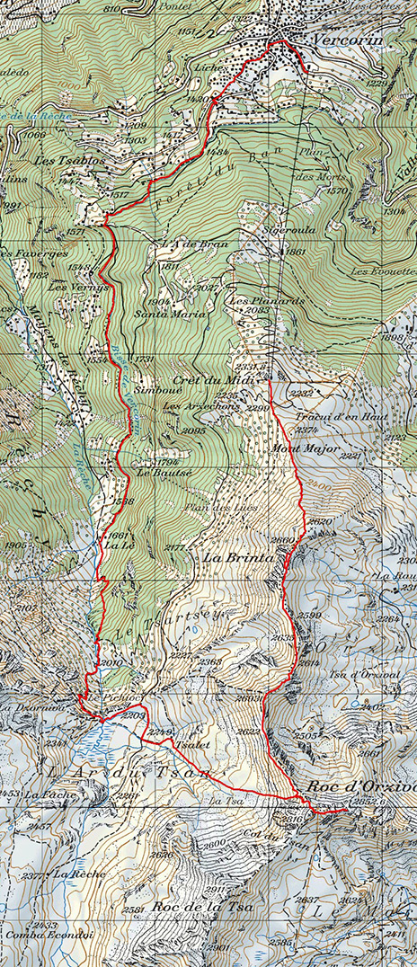
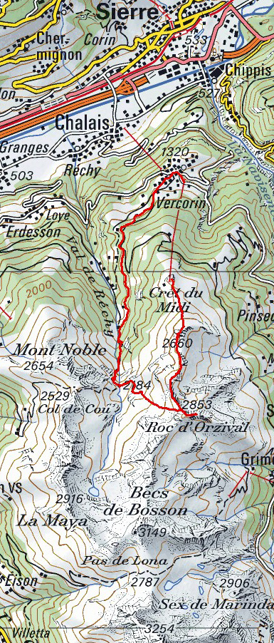
Maps:
Links (click on flag):
Lower Vallon de Réchy: La Brinta, Roc d'Orzival, Ar du Tsan, Bisse de Vercorin
During one of our previous walks, we had explored part of the wonderful Réchy valley. At that time we had entered the valley via the Col de Cou left via the Pas de Lovégno, so we hadn't approached either the Ar du Tsan or the Pichioc waterfall. This time we wanted to take a look at what we had missed previously and walk along the ridge that separates the Val d'Annivers from the Réchy valley, and then go down closer to see what the Ar du Tsan really is. To end up, we'd follow the bisse path back to Vercorin (a "bisse" is a gently sloping aqueduct/leat). This way we could do two walks in one outing: the one along the ridge and the bisse path as suggested in Rother's Upper Valais guide.
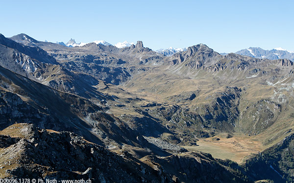
The day starts off at the Vercorin - Crêt du Midi cable-car upper station. If you're doing this walk in the autumn, don't forget to check opening days and times first. A one-way ticket is all that's needed. The Crêt du Midi is already quite high up at 2332 m (7651 ft). A signpost shows the way towards La Brinta (1 h 20 min) and the Roc d'Orzival (3 h). Even though the walk described here is quite long (distance-wise), it doesn't contain any tiresome climbs. Finding your way will be no problem since you'll be following the ridge for several hours. The ridge path is excellent and provides great views over most of the Réchy valley - even if you can't quite make out the Louché lake - as well as towards the peaks of the Val d'Anniviers. Some portions are indeed a little more tricky but these have been fitted out with chains to help you cross.
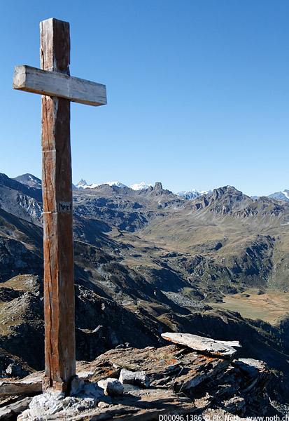
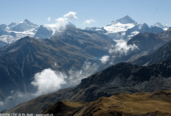
The first climb is reasonable and brings you to a small summit (Mont Major) before getting steeper on the way up to La Brinta (45 min). You'll recognise the distinctive shape of this view point. The small detour to the top isn't absolutely essential, but it only takes a few minutes to reach the cross which, rather defiantly, provides a hell of a view: Zinal and its four thousanders to the left, all of the Réchy valley straight in front of you, and beyond that the Plaine Morte glacier, the Diablerets, the Bietschorn... The shelf profile of the Réchy valley is clearly visible from here (for which explanations can be found in the short brochure available in Vercorin) and the Ar du Tsan and the Pichioc waterfall stand out in the foreground. We will come across these places shortly.
A few more chained portions, luxury here, before reaching the Brinta pass. Then it gets easier and the path heads down slightly. At the Sex de la Brinta (1 h 45 min), you'll be straight above the Ar du Tsan. The black peak with white eroded sides is the Roc du Tsan and further off behind it the Becs de Bosson, 3149 m (10,331 ft). We won't go that far, besides there doesn't seem to be a path that way. Between the Sex de la Brinta and the Roc d'Orzival the ridge gets more craggy. The path sometimes leaves the ridge and runs slightly down on the mountain side. You should reach the Roc d'Orzival after about 2 h 15 min. Due to the arrival area of the ski lift and the ski slopes of the Grimentz/Bendolla resort down below, it isn't the prettiest spot on the walk. What a difference with the inside part of the valley! Still, the view is beautiful over towards the Dent Blanche and the Moiry lake, and you can work out which peaks are which with the viewpoint indicator.
To continue the walk, follow back the way you came for a short while and then head for the bottom of the Réchy valley. In the brochure that can be found at the cable-car booth, a route is marked out between the Roc d'Orzival and Tsalet even though no path is shown on the Swiss national map. The beginning of the path can be seen leading off towards the Ar du Tsan next to an abrupt crag on the ridge very close to the Roc d'Orzival. Follow this trail, or if you can't make it out, just head straight down the slope. The sides of the valley aren't particularly steep so it is possible to find your way down without following a path. Either head for Tsalet, a chalet on the edge of a boggy area, or straight for the big boulders.
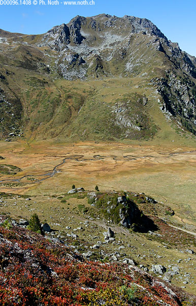
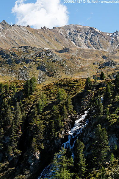
At Tsalet, (3 h 30 min), take left to find a road. Once on the road, follow the path that cuts the corners signposted for the Ar du Tsan and the Pichioc (4 h). It's worth stopping off to admire these meanders sculpted in the grassland before heading on down again towards La Lé, which according to the signpost you'll reach in about 50 min. The path runs right alongside the waterfall. It is quite steep since the Bisse mountain hut (La Lé) is some 500 metres down below. Then it crosses a bridge over the tumultuous La Rêche stream, in which runs the same water as in the quiet Ar du Tsan, before turning into a trail in the woods. At La Lé, it's nicer and more picturesque to follow the "bisse de Vercorin" - an aquaduct taking water down to the valley - than the road. Follow the small path along the water channel. After an hour, when you reach a tarmac road, blue marks indicating "Vercorin by the 'bisse' " show you the way. Another 45 minutes past the Vercorin alpine meadow chalets and you'll be back at the Crêt du Midi carpark.

