In short:
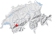
- Starting point: Sanetsch pass
- Total duration: 6 ½ hours
- Difficulty: T3 - Challenging Mountain Hikes
- KMZ file for Google Earth
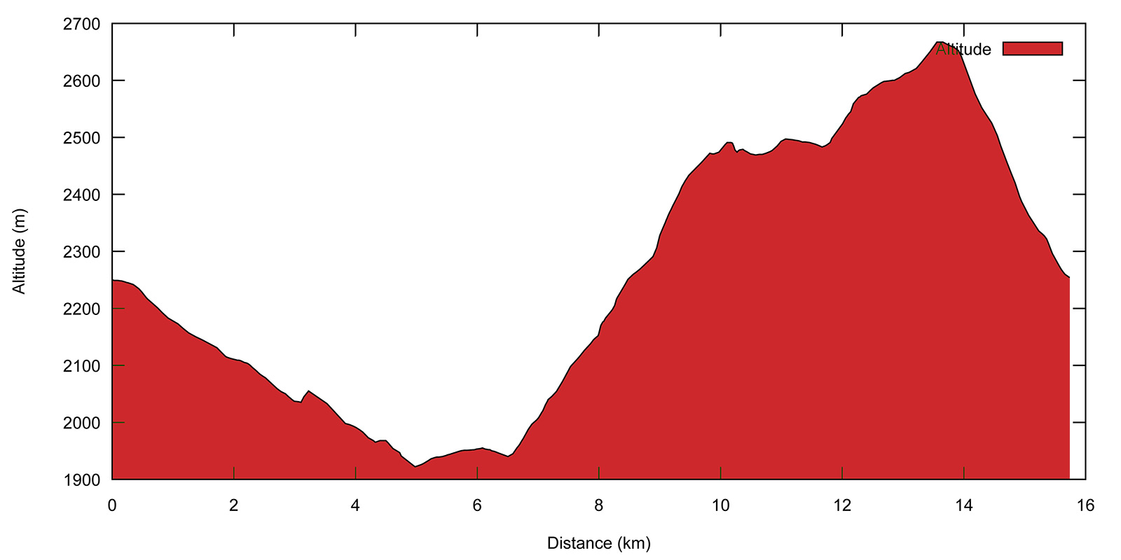
- Profile:

- Aloneness index:

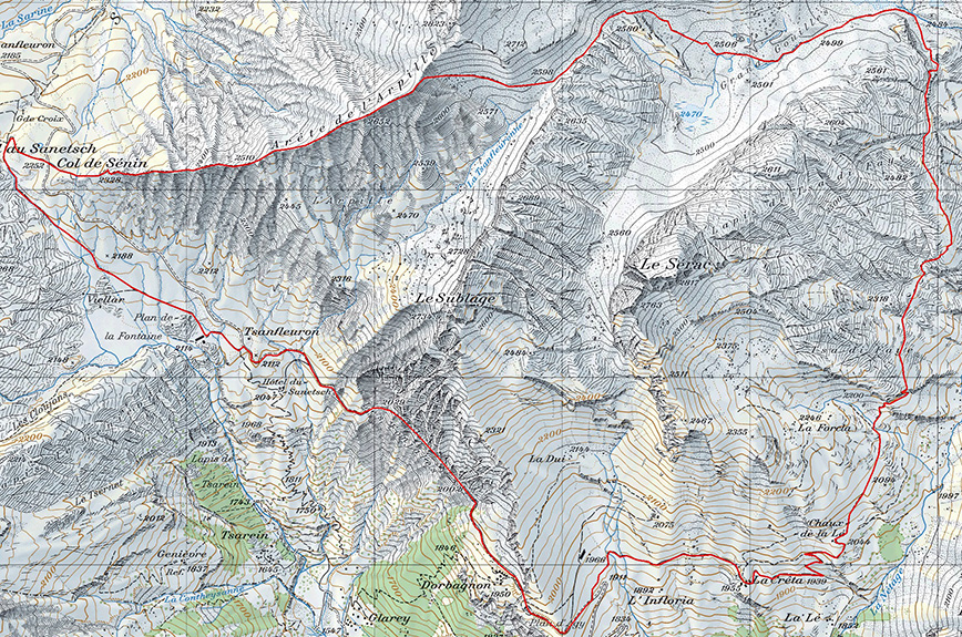
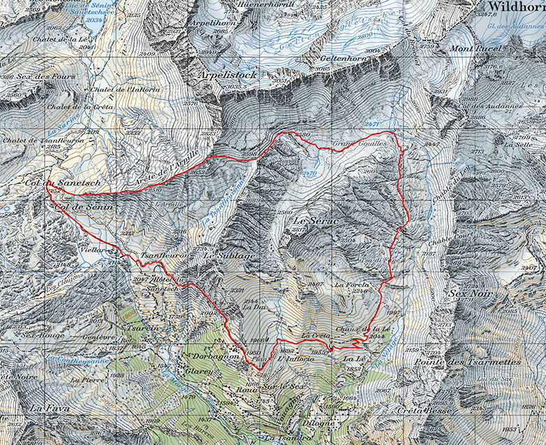
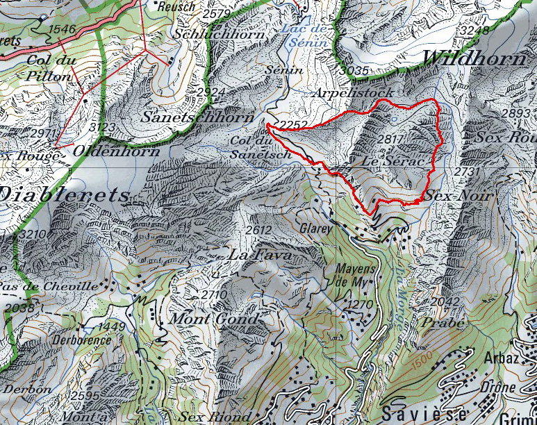
Maps:
Links (click on flag):
Tour du Sérac, vallon de la Nétage, arête de l'Arpille, Grand' Gouilles
Away from the road up to the Sanetsch pass, the small Nétage valley lies along a practically perfect north-south line as if drawn with a compass and not the result of thousands of years of erosion and weathering. The paths of this valley provide walkers with the opportunity to make a circuit around the Sérac and Sublage mountains.
I found the idea for this circuit on the internet site toprando.ch, which is now closed, it seems. It provided directions for the "Tour du Sérac" walk, a long circuit leading up the wild Nétage valley from the Infloria alpine meadows in order to reach the desolate, high altitude Grand'Gouilles plateau. The last attraction of the walk is the bleak, black Arpille ridge, particularly awesome in the evening light. It is a long walk but with many different landscapes: green mountain meadows, dark-colored shale, light gray limestone pavements, white snow on the Wildhorn ... and black tunnels!
Yes, unfortunately there is a catch: the only possible route between the Sanetsch (or Senin) pass and the start of the path at Infloria is the road down from the pass via the Fonjales tunnel. For this reason, it's best to avoid doing the whole circuit described here on a summer weekend. A good idea is to plan the walk based on the schedule of the postal bus and either take it both to reach the starting point and come back down from the pass, or just for the trip down the road by parking near Dorbagnon. Nevertheless, do take care when planning because the bus only drives down once a day, so you must get it right! At the time of writing these lines, the bus leaves the pass at 5:34 pm. If walking as a group with two cars, you can see about leaving one at the pass and the other at Dorbagnon/Infloria, although it is not always easy to find a space to park.
Setting out from the pass, a wide path leads back down to the Hotel du Sanetsch [2047 m, 30 min]. So far, so good. Walking below the Arpille ridge, with its dark lava-colored shale, grassy spots and patches of snow, feels more like crossing Iceland than walking in the Alps. Unfortunately the route then follows the road down and through the 800 m long tunnel excavated through the southern slopes of Mount Sublage. The tunnel is wide and well lit, and if you are lucky only a few cars will pass you as you walk through. The 10 minutes it takes to get through the tunnel are not the most pleasant as it was obviously not designed for pedestrians.
A little after Dorbagnon and its scarce dwellings nesting against the slope to the right of the road, opens another tunnel. However this one is very short, luckily. Leave a first track leading off to the left and continue to the next junction. This is where the walk really begins and a sign shows the way to Infloria [1920 m, 1h10]. Follow the direction Grand'Gouilles par le vallon de la Nétage (Grand'Gouilles via the Nétage valley), shown to take 1h30 but largely underestimated. A walking time of 2h30 is more realistic but only if walking continuously with no rests. To your left now you can see the peak that you will be walking around, the Sérac. It looks fairly askew at this point and its appearance will change constantly as you travel round it.
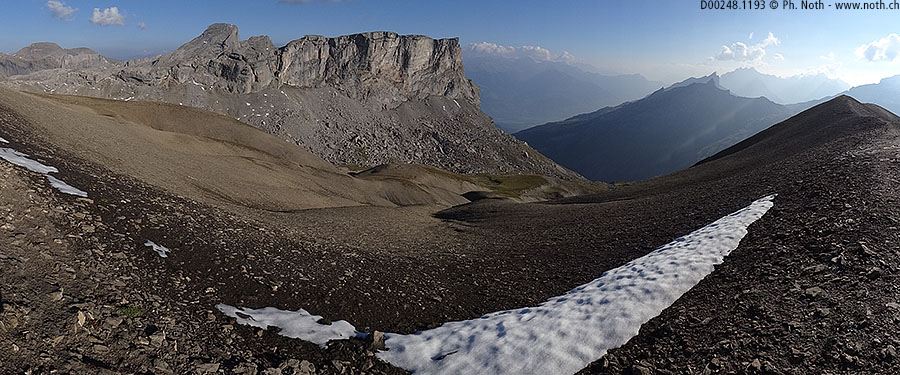
The practically flat alpine track will take you to the La Crêta farm. It continues, even if a little worse for wear, up to another farm at a slightly higher altitude, Chaux de la Lé [2044 m, 2 h]. A crucifix and an arrow painted on a rock show how to continue on towards the right. The path now starts out across the slopes of the preserved Nétage valley. The Sérac can be seen again, towering above you to the left. From here, its resemblance with Mount Kailash, the sacred mountain of Buddhists and Hindus, is amusing. Even more so as you will be walking around it, just as Tibetan pilgrims walk round Mount Kailash.

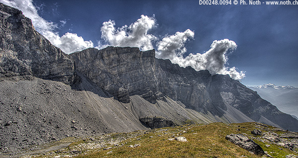
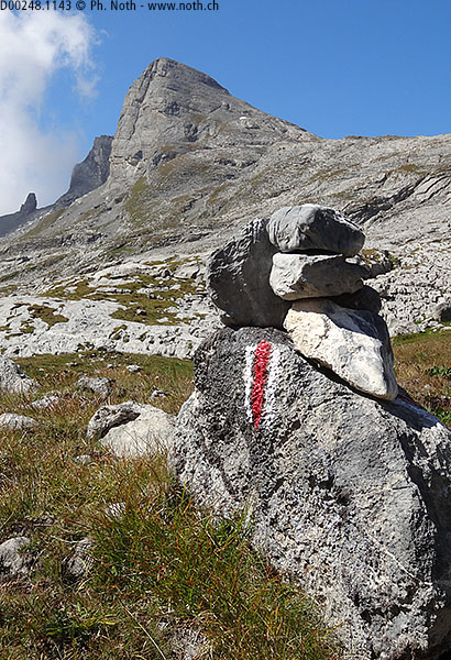
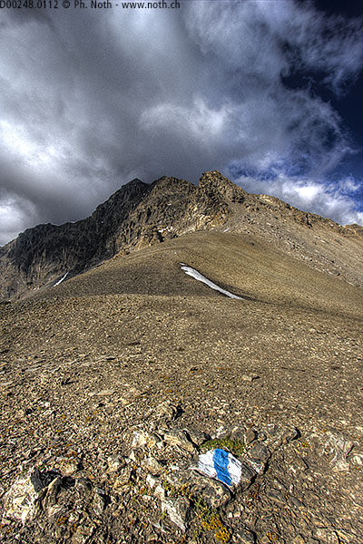
The path is neither particularly wide nor well-trodden but is quite safe. It is marked out at regular intervals but some of the markings are not easier to see. As for the other routes described in this guide, the path is shown on recent maps as the usual dashed line, but with some missing portions. You might feel as if the walls of the valley are closing in on you. But as soon as you reach the limestone ledge of Tsa di Faye, the eastern side of the Sérac opens up in front of you as a series of steep karst slopes falling down from the summit. As always, following a route across a karst landscape calls for special attention and care. The path is seldom used and quite faint even across grassy patches. It is rare to meet other walkers. Soon you reach Grand'Gouilles and a wider path coming down from the Audannes hut. From there on you will again find clear markings and a path that is much easier to follow. But for the moment you will have to make do with cairns and odd paint markings.
The view is still as awesome: the great wall on the east side of the valley stretches on up relentless to the Audannes pass and Mont Pucel. If I was a bearded vulture, this is where I would nest. Apparently a few couples of this rare species of vulture live in the area. Maybe you will be honored by the sight of one of these majestic birds. All the same, remember to look where you're putting your feet and continue on over the limestone slopes. Slightly before the ground flattens out, take care not to miss the way down under a rocky outcrop [approx. 2450 m, 3h30]. This portion of the path is a bit tricky to find and should preferably be done in good visibility.
The saddle-shaped landform you can spot on the right hand side is not the Audannes pass, the latter is higher up on the south slopes of Mont Pucel. You should be able to see the path up to the pass winding up the slope across the scree. A small fallen-down mountain hut marks the end of the Netage valley you have just climbed [2484 m, 4h]. From here, the route crosses a stretch of level, desert-like and austere land, but water can be found here depending on the season. The path first follows the Nétage valley stream before taking a left and heading west. This is Grand'Gouilles. If it has rained in the days prior to your walk, a pool might have formed in the depression near the label 2471 of the map. There is still a 200-meter climb before reaching the top of the Arpille ridge.
Continue on towards the west over this barren landscape until you reach a sign marking the beginning of the Arpille ridge [2652 m, 5h30]. Mount Sérac now looks like a giant-sized ski jump. This is where the normal ascent route leads up to the summit. In the foreground lies the long north ridge of Mount Sublage. The view up towards the Arpelistock is also astounding. Experienced hikers can attempt the ascension but it is a tricky ascent (Swiss blue/white grade). To the east lies the Diablerets glacier and the Tsanfleuron limestone pavement, and below you the Sanetsch pass and its dam and lake which mark the end of the circuit. Indeed, you need only to follow the Arpille ridge and you will be back at the Sanetsch pass. The ground falls away quite steeply on either side in some parts of the ridge, but if it is dry the route is graded T3. Allow about 6h30 to complete the walk.


This hike is featured in the book
Randonnées pour Grizzlys
Alpes valaisannes
published in 2013 by the editor Slatkine.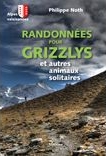
The book can be ordered online at the Slatkine website or bought in any good bookstore of French-speaking Switzerland