In short:
- Starting point: Glarey, on a side road of the Sanetsch pass road
- Total duration: 7 hours
- Difficulty: T3 - Challenging Mountain Hikes
- KMZ file for Google Earth
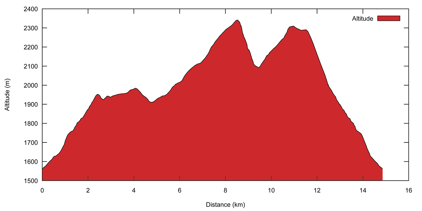
- Profile:

- Aloneness index:

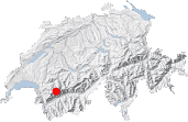
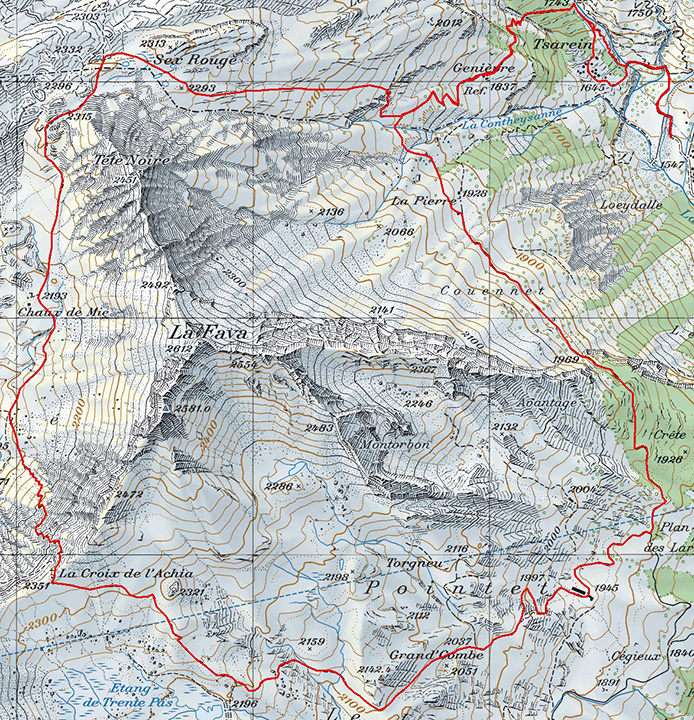
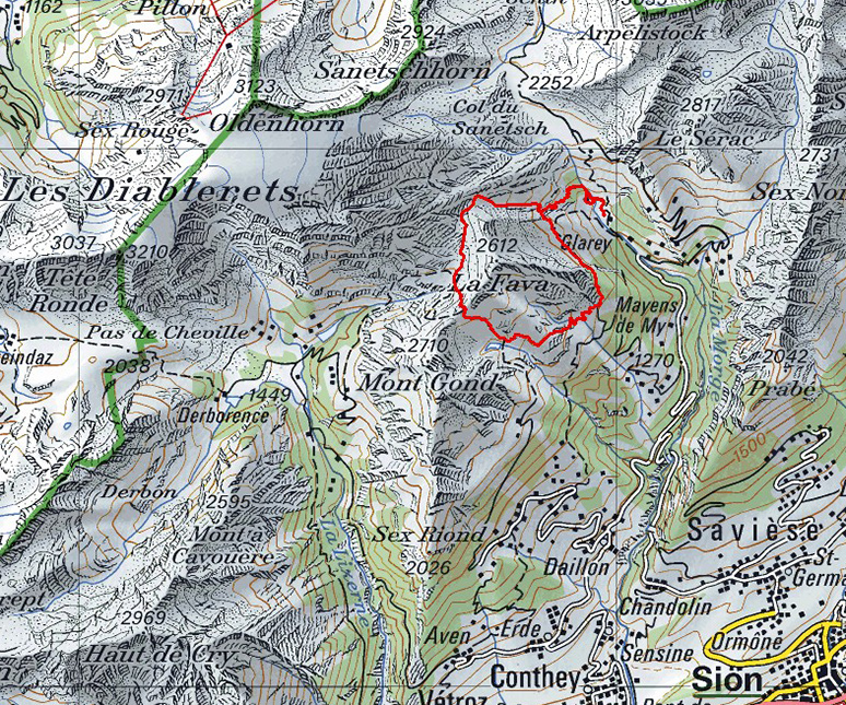
Maps:
Links (click on flag):
 Description of that circuit on Derborence.ch
Tour de la Fava, Croix de l'Achia (Croix de la Cha)
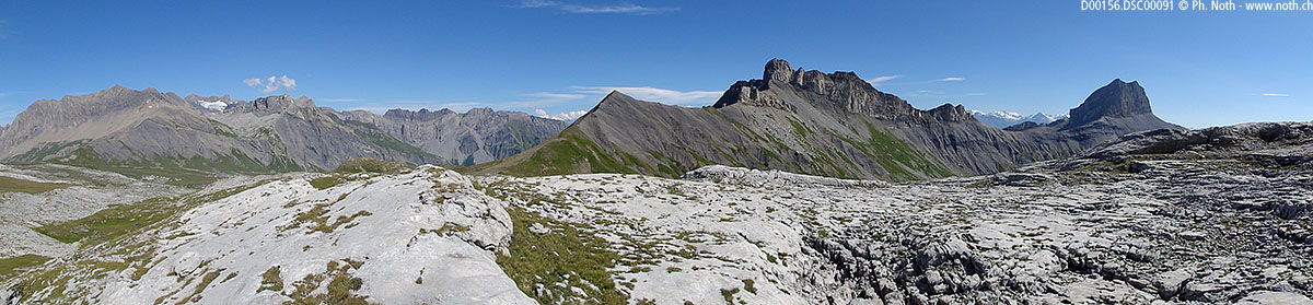
La Fava and Mont Gond are the two main peaks of a ridge between Sex Riond and the Sanetsch pass. The Croix de l'Achia pass stands between them and is the point where two trails meet: the Tour du Mont Gond trail and the Tour de la Fava trail. The first is already described on this site; here is the description of the second trail.
The two routes are really very similar with identical walking times, similar climbs and viewpoints. With the Miex limestone pavement, the Tour de la Fava trail crosses more diverse landscapes, but this also makes it harder. Having a map on hand and knowing how to use it will be helpful, especially at the following places:
- Crossing the Contheysanne torrent, which separates the Genièvre and La Pierre alpine meadows,
- Climbing the eastern slopes up to the Col de l'Achia,
- The optional off-trail portion between Sex Rouge and Genièvre.
Insufficient markings or no markings at all are to be found on these portions.
The natural starting point for this walk is the Grand-Zour bus stop on the road to the Sanetsch pass, simply because it is the lowest point of the itinerary. If you have a car, you may drive a little further up to Glarey.
After two successive bridges (the second over the Lachon), leave the road and take the path towards Genièvre. It climbs up the right bank of the stream by means of closely knit hairpin bends, then crosses a tree-covered slope and a ravine (bridge). A gate marks the entrance to the Genièvre alpine pastures [1837m, 45min]. Behind the pretty mountain hut lie the fortress-like walls of the north face of La Fava. The next couple of hours will be dedicated to circling the latter to the left. The ravine gouged out by the Contheysanne stream makes it necessary to climb some more before crossing is feasible. The meadows are home to grandiose Swiss pines, which grow here and there at some distance from each other. Their twisted, crooked silhouettes make them look like bonsais. Because neither the markings nor the path are always obvious, it's best to stay close to the ravine as you keep climbing. This way, you will soon find one of the places where it can be crossed easily. After the first ravine, a clearly marked-out path leads to a second ravine and then on to grazing lands and the La Pierre alpine pasture [1928m, 1h20]. From here, the itinerary follows the pasture track and you can continue at a faster pace without worrying about having to find your way. Far off in the distance, the Dent Blanche and Weisshorn are visible in the Pennine Alps range.
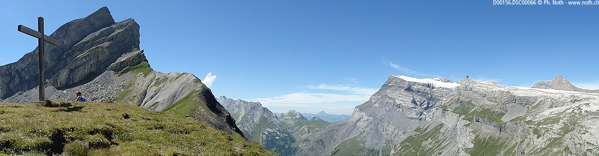
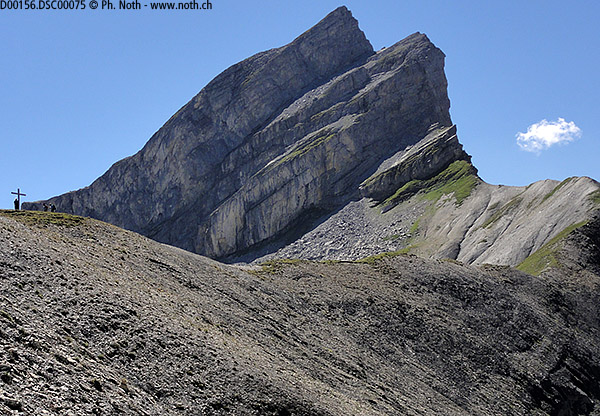
The track crosses the alpine meadows horizontally then heads slightly downwards through the forest. Out of the trees again, the track splits at a place called Plan des Larzes [1905m, 2h]. Take the track up to the right towards the Pointets farm. The signpost just before the farm building tells you to take a right. However wait until you have gone past the farm and then head up right behind the building. As you reach Grand-Combe the path becomes difficult to find again, especially since you will often find here temporary cow pens made with rope fences that make it all the more complicated. Luckily this part of the climb is quite easygoing and if you keep to the left you will soon find the markings and the path towards the Étang de Trente Pas. Leave the small lake down below you and continue on directly up to the Croix de l'Achia [2351m, 3h15]. This gentle saddle-shaped pass is obviously home to a cross, as stated in its name. Its setting between the La Fava and Mont Gond peaks is magnificent, and the view over towards the Diablerets and the Tsanfleuron karst area is outstanding. On the signposts, the information of interest for the second part of the walk is: Mié 25min and Sanetsch 1h55.
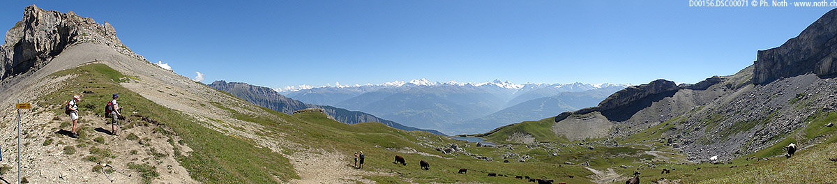
The pass marks the entry to the Haut-de-Cry nature reserve. The path leads down across dark marl schist via tight hairpin bends towards the Miex valley bottom. At the next three crossings where the path divides, always take the path to the right. Those leading off left go either to Chaux de Lodze or down to Derborence. The path then heads back up the valley gently, and past the Chaux de Miex hut [approx. 2180m, 4h]. The path gradually gets steeper as you reach the small pass that gives access to the Diablerets limestone karst area which includes the Tsanfleuron (the largest), Miex (to your left) and the Genièvre karst grounds that you are about to follow down. A path to your left heads off towards the Cabane de Prarochet. Karst landscape enthusiasts can follow that path if so desired (red and white markings and cairns) and savor the peacefulness of this strange limestone desert.
To complete the circuit, you now need to head right. To the north of the small pass at 2315 m [4h45], there are several possibilities and it can seem a bit confusing. You can opt between two solutions to finish the walk.
- The simplest is via Les Cloujons for which you just need to head for the Hôtel de Sanetsch [2047m, 5h40], easily recognizable on the road to the Sanetsch pass. If it's the right time of day, you can even catch a local bus there. Alternatively, you can follow a wide path that zigzags down to Glarey [6h30].
- The most direct route (partly off-trail) is to find the small lakes/ponds that lie west of the pass, and head straight down the valley below them, between Tête Noire and Sex Rouge. To start with a small trail materializes this option but it soon peters out. Stay carefully to the left and not in the gully that then becomes the ravine de Contheysanne. You must be careful to find the proper way down the rocky outcrop above the Contheysanne torrent: a small trail appears again just before the ravine. Take your time to find the exact right place (map or GPS are helpful), and clamber down safely. The Genièvre meadows and then Glarey are not far away [6h15 for the whole circuit].


This hike is featured in the book
Randonnées pour Grizzlys
Alpes valaisannes
published in 2013 by the editor Slatkine.
The book can be ordered online at the Slatkine website or bought in any good bookstore of French-speaking Switzerland