In short:
- Starting point: Barrage de Moiry
- Total duration: 4 hours
- Difficulty: T2 - Mountain Hikes (to the lake: T1 - Valley Hikes)
- KMZ file for Google Earth
- Profile (up & down):

- Aloneness index:

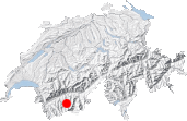
Maps:
Links (click on flag):
 Sasseneire (and also Col de Torrent) by Markus Jaton. He has other summer climbs on his website.
 The exact same tour, described on Christian Engl's website. With pictures and comments.
Lac des Autannes, Col de Torrent
The mountain pass called the Col de Torrent (2916m, 9566ft) runs between the Val d'Anniviers and the Val d'Hérens, two of the most spectacular valleys in the Alps. The hike through it is easy on your feet and legs and a delight for your eyes (lakes, glaciers, and high peaks), and, if you want more of a challenge, scale the Sasseneire.
To get there, you can either drive or take the postal coach to the Moiry Dam. Unless you want to climb up to the cabane de Moiry, there is no need to follow the lakeside road. Once you are at the barrage, cross it and walk along a wide path suitable for motor vehicles that leads to a big white building. This will take about 45 minutes. The colors could not have been more dazzling on the autumn day that I was there: the turquoise of the Lac de Moiry mirrored the whiteness of the glaciers to the south as well as the green and yellow of the alpine meadows that four months of the sun in the Valais had nearly turned into steppes.
When you arrive at the building at the Torrent pasture, there are three directions to choose from: the road that bears right to Basset de Lona, a trail along the lake that bears left, and another trail in the middle. The latter is the one that is of interest here. If you are in doubt, read the sign - you will avoid making the same stupid mistake that I did!
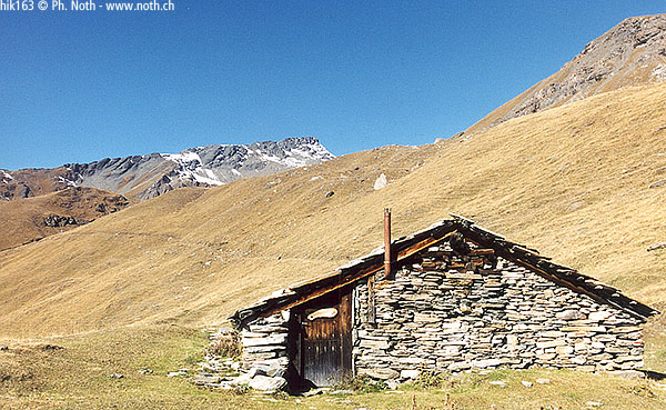
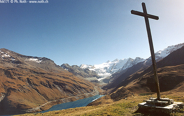
The hike through the meadows of Torrent is at times easy, at times more demanding. The path hugs the ups and down of the natural geography and leads you unmistakably to the Col de Torrent. But, on the way, after a 90-minute walk from the dam, you will not be able to resist taking a long break at the Lac des Autannes. In fact, if you like, you can make this small mountain lake the sole destination of your hike.
Mirrored on the waters of the lake, you will behold the scenery whose dominant features are the Dent Blanche and the Grand Cornier, to which you can add the mountains surrounding Zinal. But to see the full beauty of the Weisshorn and the Bishorn, you have to go a little farther. And that is exactly why you will decide to leave the lake - once you have had your fill - and do the slopes of the Col de Torrent. It's a 30-minute diagonal climb upward.
At the top, on the other side of the col, your eyes are suddenly filled with le Pigne d'Arolla and many other mountains. The village of Haudères, in the Val d'Hérens (Arolla), lies below. I think that this passage is taken by those who hike all the way to Chamonix-Zermatt via the Haute Route.
Going on to Sasseneire (3254m, 10676ft) on my own did not seem to be a good idea. I could not make out the path, owing to the pile of stones that make up the ridge. Web sites claim "easy access". I will leave that up to you to decide. 45 minutes more and you should be there!


