In short:
- Starting point: Codo/Incron (Mayens de Conthey)
- Total duration: 6 hours
- Difficulty: T3 - Challenging Mountain Hikes
- KMZ file for Google Earth
- Profile:

- Aloneness index:


Maps:
Links (click on flag):
 Description of that circuit on Derborence.ch
- Gîte de Lodze
- A first glimpse of this tour thanks to the numerous pictures taken by the people at Transpiree.ch.
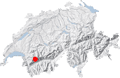
Tour du Mont Gond, Croix de la Cha (Croix de l'Achia)
Not far from Sion in the centre of the canton of Valais, two circuits of a walking time of approximately 6 hours each form a figure of eight around the Croix de l'Achia, a pass at an altitude of 2351 m. To the north-east of the pass lies the Tour de la Fava trail and to the south-west the Tour du Mont Gond trail. Both trails see relatively few hikers and cross the wild landscapes between the Sanetsch pass and Derborence lake. I prefer the Mont Gond trail myself. It does not require making superhuman efforts and winds up and down some beautiful mountainsides where wild animals can be observed. Hence the mountain ibex and bearded vulture I managed to spot on the second portion of the trail. The possibility of having one's evening meal at the Gîte de Lodze adds extra warmth and enjoyment. Make sure to remember your headlamps if you opt to add this final touch of pleasure to the walk!
The walk starts on the road to Code (Codoz) / Incron, where the way to the Gîte de Lodze is signposted. This is also where the walk ends. Local buses do not go beyond the villages of Daillon or Aven, which considerably lengthens the trail. Start walking along the tarmac road and then dirt track towards Flore. After about 50 minutes of uneventful walking, just as you emerge from the woods, ignore another path leading off left and signposted to the Gîte de Lodze. Keep heading on to the right, towards the beautiful well-named mountain meadows of Flore, which you'll reach in slightly over an hour [1h20] at an altitude of almost 2000 m.
With seemingly very little effort, walking along this track towards the mountain meadows will have taken you over 400 m up from the starting point, a gentle introduction to the rest of the trail. 400 meters is half of the overall climb up to the Croix de l'Achia pass. The path to take now starts just after the bend before the farm. Make sure you don't miss the red arrow painted on a rock. The path heads up across the sunny slopes towards the Etang de Trente Pas (marshy area). You might lose sight of the path as you cross the stream at the stone wall under the lake area. However, you can easily see the large cross at the pass and just head towards it. Even if you are slightly off-trail, you will reach the Croix de l'Achia pass (Croix de la Cha on some maps), the highest point of this trip [2351 m, 2h45] without having to overcome any difficulties.
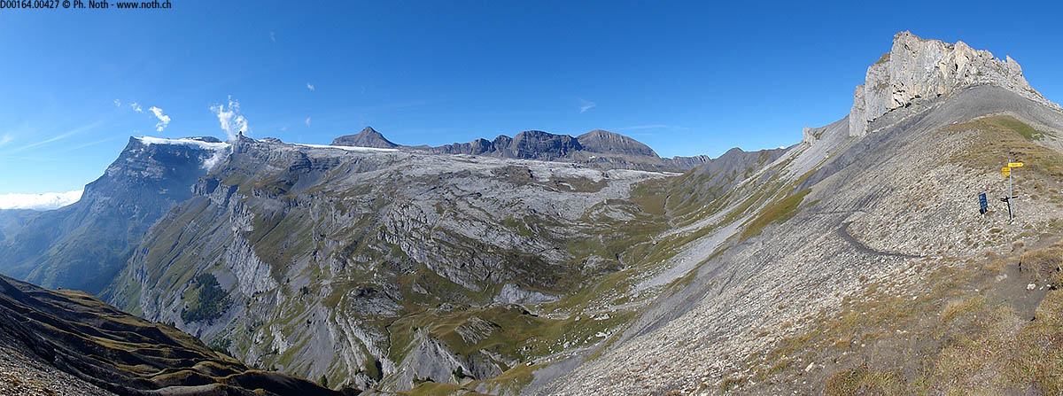
This saddle-shaped landform between the Mont Gond and the Fava peak provides amazing views towards the Diablerets on one side, and the Dent Blanche on the other. The pass is an ideal spot for a long, well-merited rest. Compared with the lively, green meadows on the south facing side, the descent down the north face seems dark and steep. Take care if patches of snow are present on this portion! The descent starts down across dark slopes of black schist and slate scree. At the first junction, take left towards Chaux de Lodze. Taking the other path would put you on the Tour de la Fava trail. The trail, which is quite narrow in parts, leads down diagonally across gentle green outcrops and black ravines. The landscape is quite peculiar. If this portion of the trail seems too dangerous, it is better to play safe and to make a detour via Mié, even if it means climbing an extra 90 meters to reach the path again after the tricky portion.
The descent from the pass ends at the junction with the Mié path at 2176 m [3h10]. From then on the path slowly circles Mond Gond, heading slightly uphill across its western slopes, more or less mid-slope. This is the wildest portion of the trail, where you might spot mountain ibex or get a glimpse of a bearded vulture. From this point of view, both the Petit Mont Gond and the main peak take on a dolomitic appearance with impressive stone walls.
Eventually the slope becomes less steep (near point 2280 m) and the path heads downhill again towards Chaux de Lodze. Be careful not to take the higher path which heads up to the ridge rather than downhill towards Lodze (the sign might be missing). The right path runs past a shelter for sheep down below but that remains out of sight for a long time. The scenery becomes inhabited again with sheep grazing on the green meadows. The walking is comfortable and easy again along the more or less level path, and the Gîte de Lodze is visible not too far off. The path narrows again to cross a few ravines but does not pose any difficulties.


The Gîte de Lodze [1976 m, 4h30] benefits from a magnificent setting above the floor of the Rhone valley. There is still an hour's walk back down to the starting point, but it is easy going and if you have remembered to put a headlamp in your backpack, it's a good idea to stop off at the restaurant and finish the walk by night. Headlamps are not a luxury though, the forest track can be very dark! It heads around a very abrupt portion of the ridge down from Mont Gond, called Sex Riond, staying close to the cliffs, before heading into the forest and back down to the tarmac road at Code/Incron.


This hike is featured in the book
Randonnées pour Grizzlys
Alpes valaisannes
published in 2013 by the editor Slatkine.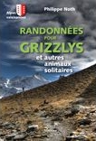
The book can be ordered online at the Slatkine website or bought in any good bookstore of French-speaking Switzerland