The book can be ordered online at the Slatkine website or bought in any good bookstore of French-speaking Switzerland
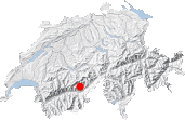
Gredetschtal, bisse de la Wyssa
Wild, secluded valleys are what all loners strive to find. They are not always easy to come across but do still exist in places. The aim of this book is to describe some of them. Several such valleys can be found in this part of the Haut Valais region stretching between the Lötschental valley and Belalp, that is the southern slopes of the Bietschhorn range. These sunny slopes are devoid of both ski resorts and villages or other permanent settlements. No giant dams either. On the contrary, magnificent ancient bisses (irrigation channels), often still in working state and proudly maintained by the locals, bring water down from the heights to meadows and villages. This region is little visited by the inhabitants of Swiss Romandy, even though it is relatively near the main cities and easily accessible by public transport.
The southern slopes of the Bietschhorn range are therefore well worth a visit and three walks in this area are described in this guide. Each valley is different in character: Gredetschtal is green and calm, Baltschiedertal is glacial immensity and Seetel inspires maturity.
To get acquainted with this region, let's first take a stroll up the Gredetschtal valley. The relatively low altitude and gentle slope of this U-shaped valley make it a good trip out in June or July, when other routes are still covered with snow. As autumn comes to an end, the valley sees little sun and is less welcoming. This walk is best done without specific purpose, following the path until it peters out or until the masses of snow accumulated after avalanches during the winter stop you from going any further. Apart from silence, you will find nothing particular in Gredetschtal: no shepherd's hut, no summits or passes for hikers, no pasture land above Strick, simply a barely discernible path.
In the center of Mund, a village were saffron is grown, take the track towards Roosse. If needed, a small car park can be found after two more bends as you enter Tähischinu. Trying to park any higher is not required because on the way back the path following the Stigwasser bisse will bring you straight back to Tähischinu.
The path to Roosse crosses the road several times. Yellow markings are sometimes to be found, but not always, as if perhaps somebody didn't want the amazing Wyssa bisse to be too easy to find. From Roosse [1406 m, 20 min], follow the path to Strick (Stollen Gredetsch Suon) which climbs between some barns. As you can see, there is no mention of the Wyssa bisse anywhere. However, the word "Stollen" means tunnel and tunnels were often dug out at the same time as bisses. If, like me, you miss the last portion of the path, head back right when you see the Salwald sign along a track signposted to Wässerwasser.
This will bring you to Zienzhischinu [1473 m, 45 min], a name that sounds Chinese and marks either the start of the bisse or the tunnel entry. If you do not like heights, it's best to use the track via the tunnel which is wide and well lit, because the path along the Wyssa bisse is vertiginous and requires being very sure-footed. Only a few minutes and you will be entirely convinced of this. As the bisse path reaches the cliffs it flows alternatively through tunnels and channels of rock dug out of the mountain side. A warning sign often seen on photos about the valley tells walkers to be careful.
Short tunnels like these are common on bisses. But these ones are special. Usually in such tunnels, you walk alongside the water and not above it on planks! The mountain side is really very abrupt and the bisse flows through tunnel after tunnel. There's no risk of falling but you might bump your head. As Indiana Jones in the Last Crusader where only the penitent man could pass, it's best to adopt a humble stance and keep your head down! The graal - the Gredetschtal valley - is only steps away. The last portion, out on the cliff face again, is quite impressive and cables are provided. You can now risk a glance or two towards the wild valley. If you are not prone to vertigo, then the bisse path with its tunnels and overhangs are actually quite fun. In one place a very spectacular channel overhangs a vertiginous drop for several meters. The waterwheel and hammer alerting the bisse keeper if the flow gets too heavy have also been reconstructed [3].
Two of the tunnels are too long to be entirely lit by natural light. Careful as you go through these, walking along wooden planks doubled over in pitch black is not easy and pray none of the planks are missing. One of the last tunnels is so low that it requires crawling! After the cliffs [1h45], the atmosphere becomes more soothing, with pastures, grazing cattle and many flowers along the sides of the bisse. Keep following the stream until you reach the mountain track from the main tunnel (cross). At this point, looking slightly down, you can see the water inlet on the Mundbach stream.
Bisse fans will be aware that the Wyssa bisse is one of the most spectacular bisses in Switzerland. It is therefore not uncommon to meet people coming the other way (crossing can be difficult). From now on though, the feeling of aloneness will keep growing as most walkers don't go further up the valley. They prefer to neglect this beautiful valley and head down and across the stream to follow another bisse, the Obersta.
Continuing up the track, you will first pass Chiestelli and then the Strick farm with its sheep pens, called Färricha in the local dialect [1655 m, 2h20]. From here on, the track becomes an uneven path. Keep climbing the glacial U-shaped valley until you have had enough of it or get blocked by snow: Strick, Lüterbrunno, or beyond. Recent maps show a dotted path that eventually stops about an altitude of 2006 m.
After a tiny shepherd's shelter half hidden from view (and not shown on the map), the path narrows into a small trail. It is still very easy-going and Lüterbrunno [1819 m, 3 h] is a very good place for a break: a few large boulders on the banks of the Mundbach, and nothing else.
The descent follows the same itinerary until you get back to the junction between the track and the path along the Wyssa bisse [3h45]. Then you can choose between three options:
• going back the same way along the Wyssa bisse,
• taking the main tunnel: in this case, stay on the track,
• taking the Stigwasser bisse path, a bisse again off the Mundbach stream, but about 200 meters lower. For this third option, take the path that leaves the track and heads off left down the slope. It leads towards and then along the Mundbach. You will soon reach Üssers Sentum (building, cross and bridge) [1344 m, 4 h]. Shortly afterwards, a signpost at a fork in the path shows the way to the bisse. Take the upper path: Tähischinu, Mund (Stiegwasser). Compared with the Wyssa bisse, the builders of the Stigwasser opted for a much easier course and the channel simply stays practically level through the forest and out of the Gredetschtal valley. Unfortunately, the closer you get to the village, and the more the bisse could do with some repairs. Towards the end as you come out of the trees, you will have to push your way through high grass to reach Tähiscinu. The comfortable, quiet Stigwasser path even actually becomes quite unpleasant and you may struggle to see where the bisse goes and where to put your feet.
The walking time is similar for the three options back. You should count 4h30 for the whole Mund-Lüterbrunno-Mund circuit without breaks.


This hike is featured in the book
Randonnées pour Grizzlys
Alpes valaisannes
published in 2013 by the editor Slatkine.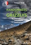
The book can be ordered online at the Slatkine website or bought in any good bookstore of French-speaking Switzerland