In short:
- Starting point: Grimentz or the road turn on the Gougra river
- Total duration: 6 ½ hours
- Difficulty: T3+ - Challenging Mountain Hikes
- KMZ file for Google Earth
- Profile:

- Aloneness index:

Maps:
Links (click on flag):
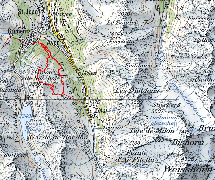
Pointe de Tsirouc, Grand Plan, Corne de Sorebois
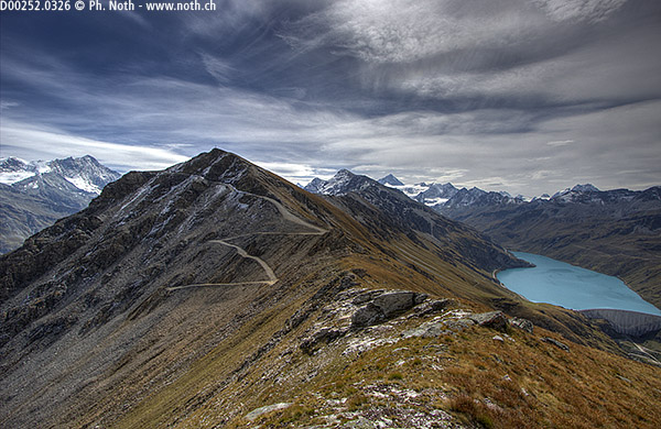
It is only sometimes a short step from pure beauty to ugliness, but this is the change in landscape you will find as you walk the couple-hundred metres as the crow flies from the Pointe de Tsirouc to the Corne de Sorebois. Saying that Sorebois is terribly ugly is probably somewhat exaggerated, but who really enjoys walking across the man-made slopes of a ski resort cut out of the mountain side? The Pointe de Tsirouc is the most north-lying peak of the long ridge separating the Zinal and Moiry valleys. Although only a few cable lengths (as in ski lift lengths) from the Zinal-Sorebois ski resort facilities, the Pointe de Tsirouc is rarely reached by the tourists who have already put themselves out to reach the summit of the Corne de Sorebois.
The Pointe de Tsirouc was brought to my attention by one of the more recent posts on the hikr.org website, not only was the Swiss-German author's post the first to mention Tsirouc on the website but he was adamant: he had not met a living soul all day long. The scare results to any Google searches about Tsirouc finally convinced me that this itinerary would most probably meet my requirements for walks for loners. Instead of following the same path there and back, the instructions below are for a round walk via the top of the Sorebois ski slopes. However, if you really want to keep away from any artificial landscapes, you can also climb the Pointe de Tsirouc and come back down the same way.
The walk is best started in Grimentz, because the actual path starts just 10 minutes above the village on the Grimentz - Mottec - Zinal road. More precisely, the path heads discretely up into the woods just after the bend and the bridge over the Gougra river. The sign only shows the way to go (Tsirouc-Sorebois-Zinal) with no further information or walking times.
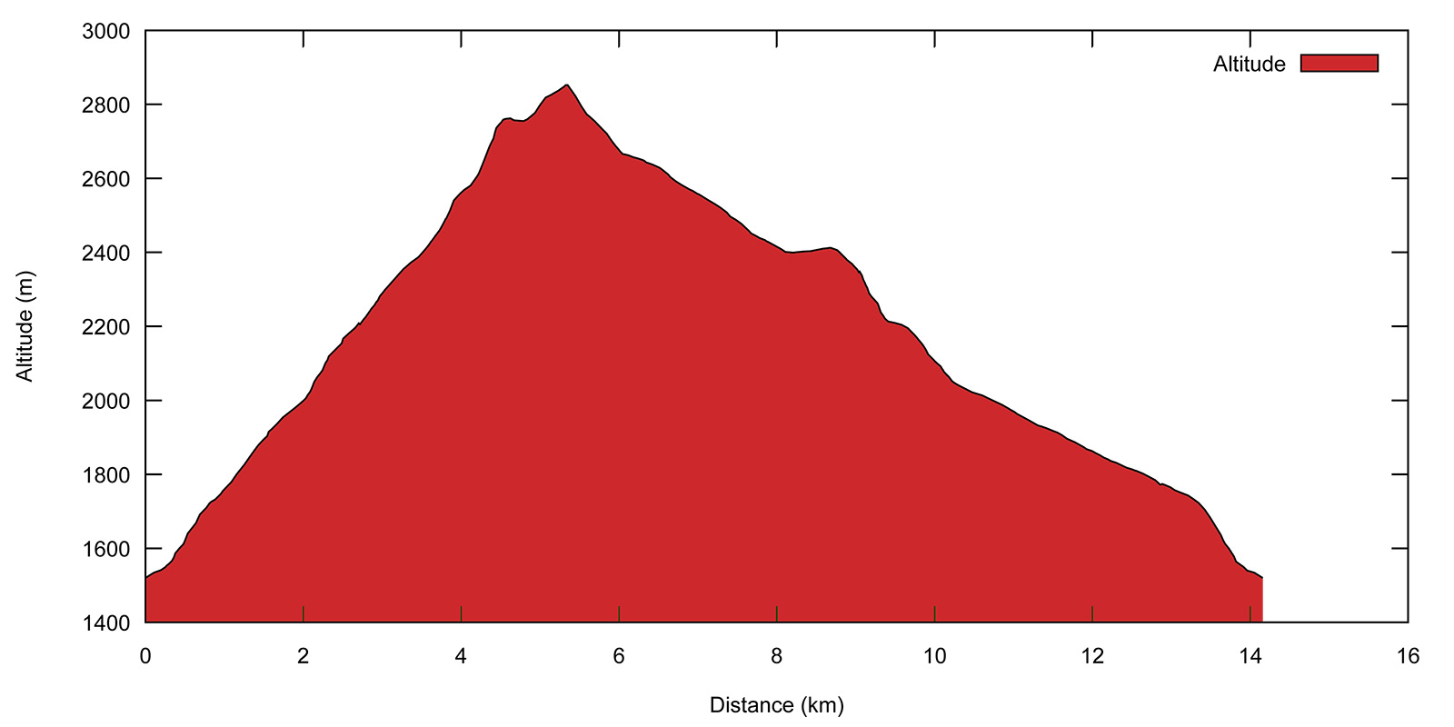
The path heads up through the Morasses woods, meeting and crossing the same forestry track several times. Take care always to follow the directions Sorebois and Tsirouc alpage. The path keeps climbing hard under the trees and it is only after 1¼ hours that you will find the first clearing [1925 m]. From it you can see the opposite side of the valley, towards the Col des Arpettes. If you have good eyes or binoculars, you might be able to see the Hôtel Weisshorn.

The path disappears again into the woods, even if the trees are now less dense. At the next junction, take the path to the right towards Sorebois. The path is not in good condition, especially if you are unluckily enough to follow it shortly after the cattle on their way up to the Tsirouc summer pastures. You will reach these pastures after 2 full hours of relentless effort. They are officially named Grand Plan on Swiss maps and lie at an altitude of 2206 m.
Now comes the prettiest part of the walk, so make sure you take it all in. Sorebois is given at another 1h20 and that is the path to follow, for the moment at least. The climb is easier now as the path winds its way up through the pasture land. Down to your left is a particularly pretty landscape in the autumn time, an entanglement of massive boulders and red-leaved bushes not far from Le Biolec that you will pass through on the way back down.
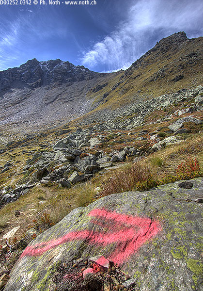
For the first time a sign shows the way to the Pointe de Tsirouc [2334 m, 2h15]. Leave the path towards Sorebois to your left and keep climbing up the combe. If you do not wish to climb the summit – the hardest part of the walk - you can join the descent route by taking a left here (towards Sorebois) or a little higher up via the upper pasture path. From this point on the path becomes less well-trodden and heads straight up towards the peak. It climbs on up past a stone shelter and then a tiny pond. Scarce blue/white markings take you up to the last hairpin of a large track from Sorebois.
Take care not to follow the bright pink arrow at the bend of the track. It points towards what looks like a good path heading towards the ridge down from the Pointe de Tsirouc. The proper path, marked as before with blue/white paint, can be found just after the bend and climbs up the eastern slope of the mountain. This is the part of the walk which involves some scrambling and is the reason for its T3+ grade. You will soon reach the ridge which is wide enough to allow you to stay at a safe distance from the crumbly, steep western side. When you get to the summit [2778m, 3h30], you realize that the peak is actually not as steep and rugged as expected. In the foreground you can see the turquoise water of the Lac de Moiry, and behind it the Weisshorn, the Grand Cornier and in the opposite direction the Bietschhorn.

The easiest return route, although not the shortest way back, is via Sorebois. Leave the summit and continue on southwards. After 10 minutes walking down the grassy ridge, you will get to the wide track from Sorebois, and after 20 minutes the first of the ski lifts. Snow cannons line the track and further mar the landscape. Whether you choose to stay on the track or plunge straight down across the ski slopes, you will end up at the upper part of the Sorebois resort [2438 m, 4h45]. As described on hikr.org, you can choose to end your trip here and take the cable car back down to Zinal. Otherwise, take the path left towards Grimentz. The sign gives a walking time of 3 hours to Grimentz but luckily only 10 minutes later it has already dropped to 2h30! The wide path gradually becomes more reasonably sized as you head down towards Le Biolec. An arrow on a rock marks the beginning of the real descent down across the beautiful mountain side you admired from Grand Plan on the way up. A feast of colors in the autumn time! The descent is rather grueling but only lasts about 40 minutes and is eased by cables in places.
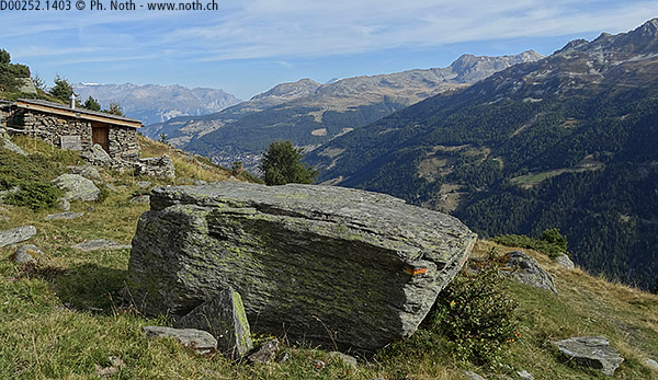
Quite unbelievably, the path ends at a sort of round-about on a road, a most peculiar sight up a mountain! A few minutes later you will pass the Biolec chalets [2021 m, 5h45]. The route now follows the tarmac road until you reach the path climbed earlier in the morning. Both road and path will take you back to your starting point. The round trip takes about 7 hours in all.
When I did this walk, a new cable car link between Grimentz and Sorebois was under construction. High up on the ski slopes (altitude 2693 m), a gigantic crane was at work. So for how long still will the Tsirouc combe remain untarnished? The question remains.


This hike is featured in the book
Randonnées pour Grizzlys
Alpes valaisannes
published in 2013 by the editor Slatkine.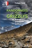
The book can be ordered online at the Slatkine website or bought in any good bookstore of French-speaking Switzerland