In short:
- Starting point: Bourg-St-Pierre, on the road to Grand St-Bernard
- Total duration: 7 hours
- Difficulty: T3 - Challenging Mountain Hikes
- KMZ file for Google Earth
- Profile (up & down):

- Aloneness index:
Maps:
Links (click on flag):
 Notes on Cabane Valsorey and the quality of its welcome, Guide des refuges de haute et moyenne montagne by Markus Jaton.
 The Valsorey cabin's official website.
 Hike report on Hikr.org.

 More details about the Valsorey cabin. From the Grand-Saint-Bernard region website.
Cabane de Valsorey
Perched high on the south side of the Grand Combin (4314m, 14154ft), the Valsorey hut (3030m, 9941ft) paradoxically offers no interesting view of that alpine giant. The Mont Vélan and the Mont Blanc massif are what you are looking for.
The starting point, on the route of the Grand Saint Bernard just at the Bourg Saint Pierre exit, is easily accessible by public transport - postal bus, for example. If you are driving, you can try to park your vehicle a little higher up, on the edge of the small road named "Valsorey". And I say "try" to park because parking space is very limited.
You start off on a wide path that leads to 2 old chalets made of stone with slate roofs. A sign estimates the time that it will take you to reach the hut at 3 hours and 45 minutes. The path goes up slowly on the left-hand side of the stream named the Valsorey and the valley opens up gradually, closed at the end by the Aiguilles de Valsorey. As you will have guessed by now, everything bears the name of "Valsorey" in this Vallon de. Valsorey :-) You will soon be able to see the Glacier de Valsorey and, as though that were not enough, the name of one of the peaks of the Grand Combin is the Combin de Valsorey!
After a little more than an hour of hiking, the path forks: you can either take a right, which leads to the Cabane de Vélan on the other side of the torrent, or keep straight on toward the Cabane Valsorey. Keep your eyes on the moraine in the shape of an S, you will soon make out the futuristic tower of the Cabane du Vélan.
You will walk between the chalets of Amont. One is in ruins while the other has a solar panel on it! From this point on, things get more serious: the slope inclination accentuates and your strides get longer to step over the big stones on the path. 2 hours later, you reach a pretty plateau that offers beautiful views of the Glacier de Valsorey, which has been out of sight up to now.
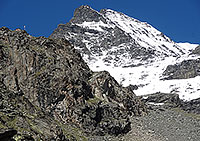
Another harsh but brief ascent leads you to the Grands Plans, another shelf. Here is where you discover where the hut is found: on a rock promontory under the Combin de Valsorey. The incentive that the view of the hut gives you is toned down by the significant gradients that remain to be covered (approx. 500m/1600ft). This last stretch nevertheless took me 90 minutes. The ground, made up of big blocks of landslip and scree, is indeed less welcoming.
But the end of the effort is near. The balcony on which the hut was built directly faces the Mont Vélan. You can also see the Mont Blanc and the Grandes Jorasses. In the opposite direction, the entire space is taken up by a dark Combin de Valsorey. Judging from the persons present and the links found on the Internet, the hut is mainly frequented by alpinists on their way to one of the peaks of the Grand Combin or, in the springtime, people doing the Haute Route.
You take the same path to make your way back down. I would, however, like to point out that the variant marked on Swiss national maps that cuts directly to the Chalet d'Amont is, I believe, a well-worn path - still marked but could do with a fresh coat of paint, so to speak; the person who takes this variant slopes down a humid cliff using ladders and cables. If you do not take this way, as I did by mistake, the hike can be qualified as technically easy. But the difference of 1200m (4000ft) and the altitude are what make the Cabane de Valsorey a demanding goal.


